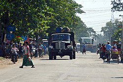
The government of Myanmar has two ministries controlling transportation, the Ministry of Transport and the Ministry of Rail Transport.

Ayeyarwady Region, is a region of Myanmar, occupying the delta region of the Ayeyarwady River. It is bordered by Bago Region to the north, Bago Region and Yangon Region to the east and the Bay of Bengal to the south and west. It is contiguous with the Rakhine State in the northwest.
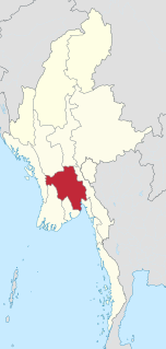
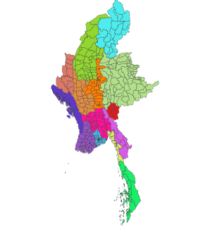
Bago Region is an administrative region of Myanmar, located in the southern central part of the country. It is bordered by Magway Region and Mandalay Region to the north; Kayin State, Mon State and the Gulf of Martaban to the east; Yangon Region to the south and Ayeyarwady Region and Rakhine State to the west. It is located between 46°45'N and 19°20'N and 94°35'E and 97°10'E. It has a population of 4,867,373 (2014).

Magway Region is an administrative division in central Myanmar. It is the second largest of Myanmar's seven divisions, with an area of 44,820 km2. Pa Del Dam (ပဒဲဆည်) is one of the dams in Aunglan Township, Magway Division. The capital and second largest city of the Magway Division is Magway. The largest city is Pakokku. The major cities of Magway Division are Magway, Pakokku, Chauk, Aunglan, Yenangyaung, Taungdwingyi, Minbu, Thayet and Gangaw.
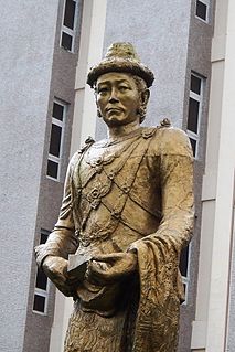
Alaungpaya was the founder of the Konbaung Dynasty of Burma (Myanmar). By the time of his death from illness during his campaign in Siam, this former chief of a small village in Upper Burma had unified Burma, subdued Manipur, conquered Lan Na and defeated the French and the British who had given help to the Restored Hanthawaddy Kingdom. He added settlements around Dagon, and called the enlarged town Yangon.

Taungoo is a district-level city in the Bago Region of Myanmar, 220 km from Yangon, towards the north-eastern end of the division, with mountain ranges to the east and west. The main industry is in forestry products, with teak and other hardwoods extracted from the mountains. The city is known for its areca palms, to the extent that a Burmese proverb for unexpected good fortune is equated to a "betel lover winning a trip to Taungoo".

Thanlyin is a major port city of Myanmar, located across Bago River from the city of Yangon. Thanlyin Township comprises 17 quarters and 28 village tracts. It is home to the largest port in the country, Thilawa port.

Mandalay Region is an administrative division of Myanmar. It is located in the center of the country, bordering Sagaing Region and Magway Region to the west, Shan State to the east, and Bago Region and Kayin State to the south. The regional capital is Mandalay. To the south of the region lies the national capital of Nay Pyi Taw. The division consists of seven districts, which are subdivided into 28 townships and 2,320 wards and village-tracts.
Articles related to Myanmar include:
Chaung-U is a town in central Myanmar. It is located in Monywa District, Sagaing Division. It is the principal town of Chaung-U township. In the Bagan dynasty, when King Popa Saw Rahan governed the country, it was named "San Tauk Village". It was a large village where different natives of the Union of Myanmar, like Kayin, Shan and Lawah (Wah) natives, lived happily together. Then, King Kyansit founded the city, gathering ten villages together, for example, Ywa Thit and Ywa Ma, naming it Chaung Oo. It is situated 231.46 feet (70.55 m) above sea level at north latitude 22° 45' and east longitude 95° 8' to 95° 25'. The Monywa–Mandalay highway road passes it, so the communication to it is good, quick and easy. The Monywa–Mandalay railway meets that of Chaung-U–Pakokku in the town's station, so it is possible to get there by train. Its official township boundary touches the boundaries of other townships: Myinmu is in the east, Myaung is in the south and south-east, Salingyi is in the west, and Monywa is in the north. The Chindwin River is in the west of the township and the town is six miles away from the river. In Chaung-U there are historical ancient pagodas. Besides, its township has other historical villages, streams, and hills.
Lewe Township is one of eight townships of Naypyidaw Union Territory, Burma.
Lewe is a town in the Naypyidaw Union Territory of central Myanmar.

The University of Distance Education, Yangon, located in Yangon, is one of two universities under the University of Distance Education system in Myanmar. With over 500,000 students mostly studying liberal arts and economics, the UDE system is the largest university in Myanmar. The Yangon university serves distance education students in Lower Myanmar whereas the University of Distance Education, Mandalay serves Upper Myanmar.
Townships are the third-level administrative divisions of Myanmar. They are the sub-divisions of the Districts of Myanmar. According to the Myanmar Information Management Unit (MIMU), as of December 2015, there are 330 townships in Myanmar.
Taungoo Educational College is located at Taungoo, Bago Division, Myanmar. Formerly it was the Convent High School under the Taungoo, Roman Catholic Diocese. After nationalization, it became Teacher's Training College. In 2000, the named has been changed to Taungoo Educational College and the government upgraded the level. Primarily a teacher training college, the college offers bachelor's and master's in education to the country's prospective primary, secondary and tertiary school teachers.

Daik-U Township is a township in Bago District in the Bago Region of Burma. The principal town is Daik-U.

Pagoda festivals are regular festivals found throughout Burma (Myanmar) that commemorate major events in pagoda's history, including the founding of a pagoda and the crowning of the pagoda's hti (umbrella). Pagoda festivals are dictated by the Burmese religious calendar and often are held several days at a time. Major events in a pagoda festival typically do not coincide with Uposatha days, during which devout Buddhists observe the Eight Precepts. The majority of pagoda festivals are held during the dry season, from the months of Tazaungmon (November) to Tabaung (March). During the full moon day of Tabaung, Buddhist devotees in various parts of Myanmar also celebrate sand pagoda festivals.
The October 2013 Myanmar bombings were a string of unexplained bombings that killed three people and injured 10 others from 11 to 17 October 2013 in different parts of Myanmar (Burma). There is no strong evidence to blame a particular group, but these attacks were likely connected.

Nyaunglebin is the second largest city in the Bago District of Bago Region