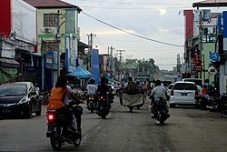
Taungoo (Burmese: တောင်ငူမြို့; MLCTS: taung ngu mrui., pronounced[tàʊɰ̃ŋùmjo̰]Tauñngu myoú; S'gaw Karen: တီအူ), also spelled Toungoo and formerly Toung-ngú,[2] is a district-level city in the Bago Region of Myanmar, 220km from Yangon, towards the north-eastern end of the division, with mountain ranges to the east and west. The main industry is in forestry products, with teak and other hardwoods extracted from the mountains. The city is known for its areca palms and betel nut chewing.
The city is famous in Burmese history for the Toungoo dynasty which ruled the country for over 200 years between the 16th and 18th centuries. Taungoo was the capital of Burma in 1510–1539 and 1551–1552.
Taungoo was founded in 1279 in the waning days of Pagan as part of frontier expansion southwards. After the fall of Pagan Empire in 1287, Taungoo came under the rule of Myinsaing Kingdom and later Pinya Kingdom. In 1358, Taungoo successfully revolted and became independent until 1367 when it became a nominal part of the Ava Kingdom. Its rulers retained a large degree of autonomy, playing larger Ava and Hanthawaddy kingdoms against each other. In 1470, Ava put down another rebellion and made Sithu Kyawhtin, the general who defeated the rebellion, governor. Sithu Kyawhtin's grandson Mingyi Nyo became governor of Taungoo in 1485. Under Mingyi Nyo's leadership, the principality grew powerful. In October 1510, Mingyi Nyo formally broke away from Ava and founded the Taungoo Kingdom.[4]
Mingyi Nyo's successors Tabinshwehti and Bayinnaung went on to found the largest empire in the history of south-east Asia.[5] Taungoo's stint as capital was short-lived, however. Tabinshwehti moved the kingdom's capital to Pegu (Bago) in 1539. The city briefly again became capital of a rebellion in 1599 when viceroyMinye Thihathu II of Taungoo declared himself king. In December 1599, Taungoo's forces in collaboration with the Arakanese armies aided by Portuguese mercenaries, sacked Pegu. The rebellious city state remained independent for another 10 years when Natshinnaung ascended the Taungoo throne in 1609. In the following year, King Anaukpetlun captured Taungoo and ended the city's long line of rulers.[6] Although few visible historic remains survive, all four sides of the brick city wall remain from the dynastic period, with the exception of the part of the southern wall. The 9.6 m wide moat has largely dried up, except for a section on the eastern side, which is still maintained.
By the mid-19th century, Taungoo was governed by a local governor appointed by the Konbaung kings. The Taungoo District consisted of 52 wards, including today's Pyinmana (and Naypyidaw) regions. The district was cut in half after the Second Anglo-Burmese War. The British annexed the southern half, including the city of Taungoo while the northern portion, including Pyinmana and Ela, remained under Burmese control.[7] British troops were withdrawn in 1893.[8]
In 1940, the British Royal Air Force built an airfield north of the town, which from August 1941 through February 1942 served as a training and support base for the 1st American Volunteer Group, popularly known as the Flying Tigers.
Taungoo celebrated its 500th birthday on 16 October 2010, by reconstructing and renovating many city attractions.[4]
Geography
Three mountain ranges traverse the district—the Pegu Yomas, the Karen Hills, and the Nat Ma Taung or "Great Watershed"—all of which have a north and south direction, and are covered for the most part with dense forest. The Pegu Yomas have a general elevation of from 800 to 1,200 feet (240 to 370m), while the central range averages from 2,000 to 3,000 feet (610 to 910m). The rest of Taungoo forms the upper portion of the valley of the Sittaung River.[8]
Climate
Taungoo has a tropical savanna climate (Köppen climate classificationAw) bordering on a tropical monsoon climate (Köppen climate classification Am). Temperatures are hot throughout the year, and the months before the monsoon (March–May) are especially hot with average maximum temperatures exceeding 35°C (95°F). There is a winter dry season (November–March) and a summer wet season (April–October).
Climate data for Taungoo (1991–2020, extremes 1942–1994)
Naw Bu Paw Mountain (Kayin State, over sea level 4,824ft)
Than Daung Kyi Mountain city
Investigative bodies
Military Intelligence No.3 (MI)
Special Intelligence (Special Branch) SB
Bureau of special investigations (BSI)
Special Police Force
Narcotic
Demographics
The population of Taungoo in the 2014 census was 108,569; in the 1983 census it was 65,851.[1]
The Bamar (Burmans) make up the majority with a significant Kayin (Karen) population on the eastern side of the city. The Chinese, Indians, Shan and Kayah people make up the rest.
The main transport options to Taungoo is rail and motorways.
Rail
The Taungoo railway station is on the main north line of Myanmar Railways, and the Taungoo Highway bus station is served by domestic bus lines.
Intra-city transport is mainly through a circular railway line which serves around the Taungoo District and bus lines, which serve downtown, and suburban areas:
Taungoo Airport is the area's only airport and is a military-only air base of Myanmar Air Force. MAF's No.47 Helicopter Squadron is stationed at the airport.
↑ Victor B Lieberman (2003). Strange Parallels: Southeast Asia in Global Context, c.800-1830, volume 1, Integration on the Mainland. Cambridge University Press. pp.150–154.
↑ Maung Htin Aung (1967). A History of Burma. New York and London: Cambridge University Press. p.140.
↑ Sir James George Scott, John Percy Hardiman (1901). Gazetteer of Upper Burma and the Shan States, Part 2. Vol.3. Printed by the superintendent, Government printing, Burma. p.374.
This page is based on this Wikipedia article Text is available under the CC BY-SA 4.0 license; additional terms may apply. Images, videos and audio are available under their respective licenses.


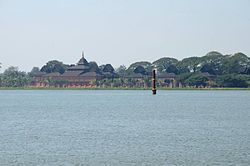

 Myazigon Pagoda
 Sacred Heart Roman Catholic Cathedral
 No.5 State High School, Taungoo
 No.4 State High School, Taungoo
 Hsaw Hti Thaw Karen Baptist Church
 Paku Karen Baptist Association