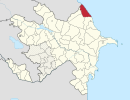
Kangarli is the newest rayon of Azerbaijan, in the Nakhchivan Autonomous Republic. Kangarli district was established in March 19, 2004. The district of Kangarli is located between the districts of Babek and Sharur. The southern part of the district is bordered by Iran, the northern - by Armenia. The landscape of the district is predominantly mountainous; it is located on the Daralayaz Plateau. The area is 704 square km. It was split off from Sharur rayon in March 2004. The administrative center of the rayon is Givrakh. The name Kangarli was originally applied to a Turkic tribe who founded a regional Maku Khanate that ruled the area. On 25 May 2004, President Ilham Aliyev appointed Nazim Cafarov as the executive head of the rayon.

Runcu is a commune in Dâmbovița County, southern Romania with a population of 4,397 people. It is composed of six villages: Bădeni, Brebu, Ferestre, Piatra, Runcu and Siliștea.

Yenikənd, is a village in Agsu Rayon, Azerbaijan. The village forms part of the municipality of Gürcüvan.
Dzherimbel is a village in the Jalilabad Rayon of Azerbaijan.
Yuxarı Astanlı is a village in the Yardymli Rayon of Azerbaijan.
Gyullu is a village in the Bilasuvar Rayon of Azerbaijan.
Ashim is a village in the Bilasuvar Rayon of Azerbaijan.
Karadara is a village in the Jabrayil Rayon of Azerbaijan.
Molday is a village in the Saatly Rayon of Azerbaijan.
Byandovan is a village in the Salyan Rayon of Azerbaijan.
Cəfərli is a village in the Jalilabad Rayon of Azerbaijan.
Qırmızı Şəfəq is a village in the municipality of Yenikənd in the Neftchala Rayon of Azerbaijan.
Hasıllı is a village and municipality in the Jalilabad Rayon of Azerbaijan. It has a population of 392.
Çünəxanlı is a village and municipality in the Jalilabad Rayon of Azerbaijan. It has a population of 233.
Fərəcullalı is a village and municipality in the Jalilabad Rayon of Azerbaijan. It has a population of 155.
Qurbantəpə is a village in the Jabrayil Rayon of Azerbaijan.
Xallava is a village in the Qubadli Rayon of Azerbaijan.
Muncuqlu is a village in the municipality of Çatax in the Tovuz Rayon of Azerbaijan.
Musa is a village in the municipality of Aşağı Astanlı in the Yardymli Rayon of Azerbaijan. According to Azerbaijan's State Statistics Committee, only eight people lived in the village as of 2014.

The Pirsaat is a river in Azerbaijan which flows through Ismailli, Shamakhi and Salyan Rayons. Length - 199 km, basin area - 2,280 km2. The river is fed by snow, rain and groundwater. Its largest tributary is Zoghalava.