Merakamudidam is a village in Vizianagaram district of the Indian state of Andhra Pradesh, India.

Whale Rock or Submarine Rock is the smallest island in Narragansett Bay in Rhode Island. It is located in the West Passage of the bay in Narragansett, Washington County, Rhode Island, west of the Beavertail area on Conanicut Island. The island received its names because it is shaped like a whale's back or a submarine's bow. It was responsible for numerous shipwrecks prior to the construction of a lighthouse. Whale Rock Light was built on the rock in 1882; it was destroyed by the 1938 New England hurricane, which also claimed the life of keeper Walter Eberle. Part of the lighthouse's foundation can still be seen.

Star Mill is an unincorporated community in Lima Township, LaGrange County, Indiana.

Podole is a village in the administrative district of Gmina Tłuchowo, within Lipno County, Kuyavian-Pomeranian Voivodeship, in north-central Poland. It lies approximately 6 kilometres (4 mi) north-west of Tłuchowo, 19 km (12 mi) east of Lipno, and 61 km (38 mi) south-east of Toruń.

Piszczatka is a village in the administrative district of Gmina Nurzec-Stacja, within Siemiatycze County, Podlaskie Voivodeship, in north-eastern Poland, close to the border with Belarus. It lies approximately 11 kilometres (7 mi) south-east of Nurzec-Stacja, 26 km (16 mi) east of Siemiatycze, and 78 km (48 mi) south of the regional capital Białystok.

Witoldów is a village in the administrative district of Gmina Widawa, within Łask County, Łódź Voivodeship, in central Poland. It lies approximately 4 kilometres (2 mi) south-west of Widawa, 25 km (16 mi) south-west of Łask, and 57 km (35 mi) south-west of the regional capital Łódź.

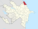
Digov is a village in the Lerik Rayon of Azerbaijan. The village forms part of the municipality of Mistan.
Bielawy is a village in the administrative district of Gmina Gostynin, within Gostynin County, Masovian Voivodeship, in east-central Poland.

Puszczykowo is a settlement in the administrative district of Gmina Strzelce Krajeńskie, within Strzelce-Drezdenko County, Lubusz Voivodeship, in western Poland. It lies approximately 8 kilometres (5 mi) west of Strzelce Krajeńskie and 22 km (14 mi) north-east of Gorzów Wielkopolski.

Gacnik is a village in the administrative district of Gmina Brusy, within Chojnice County, Pomeranian Voivodeship, in northern Poland. It lies approximately 3 kilometres (2 mi) north-east of Brusy, 26 km (16 mi) north-east of Chojnice, and 78 km (48 mi) south-west of the regional capital Gdańsk.

Jonki is a village in the administrative district of Gmina Konarzyny, within Chojnice County, Pomeranian Voivodeship, in northern Poland. It lies approximately 7 kilometres (4 mi) north-east of Konarzyny, 22 km (14 mi) north-west of Chojnice, and 96 km (60 mi) south-west of the regional capital Gdańsk.

Kukówka is a settlement in the administrative district of Gmina Sierakowice, within Kartuzy County, Pomeranian Voivodeship, in northern Poland. It lies approximately 10 kilometres (6 mi) north of Sierakowice, 20 km (12 mi) north-west of Kartuzy, and 46 km (29 mi) west of the regional capital Gdańsk.

Głusza is a settlement in the administrative district of Gmina Polanów, within Koszalin County, West Pomeranian Voivodeship, in north-western Poland. It lies approximately 7 kilometres (4 mi) south-east of Polanów, 40 km (25 mi) south-east of Koszalin, and 159 km (99 mi) north-east of the regional capital Szczecin.

Devići is a village in the municipality of Ivanjica, Serbia. It is located in Moravica District. According to the 2002 census, the village had a population of 189 people.

Chiyogadai Park Athletic Studium (千代台公園陸上競技場) is a multi-use stadium in Hakodate, Hokkaido, Japan. It holds 15,000 people. It is mostly used for track and field competitions as well as football games.
Eslamabad-e Jadid is a village in Qeshlaq-e Shomali Rural District, in the Central District of Parsabad County, Ardabil Province, Iran. At the 2006 census, its population was 1,726, in 352 families.

Beaverton is an unincorporated community in Valley County, Montana, United States located near Beaver Creek on the Valley County/Phillips County line. The community itself is all but a ghost town, with First Creek Seeds being the only remaining feature. Beaverton is halfway between the town of Saco and the community of Hinsdale.
Honey Creek is a stream in Pottawattamie and Harrison counties, Iowa, in the United States. It is a tributary of Missouri River.
Texas is an unincorporated community in Henry County, in the U.S. state of Ohio.

Gopikandar is a community development block that forms an administrative division in Dumka district, Jharkhand state, India. It is located 35 km from Dumka, the district headquarters.


