Coordinates: 41°32′N48°42′E / 41.533°N 48.700°E
A geographic coordinate system is a coordinate system that enables every location on Earth to be specified by a set of numbers, letters or symbols. The coordinates are often chosen such that one of the numbers represents a vertical position and two or three of the numbers represent a horizontal position; alternatively, a geographic position may be expressed in a combined three-dimensional Cartesian vector. A common choice of coordinates is latitude, longitude and elevation. To specify a location on a plane requires a map projection.
Manafoba | |
---|---|
Coordinates: 41°32′N48°42′E / 41.533°N 48.700°E | |
Country | |
Rayon | Khachmaz |
Municipality | Ağaşirinoba |
Time zone | AZT (UTC+4) |
• Summer (DST) | AZT (UTC+5) |
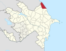
Manafoba is a village in the Khachmaz Rayon of Azerbaijan. The village forms part of the municipality of Ağaşirinoba. [1]
Azerbaijan, officially the Republic of Azerbaijan, is a country in the South Caucasus region of Eurasia at the crossroads of Eastern Europe and Western Asia. It is bounded by the Caspian Sea to the east, Russia to the north, Georgia to the northwest, Armenia to the west and Iran to the south. The exclave of Nakhchivan is bounded by Armenia to the north and east, Iran to the south and west, and has an 11 km long border with Turkey in the northwest.
Ağaşirinoba is a village and municipality in the Khachmaz Rayon of Azerbaijan. It has a population of 1,541. The municipality consists of the villages of Ağaşirinoba, Qıraqlı, and Manafoba.
Qasımbeyli is a village in the Agsu Rayon of Azerbaijan. The village forms part of the municipality of Ərəbmehdibəy.
Medeni Ingilab is a village in the Jalilabad Rayon of Azerbaijan.
Qaravultomba is a village in the Gadabay Rayon of Azerbaijan. The village forms part of the municipality of Parakənd.
Qarabulaq is a village in the Quba Rayon of Azerbaijan.
Əspərəsti is a village in the Quba Rayon of Azerbaijan. The village forms part of the municipality of Qorxmazoba.
Əcəxuroba is a village in the Qusar Rayon of Azerbaijan. The village forms part of the municipality of Əcəxur.
Gadzhyrustamoba is a village in the Khachmaz Rayon of Azerbaijan. In Soviet times the village was the location of a small military base, which was dissolved in 1992. The military base was used as a testing ground for the T-72 tank, as the location in a semi-desert proved useful to assess the reliability of the tank in dusty and hot conditions.
Zardoni is a village in the Lerik Rayon of Azerbaijan. The village forms part of the municipality of Tikəbənd.
Məsimlər is a village in the Tovuz Rayon of Azerbaijan. The village forms part of the municipality of Böyük Qışlaq.
Bozbinə is a village in the Zaqatala Rayon of Azerbaijan. The village forms part of the municipality of Dombabinə.
Arzu is a village and municipality in the Khachmaz Rayon of Azerbaijan. It has a population of 1,249.
Sahillər is a village in the municipality of Seyidlikəndyeri in the Khachmaz Rayon of Azerbaijan.
Yeni Sudur is a village in the municipality of Pirquluoba in the Khachmaz Rayon of Azerbaijan.
Vənəşikəş is a village in the municipality of Burzubənd in the Astara Rayon of Azerbaijan.
Çükəş is a village in the municipality of Sipiyəpart in the Astara Rayon of Azerbaijan.
Yuxarı Fərəcan is a village in the Lachin Rayon of Azerbaijan.
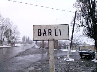
Barlı is a village and municipality in the Quba Rayon of Azerbaijan. It has a population of 1,585.
Xanagahyolu is a village in the municipality of Güləzi in the Quba Rayon of Azerbaijan.
Haçatala is a village and municipality in the Qusar Rayon of Azerbaijan. It has a population of 271. The municipality consists of the villages of Haçatala and Gican.
Qayadibi is a village in the municipality of Qaradaş in the Tovuz Rayon of Azerbaijan.
This Khachmaz Rayon location article is a stub. You can help Wikipedia by expanding it. |