Municipal Stadium is a multi-purpose stadium in Mombasa, Kenya. It is used mostly for football matches and holds 10,000 people.

Timiryazev is a district of North Kazakhstan Region in northern Kazakhstan. The administrative center of the district is the town of Timiryazevo. Population: 12,960 ; 13,978 ; 20,081.

Şambulbinə is a village forming part of the municipality of Qazma.

Sumağavaqazma is a village in the Davachi Rayon of Azerbaijan. The village forms part of the municipality of Pirəbədil.

Qarıqışlaq is a village in the Lachin Rayon of Azerbaijan.

Ləngi is a village in the Qusar Rayon of Azerbaijan. The village forms part of the municipality of Yeni Həyat.

Chrzanowo is a village in the administrative district of Gmina Opinogóra Górna, within Ciechanów County, Masovian Voivodeship, in east-central Poland. It lies approximately 5 kilometres (3 mi) south-west of Opinogóra Górna, 3 km (2 mi) east of Ciechanów, and 77 km (48 mi) north of Warsaw.
Yeni Sudur is a village in the municipality of Pirquluoba in the Khachmaz Rayon of Azerbaijan.
Bedağar is a village in the municipality of Qazma in the Balakan Rayon of Azerbaijan.
Cillik is a village in the municipality of Qazma in the Balakan Rayon of Azerbaijan.
Öküzovtala is a village in the municipality of Qazma in the Balakan Rayon of Azerbaijan.
Qımılqazma is a village and municipality in the Quba Rayon of Azerbaijan. It has a population of 889. The municipality consists of the villages of Qımılqazma and Küsnətqazma.

Dąbrówka is a settlement in the administrative district of Gmina Brusy, within Chojnice County, Pomeranian Voivodeship, in northern Poland. It lies approximately 10 kilometres (6 mi) south-west of Brusy, 15 km (9 mi) north-east of Chojnice, and 89 km (55 mi) south-west of the regional capital Gdańsk.

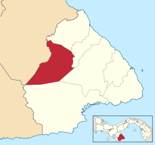
Macaracas District is a district (distrito) of Los Santos Province in Panama. The population according to the 2000 census was 9,137. The district covers a total area of 504 km². The capital lies at the city of Macaracas.

Shippee is an unincorporated community in Butte County, California. It lies at an elevation of 131 feet. It is 7.5 miles (12.1 km) west-northwest of Oroville on the Sacramento Northern Railroad and the Northern Electric Railroad.
Košátky is a village and municipality in Mladá Boleslav District in the Central Bohemian Region of the Czech Republic.
Menzel Farsi is a town and commune in the Monastir Governorate, Tunisia.

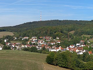
Hardberg is a hill in the Odenwald range in Hesse, Germany.
Uulutilaid is a small islet positioned just off the coast of Virtsu Peninsula in the Baltic Sea belonging to the country of Estonia.


