Veľaty is a village and municipality in the Trebišov District in the Košice Region of south-eastern Slovakia.

Hivəri is a village in the Lerik Rayon of Azerbaijan. The village forms part of the municipality of Qosmalyan.
Akuşapeştə is a village in the Lerik Rayon of Azerbaijan. The village forms part of the municipality of Siyov.
Qarabulaq is a village in the Quba Rayon of Azerbaijan.
Sırt Çiçi is a village in the Quba Rayon of Azerbaijan. The village forms part of the municipality of Səbətlər.
Novonikolayevka is a village in the Quba Rayon of Azerbaijan. The village forms part of the municipality of Hacıhüseynli.
Əcəxuroba is a village in the Qusar Rayon of Azerbaijan. The village forms part of the municipality of Əcəxur.
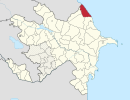
Gadzhyrustamoba is a village in the Khachmaz Rayon of Azerbaijan. In Soviet times the village was the location of a small military base, which was dissolved in 1992. The military base was used as a testing ground for the T-72 tank, as the location in a semi-desert proved useful to assess the reliability of the tank in dusty and hot conditions.
Vələmir is a village in the Khachmaz Rayon of Azerbaijan. The village forms part of the municipality of Müqtədir.
Zardoni is a village in the Lerik Rayon of Azerbaijan. The village forms part of the municipality of Tikəbənd.
Manafoba is a village in the Khachmaz Rayon of Azerbaijan. The village forms part of the municipality of Ağaşirinoba.
Məhləabad is a village in the municipality of Kələxan in the Lerik Rayon of Azerbaijan.
Xocadoy is a village in the municipality of Aşağı Amburdərə in the Lerik Rayon of Azerbaijan.
Seliqavol is a village in the municipality of Biləsər in the Lankaran Rayon of Azerbaijan.
Çükəş is a village in the municipality of Sipiyəpart in the Astara Rayon of Azerbaijan.
Dəstor is a village in the municipality of Asxanakəran in the Astara Rayon of Azerbaijan.
Vələparqo is a village in the municipality of Motolayataq in the Astara Rayon of Azerbaijan.
Əliməmmədoba is a village and municipality in the Quba Rayon of Azerbaijan. It has a population of 825.
Xanagahyolu is a village in the municipality of Güləzi in the Quba Rayon of Azerbaijan.
Aşağı İmamqulukənd is the Lezgin village and municipality in the Qusar Rayon of Azerbaijan. It has a population of 770. The municipality consists of the villages of Aşağı İmamqulukənd and Mucuqoba.