
Wantagh is a hamlet and census-designated place (CDP) in the Town of Hempstead in Nassau County, on Long Island, New York, United States. The population was 18,613 at the time of the 2020 census.

Markham is a city in York Region, Ontario, Canada. It is approximately 30 km (19 mi) northeast of Downtown Toronto. In the 2021 Census, Markham had a population of 338,503, which ranked it the largest in York Region, fourth largest in the Greater Toronto Area (GTA), and 16th largest in Canada.

Richmond Hill is a city in south-central York Region, Ontario, Canada. Part of the Greater Toronto Area, it is the York Region's third most populous municipality and the 27th most populous municipality in Canada. Richmond Hill is situated between the cities of Markham and Vaughan, north of Thornhill, and south of Aurora.

Thornhill is a suburban district in the Regional Municipality of York in Ontario, Canada. The western portion of Thornhill is within the City of Vaughan and its eastern portion is within the City of Markham, with Yonge Street forming the boundary between Vaughan and Markham. Thornhill is situated along the northern border of Toronto, centred on Yonge, and is also immediately south of the City of Richmond Hill. Once a police village, Thornhill is still a postal designation. As of 2016, its total population, including both its Vaughan and Markham sections, was 112,719.

The Rouge River is a river in Markham, Pickering, Richmond Hill and Toronto in the Greater Toronto Area of Ontario, Canada. The river flows from the Oak Ridges Moraine to Lake Ontario at the eastern border of Toronto, and is the location of Rouge Park, the only national park in Canada within a municipality. At its southern end, the Rouge River is the boundary between Toronto and southwestern Pickering in the Regional Municipality of Durham.

Scarborough Village is a neighbourhood in Toronto, Ontario, Canada, located in the larger namesake Scarborough district. It was one of the earliest settlements in the former township of Scarborough with the distinction of being the site of the township's first post office. Despite this, it was not the town centre from where the later City of Scarborough grew, with mass urbanization of the former municipality actually having began as spillover growth from the old City of Toronto at Birch Cliff in the district's southwestern extremity. Today, the neighbourhood is composed of private and public housing, apartment complexes, schools, a few condominiums, and strip mall plazas. The neighbourhood lies along the Scarborough Bluffs escarpment.

McCowan Road is a major north-south thoroughfare in the Greater Toronto Area, Canada. It runs through the city of Toronto and into the Regional Municipality of York where it ends at the Town of Georgina.

Brimley Road is a north-south street in Toronto and the Regional Municipality of York, Ontario, Canada. In Toronto, it is located entirely within Scarborough and carried 32000 vehicles daily in May 2007 Hence, it is classified as a major arterial road by the city of Toronto.

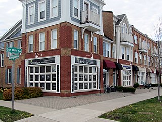
Unionville is a suburban district and former village in Markham, Ontario, Canada, 2 km (2.5 mi) northeast of Downtown Markham, 2 km (2.5 mi) west of Markham Village, and 33 km (20.5 mi) northeast of Downtown Toronto, centred around the intersection of Highway 7 and Kennedy Road. The boundaries of Unionville are not well-defined. Several nearby neighbourhoods are claimed to be part of it however, this has been disputed between the various wards. The Unionville Ratepayers Association designates Rodick Road as its western boundary.

Markham—Unionville is a federal electoral district in Ontario, Canada, that has been represented in the House of Commons of Canada since 2004.
Cornell is a neighbourhood in northeast Markham, Ontario and bounded by Highway 407, 16th Avenue, Ninth Line, and the Donald Cousens Parkway. The 2011 population of this area was 9,880. Adding Cornell North's 2,178 it has 12,058 residents.

Milliken and Milliken Mills are neighbourhoods in the cities of Toronto and Markham. Milliken is situated in the north west section of Scarborough, whereas Milliken Mills is situated in the south-central portions of Markham. The neighbourhoods are centered on Kennedy Road and Steeles Avenue, the latter street serving as the boundary between the cities of Markham and Toronto.

Woburn is a neighbourhood located in eastern Toronto, Ontario, Canada, in the former suburb of Scarborough. Woburn is bordered by Highway 401 to the north, Orton Park Road to the east, Lawrence Avenue to the south, and McCowan Road to the west.

Markville Secondary School is a public high school located in the community of Unionville within the city of Markham, Ontario, Canada. It is one of 33 high schools administered by the York Region District School Board.

Armadale is a neighbourhood which overlaps the city of Markham, Ontario and the city of Toronto, Ontario, in Canada. The historical community is situated in the south-east of Markham and north-east of the former suburb of Scarborough, now part of Toronto.

Berczy Village is a residential neighbourhood in Markham, Ontario, Canada. It is bounded to the north by Major Mackenzie Drive, to the east by McCowan Road, to the south by 16th Avenue, and to the west by Kennedy Road. This area is north of Unionville. The community is named after William Berczy, Markham's founder. The name is shown on limestone plaques throughout the community's arterial road entrances.

Wismer Commons is a residential area of Markham, Ontario, Canada, north of 16th Avenue, west of Markham Road and east of McCowan Road. Wismer Commons is named after the Wismer Family, one of the founding pioneer families of Markham, Ontario. The family of David Wismer, originally from Germany and subsequently Pennsylvania, arrived in Markham Township in 1806.

Raymerville - Markville East(Census Tract No. 5350400.03 and 5350400.12) is a community in Markham, Ontario, Canada. The name "Raymerville" came from the community's major collector road, Raymerville Drive. The name "Markville" came from the local major shopping mall, Markville Shopping Centre. The community is referred to as "Markville East" because it is located immediately east of Markville Shopping Centre.

Markham Village is the historic town centre of Markham, Ontario, Canada. Originally settled in 1825, the village, which was originally named Reesorville sometime after 1804 and also known as Mannheim, was founded by Mennonites from Upstate New York and Pennsylvania. Eventually, as Upper Canada started to experience immigration from the British Isles, Markham would experience significant growth. By 1825, the name "Markham" was established as the permanent name. In 1850, it was established as a police village, and in 1873 was fully incorporated as a village within York County. Markham was amalgamated with the surrounding Markham Township, which included the villages of Unionville and Thornhill in 1971, and incorporated as a town.
