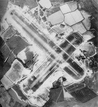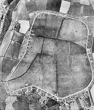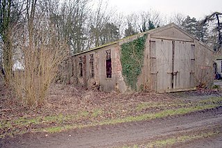
Royal Air Force Kenley, more commonly known as RAF Kenley is a former airfield station of the Royal Flying Corps in the First World War and the RAF in the Second World War. It played a significant role during the Battle of Britain as one of the three RAF stations specifically tasked with the defence of London. It is located near Kenley on the edge of Greater London. The site remains in use with the Ministry of Defence, as Kenley Airfield.

Royal Air Force Kingsnorth or more simply RAF Kingsnorth is a former Royal Air Force Advanced Landing Ground in Kent, England. It was at Bliby Corner approximately 2 miles (3.2 km) southeast of Ashford; about 50 miles (80 km) southeast of London. It is not to be confused with RNAS Kingsnorth, later RAF Kingsnorth, which was an airship station in operation during and after the First World War.

Royal Air Force Woodchurch, or more simply RAF Woodchurch, is a former Royal Air Force Advanced Landing Ground located in Kent, England. The airfield is located approximately 5 miles (8.0 km) west of Ashford; about 50 miles (80 km) southeast of London.

Royal Air Force Staplehurst or more simply RAF Staplehurst is a former Royal Air Force Advanced Landing Ground located in Kent, England. The airfield is located approximately 1 mile (1.6 km) northeast of Staplehurst; about 38 miles (61 km) southeast of London.

Royal Air Force Fairwood Common, or more simply RAF Fairwood Common, is a former Royal Air Force sector station located on Fairwood Common, on the Gower Peninsula, to the west of Swansea. It is now the location of Swansea Airport.

Royal Air Force Westhampnett or more simply RAF Westhampnett is a former Royal Air Force satellite station, located in the village of Westhampnett near Chichester, in the English County of West Sussex.
Royal Air Force Fairlop or more simply RAF Fairlop is a former Royal Air Force satellite station situated near Ilford in Essex. Fairlop is now a district in the London Borough of Redbridge, England.

Royal Air Force Zeals, or more simply RAF Zeals, is a former Royal Air Force station in Wiltshire, sited to the north of the village of Zeals, next to the village of Stourton and the Stourhead estate.
Royal Air Force Brenzett or more simply RAF Brenzett was a Royal Air Force advanced landing ground close to the village of Brenzett near Romney Marsh in Kent during the Second World War. It was used as an airfield in 1944 for the Mustang Wing which comprised three squadrons including two Polish squadrons in exile and operated patrols against V-1 flying bombs.

Royal Air Force Harrowbeer or more simply RAF Harrowbeer is a former Royal Air Force station situated next to Yelverton in the parish of Buckland Monachorum, Devon, England

Royal Air Force Charterhall or more simply RAF Charterhall is a former Royal Air Force satellite station located in the Scottish Borders and the historic county of Berwickshire between the village of Greenlaw and Duns. It was originally a First World War landing ground named Eccles Toft. The airfield was reconstructed in 1942 and was used mainly by No. 54 Operational Training Unit during Second World War. The RAF left in 1947 and the airfield was officially closed.

Royal Air Force Chailey or more simply RAF Chailey is a former Royal Air Force advanced landing ground close to the village of Chailey near Burgess Hill in East Sussex during the Second World War. It was an example of an Advanced Landing Ground (ALG), a type of simple, temporary airfield designed to support the invasion of continental Europe.

Royal Air Force Bradwell Bay or more simply RAF Bradwell Bay is a former Royal Air Force station located 9.5 miles (15.3 km) east of Maldon, Essex, England and 3.1 miles (5 km) south west of West Mersea, Essex.
Royal Air Force Appledram or more simply RAF Appledram is a former Royal Air Force Advanced Landing Ground 2.3 miles (3.7 km) southwest of Chichester, West Sussex, England and 12.2 miles (19.6 km) east of Portsmouth, Hampshire.

Royal Air Force Wellingore or more simply RAF Wellingore is a former Royal Air Force fighter relief landing ground located 1.9 miles (3.1 km) south of Navenby, Lincolnshire and 10 miles (16 km) south of Lincoln, Lincolnshire, England.

Royal Air Force Church Fenton or more simply RAF Church Fenton is a former Royal Air Force station located 4.3 miles (6.9 km) south-east of Tadcaster, North Yorkshire, England and 6.3 miles (10.1 km) north-west of Selby, North Yorkshire, near the village of Church Fenton.

Royal Air Force Coolham, or more simply RAF Coolham, also known as Coolham Advanced Landing Ground (ALG), is a former Second World War Royal Air Force Advanced Landing Ground located in Coolham, West Sussex, England, United Kingdom.
Royal Air Force Bognor or more simply RAF Bognor is a former Royal Air Force advanced landing ground 2 miles (3.2 km) north of Bognor, West Sussex, England.
Royal Air Force Funtington or more simply RAF Funtington is a former Royal Air Force advanced landing ground located in West Sussex, England.
Royal Air Force Selsey or more simply RAF Selsey is a former Royal Air Force Advanced Landing Ground located 2 miles north east of Selsey, West Sussex and 5 miles south of Chichester, West Sussex, England.


