Rainy Creek (Lennox and Addington County)

Last updated
Rainy Creek
River
Country Canada
Province Ontario
Region Eastern Ontario
County Lennox and Addington
Municipality Addington Highlands
Part of Great Lakes Basin
SourceUnnamed marsh
 - elevation349 m (1,145 ft)
 - coordinates 44°53′20″N77°23′34″W / 44.88889°N 77.39278°W / 44.88889; -77.39278
Mouth Skootamatta River
 - elevation315 m (1,033 ft)
 - coordinates 44°54′07″N77°17′24″W / 44.90194°N 77.29000°W / 44.90194; -77.29000 Coordinates: 44°54′07″N77°17′24″W / 44.90194°N 77.29000°W / 44.90194; -77.29000
Length9.5 km (6 mi)
Canada Southern Ontario location map 2.png
Red pog.svg
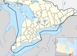
Location of the mouth of Rainy Creek in southern Ontario

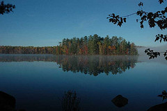
Rainy Creek is a creek in the Moira River and Lake Ontario drainage basins in Addington Highlands, Lennox and Addington County, Ontario, Canada.

Stream A body of surface water flowing down a channel

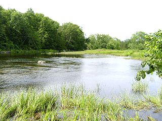
A stream is a body of water with surface water flowing within the bed and banks of a channel. The stream encompasses surface and groundwater fluxes that respond to geological, geomorphological, hydrological and biotic controls.

Moira River river in Canada

The Moira River is a river in Hastings County in eastern Ontario, Canada. It travels from its source in the centre of the county to the county seat Belleville to the Bay of Quinte.

Lake Ontario one of the Great Lakes in North America

Lake Ontario is one of the five Great Lakes of North America. It is surrounded on the north, west, and southwest by the Canadian province of Ontario, and on the south and east by the American state of New York, whose water boundaries meet in the middle of the lake. Ontario, Canada's most populous province, was named for the lake. Many of Ontario's most populous cities, including Toronto, Canada's most populous city, and Hamilton, are on the lake's northern or western shores. In the Huron language, the name Ontarí'io means "Lake of Shining Waters". Its primary inlet is the Niagara River from Lake Erie. The last in the Great Lakes chain, Lake Ontario serves as the outlet to the Atlantic Ocean via the Saint Lawrence River. It is the only Great Lake not to border the state of Michigan.

Contents

Course

Rainy Creek begins in an unnamed marsh at an elevation of 349 metres (1,145 ft), 1.2 kilometres (0.7 mi) north of Grimsthorpe Lake on the sister tributary of the Skootamatta River, Partridge Creek. It flows south, then turns east for the rest of its run. The creek reaches Rainy Lake at an elevation of 325 metres (1,066 ft), and enters Bon Echo Provincial Park. The creek then reaches its mouth at the Skootamatta River at an elevation of 315 metres (1,033 ft), between Joeperry Lake and Pearson Lake and about 12.5 kilometres (7.8 mi) northwest of the community of Cloyne.

Grimsthorpe Lake is a lake in the Moira River and Lake Ontario drainage basins that straddles the border between Tweed, Hastings County and Addington Highlands, Lennox and Addington County in Ontario, Canada.

Skootamatta River river in Canada

The Skootamatta River is a river in the Lake Ontario drainage basin in Hastings and Lennox and Addington Counties in Ontario, Canada. It flows from Joeperry Lake to join the Moira River in Tweed. The river's name is thought to come from Ojibwa words meaning "burnt shoreline".

Partridge Creek (Ontario) river in Canada

Partridge Creek is a creek in the Moira River and Lake Ontario drainage basins in Hastings and Lennox and Addington Counties, Ontario, Canada.

See also

Related Research Articles

Skootamatta Lake is a lake in the Lake Ontario drainage basin in Addington Highlands, Lennox and Addington County, Ontario, Canada. It is 2.7 kilometres (1.7 mi) west of Cloyne, and Bon Echo Provincial Park is located just to the north. The lake's name is thought to come from Ojibwa words meaning "burnt shoreline".

Joeperry Lake lake in Ontario, Canada

Joeperry Lake is a lake in the Lake Ontario drainage basin in Addington Highlands, Lennox and Addington County, Ontario, Canada. It measures approximately 13 kilometres (8 mi) northwest of Cloyne and is within Bon Echo Provincial Park.

Flinton Creek river in Canada

Flinton Creek is a creek in the Moira River and Lake Ontario drainage basins in Hastings and Lennox and Addington Counties in Ontario, Canada.

Elzevir Creek stream in Ontario, Canada

Elzevir Creek is a creek in the Moira River and Lake Ontario drainage basins in Tweed, Hastings County in Central Ontario, Canada.

Partridge Lake (Lennox and Addington County) lake in Ontario, Canada

Partridge Lake is a lake in the Great Lakes Basin in Addington Highlands, Lennox and Addington County, Ontario, Canada.

Merrill Creek (Ontario) river in Canada

Merrill Creek is a creek in the Moira River and Lake Ontario drainage basins in Hastings and Lennox and Addington Counties, Ontario, Canada.

Merrill Lake is a lake in the Moira River and Lake Ontario drainage basins that straddles the border between the Cashel portion of Tudor and Cashel, Hastings County and Addington Highlands, Lennox and Addington County in Ontario, Canada.

Little Merrill Lake is a lake in the Moira River and Lake Ontario drainage basins in Addington Highlands, Lennox and Addington County in Ontario, Canada.

Whitefish Lake is a lake in the Moira River and Lake Ontario drainage basins on the border between the Cashel portion of Tudor and Cashel, Hastings County and Addington Highlands, Lennox and Addington County in Ontario, Canada.

Pearson Lake is a lake in the Moira River and Lake Ontario drainage basins in Addington Highlands, Lennox and Addington County, Ontario, Canada. The lake is about 10 kilometres (6 mi) northwest of the community of Cloyne and is within Bon Echo Provincial Park.

Little Mink Lake is a lake in the Moira River and Lake Ontario drainage basins in Addington Highlands, Lennox and Addington County in Ontario, Canada. A Hydro One transmission line crosses over the west end of the lake.

Todd Lakes is a lake in the Moira River and Lake Ontario drainage basins in Addington Highlands, Lennox and Addington County, Ontario, Canada.

Rainy Lake is a lake in the Moira River and Lake Ontario drainage basins in Addington Highlands, Lennox and Addington County, Ontario, Canada.

Norway Lake is a lake in the Moira River and Lake Ontario drainage basins in Addington Highlands, Lennox and Addington County, Ontario, Canada.

Killer Creek (Ontario) river in Canada

Killer Creek is a creek in the Moira River and Lake Ontario drainage basins in Addington Highlands, Lennox and Addington County, Ontario, Canada.

Little Skootamatta Creek river in Canada

Little Skootamatta Creek is a creek in the Moira River and Lake Ontario drainage basins in Hastings and Lennox and Addington Counties in Ontario, Canada. The river's name is thought to come from Ojibwa words meaning "burnt shoreline".

Jacksons Lake is a small lake in the Moira River and Lake Ontario drainage basins in Addington Highlands, Lennox and Addington County, Ontario, Canada.

References

The Department of Natural Resources, operating under the FIP applied title Natural Resources Canada (NRCan), is the ministry of the government of Canada responsible for natural resources, energy, minerals and metals, forests, earth sciences, mapping and remote sensing. It was created in 1995 by amalgamating the now-defunct Departments of Energy, Mines and Resources and Forestry. Natural Resources Canada (NRCan) works to ensure the responsible development of Canada's natural resources, including energy, forests, minerals and metals. NRCan also uses its expertise in earth sciences to build and maintain an up-to-date knowledge base of our landmass and resources. To promote internal collaboration, NRCan has implemented a departmental wide wiki based on MediaWiki. Natural Resources Canada also collaborates with American and Mexican government scientists, along with the Commission for Environmental Cooperation, to produce the North American Environmental Atlas, which is used to depict and track environmental issues for a continental perspective.

The Atlas of Canada is an online atlas published by Natural Resources Canada that has information on every city, town, village, and hamlet in Canada. It was originally a print atlas, with its first edition being published in 1906 by geographer James White and a team of 20 cartographers. Much of the geospatial data used in the atlas is available for download and commercial re-use from the Atlas of Canada site or from GeoGratis. Information used to develop the atlas is used in conjunction with information from Mexico and the United States to produce collaborative continental-scale tools such as the North American Environmental Atlas.