Raja Ampat Regency

Last updated
Raja Ampat Regency
Kabupaten Raja Ampat
Raja Ampat, West Papua, Indonesia.jpg
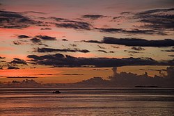
Sunset in Raja Ampat
Lambang Kabupaten Raja Ampat, Papua Barat.gif
Motto(s): 
Mbilin Kayam
(Maya-Biak: Building Together)
Lokasi Papua Barat Daya Kabupaten Raja Ampat.svg
Location in Southwest Papua
Indonesia location map.svg
Red pog.svg
Raja Ampat Regency
Location in Indonesia
Coordinates: 0°50′S130°30′E / 0.833°S 130.500°E / -0.833; 130.500
Country Indonesia
Province Southwest Papua
Capital Waisai
Government
  RegentAbdul Faris Umlati
  Vice RegentManuel Piter Urbinas
Area
  Total
7,559.61 km2 (2,918.78 sq mi)
Population
 (mid 2023 estimate) [1]
  Total
68,501
  Density9.1/km2 (23/sq mi)
Time zone UTC+9 (Indonesia Eastern Time)
Area code (+62) 956
Website rajaampatkab.go.id

Raja Ampat Regency is a regency of Southwest Papua Province of Indonesia. The regency, which was formed by separating the archipelago from Sorong Regency, based on the Law 26 of 2002, was inaugurated on 12 April 2003. It consists of a number of groups of islands situated off the north-west end of West Papua; the four main islands from south to north are Misool, Salawati, Batanta, and Waigeo. At present, the regency covers a land area of 7,559.60 km2, with a total area (including 59,820.01 km2 of sea area) stated as 67,379.61 km2. It had a population of 42,508 at the 2010 Census [2] and 64,141 at the 2020 Census; [3] the official estimate as at mid 2023 was 68,501 (comprising 36,000 males and 32,501 females). [1] The principal town lies at Waisai on Waigeo Island.

Contents

On 25 October 2013 the People's Representative Council (DPR) began reviewing draft laws on the establishment of new regencies, including two new regencies of North Raja Ampat and South Raja Ampat within the borders of the existing Raja Ampat Regency. As at May 2024, these changes have not yet been implemented.

The Beauty of Raja Ampat

Raja Ampat is known for its beautiful sea and scenery. It is recognized as the home of the largest coral reef biodiversity in the world. With more than 550 distinct variety of coral, 700 different kinds of mollusks, and 1427 different species of fish, it is a significant center for marine biodiversity. Seventy-five percent of all known coral species may be found in the seas around the Raja Ampat Islands, which are home to some of the world's most diverse species. [4]

Geography

Raja Ampat Regency is a regency located at a position of 2° 25' north latitude to 40° 25' latitude south, and 130° – 132° 55' east longitude. Administratively, the boundaries of the Raja Ampat Regency are as follows:

Administrative Districts

The Raja Ampat Archipelago Karta ID RajaAmpat Isl.PNG
The Raja Ampat Archipelago

At the 2010 Census, the regency was divided into seventeen districts (kecamatan). Subsequently, seven additional districts have been created by the division of existing districts. The twenty-four districts are tabulated below with their areas and their populations at the 2010 Census [2] and the 2020 Census, [3] together with the official estimates as at mid 2023. [1] They are grouped according to the proposed split into three regencies currently under consideration (since 2013) by the government. The table also includes the locations of the district administrative centres, the number of administrative villages in each district (4 urban kelurahan in Waisai Town District, and 117 rural kampung in all the other districts), the number of named islands in each district, and its postal code.

Kode
Kemendagri
Name of
District
(distrik)
Land
area
in km2
Pop'n
Census
2010
Pop'n
Census
2020
Pop'n
Estimate
mid 2023
Admin
centre
No.
of
villages
No.
of
islands
Post
code
Villages
92.05.13Misool Selatan
(South Misool)
91.163,0263,5043,610Dabatan529598485Dabatan, Fafanlap, Harapan Jaya, Usaha Jaya, Yellu
92.05.16Misool Barat
(West Misool)
336.841,2911,4981,550Lilinta57998484Biga, Gamta, Kapatcol, Lilinta, Magey
92.05.01Misool (or
Misool Utara)
1,235.681,7612,0172,070Salafen53898483Aduwei, Atkari, Salafen, Solal, Waigama
92.05.10Kofiau206.232,5202,5992,670Mikiran52998482Awat, Deer, DibalaI, Mikiran, Tolobi
92.05.06Misool Timur
(East Misool)
553.662,6512,8352,920Folley613698486Audam, Folley, Limalas Barat, Limalas Timur, Tomolol,
Usaha Jaya
92.05.17Kepulauan Sembilan
(Sembilan Islands)
17.211,4581,4581,500Weijim Barat41698481Pulau Tikus, Satukurano, Wejim Barat, Wejim Timur
Total Raja Ampat Selatan2,440.7812,70713,91114,32030593
92.05.04Salawati Utara
(North Salawati)
38.522,1442,5972,710Samate65998495Jefman Barat, Jefman Timur, Kapatlap,
Samate, Waidim, Wamega
92.05.22Salawati Tengah (a)
(Central Salawati)
572.471,9171,9922,080Kalobo1098494Batbiro, Duriankari, Manfanin, Maralol, Meyaup, Sailen,
Sakapul, Waibin, Waiman, Waliam
92.05.21Salawati Barat
(West Salawati)
502.478991,1211,180Solol498493Kaliam, Kalwal, Solol, Waibon
92.05.25Batanta Selatan
(South Batanta)
188.771,3121,5981,670Yenanas498491Amdui, Wailebet, Waiman, Yenanas
92.05.20Batanta Utara
(North Batanta)
290.759091,5991,670Yensawai Timur498492Arefi Selatan, Arefi Timur, Yensawai Barat, Yensawai Timur
Total Raja Ampat Tengah1,592.987,1818,9079,3102859
92.05.03Waigeo Selatan
(South Waigeo)
240.121,7152,1732,300Saonek519798475Friwen, Saonek, Saporkren, Wawiyai, Yenbeser
92.05.09Teluk Mayalibit
(Mayalibit Bay)
621.938461,2971,370Yenanas43498473Kalitoko, Lopintol, Mumes, Warsamdin
92.05.11Meos Mansar218.871,6252,2212,400Yinbekwan998472Arborek, Kabuy, Kapisawar, Kurkapa, Sawandarek,
Sawinggrai, Yenbekwan, Yenbuba, Yenwaupnor
92.05.18Kota Waisai
(Waisai Town)
121.876,97621,79724,280Waisai498471Bonwakir, Sapordanco, Waisai, Warmasen
(all kelurahan)
92.05.19Tiplol Mayalibit200.519301,1711,240Go698474Arway, Beo, Go, Kabilol, Waifoi, Warimak
92.05.07Waigeo Barat
(West Waigeo)
763.641,4091,7861,890Waisilip532798464Bianci, Mutus, Saleo, Selpele, Waisilip
92.05.15Waigeo Barat Kepulauan
(West Waigeo Islands)
103.302,0842,7682,970Manyaifun62298465Gag, Manyaifun, Meosmanggara,
Pam, Saukabu, Saupapir
92.05.02Waigeo Utara
(North Waigeo)
149.571,4771,8001,880Kabare698466Andey, Asukweri, Bonsayor, Darumbab,
Kabare, Kalisade
92.05.14Warwarbomi297.331,0451,3891,450Warwanai498467Boni, Mnier, Warkori, Warmanai
92.05.23Supnin223.829081,1171,170Rauki498463Duber, Kapadiri, Rauki, Urai
92.05.05Kepulauan Ayau (b)
(Ayau Islands)
12.661,2301,0921,110Abidon598462Boiseran, Dorehkar, Runi, Yenkanfan, Yenkawir
92.05.24Ayau (b)5.839891,1031,130Dorehkar44598461Abidon, Meosbekwan, Reni, Rutum
92.05.08Waigeo Timur
(East Waigeo)
555.401,3861,6091,660Urbinasopen42798476Puper, Urbinasopen, Yenbekaki, Yensner
Total Raja Ampat Utara3,514.8522,62041,32344,85063652
Total Regency7,559.6042,50864,14168,501Kota Waisai
(town)
1212,179

Note: (a) not to be confused with the similarly-named Salawati Tengah District within Sorong Regency.
(b) the Ayau Islands (including Ayau District) lie some distance to the north of Waigeo.

Coral reef off of Piaynemo, an island in Misool District Pulau Piaynemo, Raja Ampat.jpg
Coral reef off of Piaynemo, an island in Misool District

Since 2010, the new Waisai district has been created from part of Waigeo Selatan District, the new Tiplol Mayalibit District has been created from part of Teluk Mayalibit District, the new Supnin District has been created from part of Waigeo Utarat District, and the new Ayau District has been created from part of Kepulauan Ayau District.

Proposed further changes

Misool and Kofiau Islands (comprising the first six districts listed above) are currently under Indonesian government consideration to be split off to form a separate South Raja Ampat Regency under proposals approved in 2014 by the Indonesian Parliament. Similarly, Waigeo and its surrounding small islands (comprising the last thirteen districts listed above) are currently under Indonesian government consideration to be split off to form a separate North Raja Ampat Regency under proposals approved in 2014 by the Indonesian Parliament. However, as at 2024, these changes have not yet been implemented.

The proposed splits from the existing regency would leave the five remaining districts, mainly consisting of Salawati and Batanta Islands, in the centre of the existing regency; note that the southern half of Salawati Island does not form part of the existing regency, but instead constitutes the Salawati Selatan and Salawati Tengah Districts of Sorong Regency, the latter having the same name as Salawati Tengah District of Raja Ampat Regency. Since 2010, the new Salawati Tengah and Salawati Barat districts have been created from parts of Salawati Utara District, while the former Selat Sagawin District has been divided into two new districts - Batanta Utara and Batanta Selatan.

Transport

Air

In early May 2012, a 1,200 metres runway of Marinda Airport on Waigeo Island was officially opened by the Transportation minister and Raja Ampat official. The runway was later extended to 2,000 metres and was predicted to be finished in 2013. [6]

Related Research Articles

<span class="mw-page-title-main">Anambas Islands Regency</span> Regency in Riau Islands, Indonesia

Anambas Islands Regency is an island regency in the Riau Islands Province, Indonesia, located in the Natuna Sea. The regency consists of 255 islands, including five outer islands that are important for Indonesia's sovereignty boundaries, namely: Tokong Berlayar Island, Tokong Nanas Island, Mangkai Island, Damar Island, and Malangbiru Island. Anambas Islands Regency located 150 nautical miles northeast of Batam Island in the Natuna Sea between the Malaysian Peninsula to the west and the island of Borneo to the east. Geographically part of the Tudjuh Archipelago. This island regency covers a land area of approximately 661.47 square kilometres (255.39 sq mi) spread over an area of approximately 46,664 km² of water. The regency had a population of around 37,411 at the 2010 Census. and 47,402 at the 2020 Census; the official estimate as at mid 2023 was 50,140. The administrative centre is at Tarempa on Siantan Island.

<span class="mw-page-title-main">Nunukan Regency</span> Regency in North Kalimantan, Indonesia

Nunukan Regency is a regency of North Kalimantan Province in Indonesia. It was created on 4 October 1999 from the northern districts of Bulungan Regency. Nunukan Regency shares international borders with the Malaysian states of Sabah to the north and Sarawak to the west, and inter-regency borders with Tana Tidung Regency and Malinau Regency to the south, as well as the coastal city of Tarakan in the east. The regency covers an area of 14,247.50 km2 and it had a population of 140,841 at the 2010 census and 199,090 at the 2020 census; the official estimate as at mid 2023 was 217,923.

<span class="mw-page-title-main">Ende Regency</span> Regency in East Nusa Tenggara, Indonesia

Ende Regency is a regency on the island of Flores, within East Nusa Tenggara Province of Indonesia. The regency covers an area of 2,091.19 km2, and it had a population of 260,605 at the 2010 Census and 270,763 at the 2020 Census; the official estimate as at mid 2023 was 280,328. It is bordered to the west by Nagekeo Regency and to the east by Sikka Regency, while the Flores Sea lies to the north and the Savu Sea to the south.

<span class="mw-page-title-main">Sorong</span> City and capital of Southwest Papua, Indonesia

Sorong is the largest city and the capital of the Indonesian province of Southwest Papua. The city is located on the western tip of the island of New Guinea with its only land borders being with Sorong Regency. It is the gateway to Indonesia's Raja Ampat Islands, species rich coral reef islands in an area considered the heart of the world's coral reef biodiversity. It also is the logistics hub for Indonesia's thriving eastern oil and gas frontier. Sorong experienced rapid growth during the decade from 2010, and further growth is anticipated as Sorong becomes linked by road to other frontier towns in Papua's Bird's Head Peninsula. The official estimate of population as at mid 2023 was 294,978 - comprising 154,543 males and 140,435 females. The suburban area of Sorong city contains tropical rainforest and mangrove forest that has increasingly become popular as ecotourism attractions especially for birdwatching or wildlife watching.

<span class="mw-page-title-main">Raja Ampat Islands</span> Archipelago in Southwest Papua, Indonesia

Raja Ampat, or the Four Kings, is an archipelago located off of the northwest tip of Bird's Head Peninsula, Southwest Papua province, Indonesia. It comprises over 1,500 small islands, cays, and shoals around the four main islands of Misool, Salawati, Batanta, and Waigeo, and the smaller island of Kofiau.

<span class="mw-page-title-main">Sorong Regency</span> Regency in Southwest Papua, Indonesia

Sorong Regency is a regency of the Southwest Papua province of Indonesia. It covers an area of 13,075.28 km2, and had a population of 70,619 at the 2010 Census, and 118,679 at the 2020 Census; the official estimate as of mid-2023 was 129,963. Its administrative centre is the town of Aimas. Sorong Regency surrounds Sorong City (Kota) on the landward side; the city is administratively independent of the Regency and is not included in the above statistics; Sorong City has an airport, Sorong Airport, which also serves the Regency.

<span class="mw-page-title-main">Misool</span> Island in Indonesia

Misool, formerly spelled Mysol or Misol, is one of the four major islands in the Raja Ampat Islands in Southwest Papua, Indonesia. Its area is 2,034 km2. The highest point is 561 m and the main towns are Waigama, located on the island's northwest coast, and Lilinta on the island's southeast coast.

<span class="mw-page-title-main">Salawati</span> Island in Indonesia

Salawati is one of the four major islands in the Raja Ampat Islands in Southwest Papua, Indonesia. Its area is 1,623 km2. Salawati is separated from New Guinea to the southeast by the Sele Strait, and from Batanta to the north by the Pitt Strait.

<span class="mw-page-title-main">Alor Regency</span> Regency in Indonesia

Alor Regency is a regency in East Nusa Tenggara (NTT) province of Indonesia. Established in 1958, Alor Regency administers the Alor Archipelago with its seat (capital) in Kalabahi on Alor Island.

<span class="mw-page-title-main">Dogiyai Regency</span> Regency in Central Papua, Indonesia

Dogiyai Regency is one of the regencies (kabupaten) in the Indonesian province of Central Papua. The Regency was created on 4 January 2008 from what had previously been the southern districts of Nabire Regency. It covers an area of 7,052.92 km2, and had a population of 84,230 at the 2010 Census and 116,206 at the 2020 Census; the official estimate as at mid 2023 was 122,993, comprising 63,955 males and 59,038 females. The regency seat is the town of Kigamani.

<span class="mw-page-title-main">Maʼya language</span> Austronesian language spoken in Indonesia

Maʼya is an Austronesian language of the Raja Ampat islands in Southwest Papua, Indonesia. It is part of the South Halmahera–West New Guinea (SHWNG) subgroup and is spoken by about 6,000 people in coastal villages on the islands Misool, Salawati, and Waigeo, on the boundary between Austronesian and Papuan languages.

Sailolof is a small port town in the province of Southwest Papua, Indonesia, some 1,686 miles from Jakarta. It is located on the west coast of Salawati Island in Sorong Regency. and is the administrative centre for the South Salawati District of Sorong Regency. Sailolof also constitutes a historic kingdom one of the Four Kings of Raja Ampat Islands in Southwest Papua. The town is located near the western coastal tip of the Bird's Head Peninsula.

<span class="mw-page-title-main">Central Maluku Regency</span> Regency in Maluku, Indonesia

Central Maluku Regency is a regency of Maluku Province of Indonesia. The Regency covers an area of 11,595.57 km2, and had a population of 361,698 at the 2010 Census, and 423,094 at the 2020 Census. The official estimate as at mid 2023 was 430,798. The principal town lies at Masohi, on Seram Island. The regency (kebupaten) is composed of the central part of the island of Seram, the Banda Islands, and the Lease Islands, together with those parts of Ambon Island which are outside the City of Ambon.

<span class="mw-page-title-main">Maybrat Regency</span> Regency in Southwest Papua, Indonesia

Maybrat Regency is a regency of Southwest Papua Province of Indonesia. It has an area of 5,461.69 km2 (2,108.77 sq mi), and had a population of 33,081 at the 2010 Census and 42,991 at the 2020 Census; the official estimate as at mid 2023 was 46,287. The administrative centre is the town of Kumurkek, in Aifat District. The Maybrat language is spoken in the regency.

<span class="mw-page-title-main">South Sorong Regency</span> Regency in Southwest Papua, Indonesia

South Sorong Regency is a regency of Southwest Papua province of Indonesia. It has an area of 6,570.23 km2, and had a population of 37,900 at the 2010 Census and 52,469 at the 2020 Census; the official estimate as at mid 2023 was 54,277. The administrative centre is the town of Kaibus in Teminabuan District.

Salawati is an Austronesian language spoken on the west of Salawati Island, in the Raja Ampat Islands in Indonesian New Guinea.

<span class="mw-page-title-main">Pesisir Barat Regency</span> Regency in Sumatra, Indonesia

Pesisir Barat Regency is a regency in Lampung Province of Indonesia. It was created on 25 October 2012 from the eight western districts of West Lampung Regency. It covers an area of 2,907.23 km2, and had a population of 141,741 at the 2010 Census and 162,697 at the 2020 Census; the official estimate as of mid-2023 was 174,695. The administrative center is the town of Krui. The majority group in the Pesisir Barat Regency is the Lampung people, while the Bengkulu language is also spoken in some districts.

<span class="mw-page-title-main">Southwest Papua</span> Province with special status in Indonesia

Southwest Papua is the 38th province of Indonesia to be created, and was split off from West Papua on 8 December 2022. Despite being named southwest, it is a misnomer and this province is actually located in the northwest edge of Papua. The province comprises the Greater Sorong area which consists of Sorong City, Sorong Regency, South Sorong Regency, Maybrat Regency, Tambrauw Regency, and Raja Ampat Regency. The Bill (RUU) on the Establishment of the Southwest Papua Province was passed into law and therefore it became the 38th province in Indonesia with effect from 8 December 2022.

The Salawati Kingdom is the Islamic kingdom that once stood in Salawati Island, Raja Ampat Regency, Southwest Papua. The center of the Salawati kingdom was located in the Samate village which is currently located in the North Salawati district.

References

  1. 1 2 3 Badan Pusat Statistik, Jakarta, 28 February 2024, Kabupaten Raja Ampat Dalam Angka 2024 (Katalog-BPS 1102001.9205)
  2. 1 2 Biro Pusat Statistik, Jakarta, 2011.
  3. 1 2 Badan Pusat Statistik, Jakarta, 2021.
  4. "Raja Ampat Regency | Raja Ampat Biodiversty Eco Resort". Raja Ampat Biodiversity Eco Resort. Retrieved 2024-02-28.
  5. Direktorat Jendral Cipta Karya Kementerian Pekerjaan Umum dan Perumahan Rakyat, Jakarta, 2021
  6. "Pengembangan Infrastruktur Bandara Raja Ampat Hingga 2013". May 26, 2012. Archived from the original on October 14, 2014.