Ramgarh, Kaimur

Last updated
Ramgarh
India Bihar location map.svg
Red pog.svg
Ramgarh
Location in Bihar, India
India location map.svg
Red pog.svg
Ramgarh
Ramgarh (India)
Coordinates: 25°17′20″N83°39′13″E / 25.28893°N 83.65355°E / 25.28893; 83.65355 Coordinates: 25°17′20″N83°39′13″E / 25.28893°N 83.65355°E / 25.28893; 83.65355 [1]
CountryIndia
State Bihar
District Kaimur
Area
[2]
  Total4.06 km2 (1.57 sq mi)
Elevation
[1]
75 m (246 ft)
Population
 (2011)
  Total8,960 [2]
Languages
  Official Bhojpuri, Hindi
Time zone UTC+5:30 (IST)

Ramgarh is a census town and corresponding community development block in Kaimur district of Bihar, India. [2] As of 2011, its population was 8,690, in 1,345 households. [2] It was first upgraded to census town status for the 2011 census. [2] The total population of the rural areas of Ramgarh block was 123,973, in 18,375 households. [2] The overall population of the subdistrict was 132,663. [2]

Contents

Geography

Ramgarh block covers an area of 16,448 hectares, of which forests covered 3.2 in 2011. [2] The area currently under cultivation that year was 13,249.7 hectares, while orchards covered another 284.8 hectares and pastures covered an additional 96.4. [2] Another 1,726.1 hectares were under non-agricultural use. [2]

Climate

Ramgarh town gets about 1600 mm of rainfall per year on average. [2] Temperatures typically vary from 6 to 45 degrees. [2]

Demographics

According to the 2011 census, the sex ratio of Ramgarh town was 927 females for every 1000 males, which was the highest among Kaimur district's three urban areas. [2] Of the town's 8,690 people, 1,415 were between the ages of 0 and 6, and the sex ratio of this group was 1007 (i.e. there were more slightly girls than boys: 710 and 705, respectively). [2] Members of scheduled castes made up 23.77% of Ramgarh residents, and there were no members of scheduled tribes living in the town. [2] The literacy rate of Ramgarh town was 79.74%, which was lowest among urban areas in Kaimur district. [2] Literacy was higher in men than in women: 87.96% of men and 70.73% of women in Kaimur town could read and write in 2011, with the corresponding 17.23% literacy gender gap being the highest in Kaimur. [2]

Most of Ramgarh town's workforce was not employed in agriculture in 2011, with only 12.35% of workers being cultivators who owned or leased their own land, and 16.05% being agricultural labourers who worked someone else's land for money. [2] Additionally, 8.51% were classified as household industry workers. [2] Most workers (63.09%) were classified as other workers. [2] The workforce was mostly male, with 1,827 male and 148 female workers in Ramgarh. [2]

For rural areas of Ramgarh block, the sex ratio was 929; among 0-6 year olds, it was 926. [2] Members of scheduled castes made up 22.62% of rural residents, and members of scheduled tribes made up 0.62%. [2] The rural literacy rate was 72.29% (82.24% among men and 61.58% among women). [2]

Most of Ramgarh block's rural workforce was employed in agriculture in 2011, with 30.26% being cultivators and another 49.75% being agricultural labourers. [2] 5.52% were household industry workers, and the remaining 14.48% were other workers. [2] The rural workforce was mostly male, consisting of 28,978 men and 11,926 women. [2]

Amenities

As of 2011, firefighting services in Ramgarh was covered by the Bhabua fire department. [2] For electricity, Ramgarh had 495 households connected to the power grid that year, 0 commercial or industrial connections, and no electric street lights. [2] Both open and closed were used Ramgarh, and there were 0 latrines. [2]

Villages

Besides the town of Ramgarh, there are 125 rural villages in Ramgarh block, as listed below: [2]

Village nameTotal land area (hectares)Population (in 2011)
Bhatauni 1492,172
Sangapur 128964
Baijnath 2312,482
Gogarhi 108918
Bishunpura 62386
Chhatarpura 361,423
Debahalia 1913,967
Karari 240
Gadeya 380
Dharahara 520
Matiari 1001,464
Bharheria 2361,770
Kohraula 143956
Labedaha 118942
Chandarmanpur 266
Masarhi 1493,207
Rewra 1000
Mera 100612
Labedahi 74380
Narhan 2472,849
Sumerpur Barka 410
Sumerpur Chotka 340
Sehuka 3574,716
Bisrampur 440
Jamurna 1272,108
Dahrak 2993,805
Chakkupur 107171
Mahuwar 4243,701
Jangalchhera 3420
Pachgain 74962
Anantpura 86274
Rupanandpur 53365
Balha 1700
Jangalchhera Sahodarpur 9141
Jangalchhera Saray 880
Sarai 2481,783
Toroiya 991,095
Jangalchhera Taraiya 800
Jangalchhera Imlia 1340
Imlia 1761,366
Jandaha Magrabi 65491
Jangalchhera Magrabi 550
Jangalchhera Mashraki 590
Jandaha Mashraki 98758
Nagaitha 670
Madanwan 440
Nonar 3014,039
Jangalchhera Nonar 760
Ashaideh 113486
Jangalchhera Bhargawan 620
Bhargawan 87720
Bamhangawan 5868
Piparia 108530
Tilsara 35155
Chhewari 1612,041
Lasra 55787
Khorahra 168974
Abhaideh 111930
Bishunpura 111474
Gorsara 2015,014
Bandipur 1874,448
Akorhi 2992,632
Isri 2071,859
Jorar 2271,665
Khanethi 104560
Barbigha 210
Goria 5930
Bharaula 78130
Mohanpur Bharula 37179
Balpur 16303
Natwa 81200
Baraura 2764,571
Hamzapur 880
Kathidih 930
Narhan 206435
Prainpur 660
Antdih 661,630
Lahang Patti 760
Sisaunra 3233,587
Taiyan 110621
Uprauli 140943
Paikauli 3092,094
Ahiwans 3542,117
Bedaman Chak 1641,313
Hajra 570
Upadhya Sagar 123408
Sijhua 5522,739
Kalani 1973,172
Gaura 71286
Thakura 4313,093
Maheshpur 600
Senisaray 89437
Kamsaray 6918
Bairpur 860
Jalalpur 190
Bahpura 114700
Kishunpura 148881
Oriadih 92688
Alipur 110528
Tenua 84930
Gorsara 492,646
Darwansurat 476210
Judunandan Patti 4043
Murlidarwan 861,218
Dhanautia 125539
Asaura 3241,514
Chitahan 75391
Kanpura 34259
Asapur 8133
Chitahan 360
Patkhaulia 100839
Tulshipur 350
Bagarhi 164957
Kalyanpur 1500
Banwari Chak 1350
Nathua 27164
Mahuari 1561,902
Gogasaray 450
Upari 2062,152
Baluwa 97291
Lachhanpura 4240
Sultanpur 121771
Siktha 1350
Sadullahpur 3054,455
Ansi 240

See also

Related Research Articles

Nokha, Rohtas Town in Bihar, India

Nokha is a nagar panchayat town and corresponding community development block in Rohtas district in the Indian state of Bihar. As of 2011, the population of the town of Nokha was 27,302 in 4,381 households. The rural population of Nokha block was 146,025, thus bringing the total block population 173,327. The economic situation of this region is mainly dependent on parboiled rice processed by number of rice mills in this area.

Nawanagar, Bihar village in Bihar

Nawanagar is a village and corresponding community development block situated in the Buxar district of Bihar, India, and one of the developing settlements of the district. It is one of several minor villages governed and administered by the Nawanagar panchayat. The village has the only chauki among other nearby villages. Nawangar is one of the seven blocks making up the Dumraon sub-division.

Dinara, Bihar Village in Bihar, India

Dinara is a small town in Rohtas district, Bihar, India, near the National Highway 30.

Barhara Village in Bihar, India

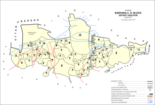
Barhara, also spelled Badahar, Barahara, or Barahra, is a village and corresponding community development block in Bhojpur District of Bihar, India. It is situated on the bank of the river Ganges. By the time of July–August most of the villages under this block are affected by deluge. As of 2011, its population was 6,889, in 927 households, while the total block population was 240,636, in 35,185 households.

Chenari, India Census town in Bihar, India

Chenāri or Chanāri is a census town and corresponding community development block in Rohtas district of Bihar, India. As of 2011, the town of Chenari had a population of 6,569, while Chenari block had a population of 131,528. Major commodities produced in the town of Chenari are chironji, rice, and pulses. The census town of Bhardua is administratively counted as part of Chenari block.

Kārākāt Village in Bihar, India

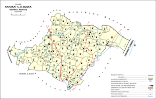
Kārākāt is a village and corresponding Community Development Block in Rohtas district of Bihar, India. As of 2011, the village of Karakat has a population of 2563, in 400 households; the total population of Karakat block is 209,284.

Rajpur, Rohtas Village in Bihar, India

Rajpur is a village and corresponding community development block in Rohtas district of Bihar, India. As of 2011, the village of Rajpur had a population of 11,780, in 1,778 households, while Rajpur block had a population of 75,213.

Suryapura, India Village in Bihar, India

Suryapura, also spelled Surajpura, is a village and corresponding community development block in Rohtas district of Bihar, India. As of 2011, the village of Suryapura had a population of 6,347, in 900 households, while Suryapura block had a population of 57,529, in 8,728 households. It is the least populous of Rohtas's 19 blocks.

Nauhatta, Rohtas Village in Bihar, India

Nauhatta is a village and corresponding community development block in Rohtas district of Bihar, India. As of 2011, the village of Nauhatta had a population of 5,103, in 909 households, while Nauhatta block had a population of 94,065, in 16,387 households. The nearest city is Dehri.

Kargahar Village in Bihar, India

Kargahar is a village and corresponding community development block in Rohtas district of Bihar, India. As of 2011, the population of Kargahar was 10,170, in 1,464 households, while the population of Kargahar block was 225,082, in 31,528 households. The nearest city is Sasaram, the district headquarters.

Itarhi, Buxar village in Bihar, India

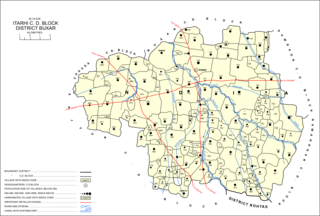
Itarhi is a village and corresponding community development block in Buxar district of Bihar, India. According to the 2011 Census of India, its population is 10,275, in 1,711 households, while the total block population is 170,629, in 25,557 households.

Udwantnagar Village in Bihar, India

Udwantnagar is a village and corresponding community development block in Bhojpur district of Bihar, India. As of 2011, its population was 9,000, in 1,496 households. The total block population was 157,809, in 24,336 households.

Tarari, Bihar Village in Bihar, India

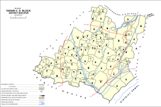
Tarari is a village and corresponding community development block in Bhojpur district of Bihar, India. As of 2011, its population was 3,586, in 393 households. The total block population was 182,631, in 28,316 households.

Agiaon Village in Bihar, India

Agiaon is a village and corresponding community development block in Bhojpur district of Bihar, India. As of 2011, its population was 4,801, in 835 households. The total block population was 148,373, in 23,117 households.

Chainpur, Kaimur Village in Bihar, India

Chainpur is a Town and corresponding community development block in Kaimur district of Bihar, India. It is located 11km west of Bhabua, the district headquarters. As of 2011, the village population was 11,306, in 1,653 households. The block population was 187,692, in 30,189 households. The main village Chainpur was also before known as Malikpur on the name of zamindar Malik Khan on of the desecents from the family of Bhabua. Chainpur was established in early 1600s. Chainpur was the capital of Chainpur Estate.

Adhaura, Kaimur Village in Bihar, India

Adhaura is a village and corresponding community development block in Kaimur district of Bihar, India. As of 2011, its population was 2,961, in 550 households. The total block population was 57,100, in 9,857 households. It is the least populated block in Kaimur district.

Chand, Kaimur Village in Bihar, India

Chand is a village and corresponding community development block in Kaimur district, Bihar, India. As of 2011, its population was 4,432, in 700 households. The total block population was 133,682 in 20,413 households.

Nuaon Village in Bihar, India

Nuaon, also spelled Noawan or Noan, is a village and corresponding community development block in Kaimur district of Bihar, India. As of 2011, its population was 5,292, in 798 households, while the overall block population was 106,530, in 15,263 households.

Bhagwanpur, Kaimur Village in Bihar, India

Bhagwanpur is a village and corresponding community development block in Kaimur district of Bihar, India. As of 2011, its population was 6,213, in 1,081 households, while the total block population was 91,113, in 15,145 households.

Rampur, Kaimur Village in Bihar, India

Rampur is a village and community development block in Kaimur district of Bihar, India. As of 2011, it had a population of 575, in 94 households. The total block population was 88,876, in 14,110 households.

References

  1. 1 2 "Geonames.org. Rāmgarh" . Retrieved 6 March 2021.
  2. 1 2 3 4 5 6 7 8 9 10 11 12 13 14 15 16 17 18 19 20 21 22 23 24 25 26 27 28 29 30 31 "Census of India 2011: Bihar District Census Handbook - Kaimur, Part A (Village and Town Directory)". Census 2011 India. pp. 22–85, 184–239, 898–99, 972–88. Retrieved 6 March 2021.