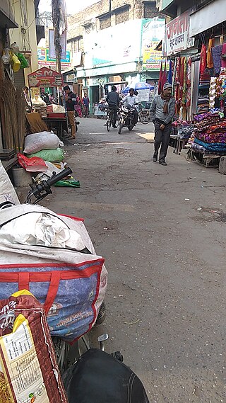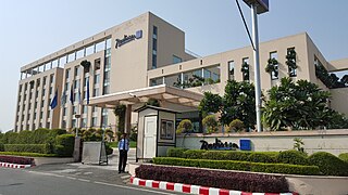
Champawat is a town and a Nagar Palika Parishad in Champawat district in the state of Uttarakhand, India. It is the administrative headquarters of Champawat district. The town was the former capital of the Kumaon Kingdom.

Roorkee (Rūṛkī) is a city and a municipal corporation in the Haridwar district of the state of Uttarakhand, India. It is 31 km (19 mi) from Haridwar city, the district headquarter. It is spread over a flat terrain under Sivalik Hills of Himalayas. The city is developed on the banks of Ganges Canal, its dominant feature, which flows from north–south through middle of the city. Roorkee is home to Asia's first engineering college Indian Institute of Technology Roorkee, formerly known as Thomson College of Civil Engineering. Roorkee is also known for the Roorkee Cantonment, one of the country's oldest military establishments and the headquarters of Bengal Engineer Group since 1853. A freight train ran in between Roorkee and Piran Kaliyar on 22 December 1851, this was two years before first passenger trains were started between Bombay and Thana in 1853 and 14 years after first freight trains ran in Chennai in 1837.

Udham Singh Nagar District is a district of Uttarakhand state in northern India. Rudrapur is the district headquarters. This district consists of nine Tehsils named Bajpur, Gadarpur, Rudrapur, Jaspur, Kashipur, Kichha, Khatima, Sitarganj, Nanakmatta. The district is located in the Terai region, and is part of Kumaon Division. It is bounded on the north by Nainital District, on the northeast by Champawat District, on the east by Nepal, and on the south and west by Bareilly, Rampur, Moradabad, Pilibhit and Bijnor District of Uttar Pradesh state. The district was created on 29 September 1995, by Mayawati government out of Nainital District. It is named for freedom fighter and Indian revolutionary Udham Singh.

Didihat is a town and a Nagar Palika in Pithoragarh District in the state of Uttarakhand, India. It is one of the eleven administrative subdivisions of Pithoragarh district and also serves as its administrative headquarter. With a population of 6522, Didihat is located at a distance of 415 km (258 mi) from the state capital Dehradun.

Nainital district is a district in Kumaon division which is a part of Uttarakhand state in India. The headquarters is at Nainital.
Afzalgarh is a city and a municipal board in Bijnor district in the Indian state of Uttar Pradesh. It is located at the border with the state of Uttarakhand.
Ramnagar may refer to the following places:

Jaspur is a developing town and a municipal board in Udham Singh Nagar district in the Indian state of Uttarakhand.
Noorpur is a City and a Municipal Board in Bijnor District in the Indian State of Uttar Pradesh.

Rudrapur is a city that serves as the headquarters of the Udham Singh Nagar district in the Indian state of Uttarakhand. Located at a distance of about 250 km (160 mi) northeast of New Delhi and 250 km (160 mi) south of Dehradun, Rudrapur is located in the fertile Terai plains in the southern part of Kumaon division over an area of 27.65 km2. With a population of 140,857 according to the 2011 census of India, it is the 5th most populous city of Uttarakhand.
Heerapur Gokal is a panchayat near Afzalgarh block in Dhampur tehsil Bijnor District in the Indian state of Uttar Pradesh. It is located at the border with the state of Uttarakhand.

Tarakeshwar is a panchayat samiti in Chandannagore subdivision of Hooghly district in the Indian state of West Bengal.
Salt or Sult is a block in Almora district, Uttarakhand, India. It is also known as Kumaun Ki Bardoli, a name given to it by Mahatma Gandhi when he visited Almora in 1929. Khumar is a village located in Salt which has a Martyr Monument.
Ramnagar Danda, is a village in Rishikesh, Dehradun district in the state of Uttarakhand in India.
Ramnagar Range, is an inhabited forest and village in Ramnagar, Nainital district in the state of Uttarakhand in India.
Ramnagar, is a town, or Nagar Palika Parishad, in Ramnagar, Nainital district in the state of Uttarakhand in India.
Ramnagar Kashipur, is a village in Kashipur, Udham Singh Nagar district in the state of Uttarakhand in India.
Ramnagar, is a village in Bajpur, Udham Singh Nagar district in the state of Uttarakhand in India.
Ramnagar Range, is an inhabited census village in Bajpur, Udham Singh Nagar district in the state of Uttarakhand in India.
Ramnagar, is a village in Roorkee, Hardwar district in the state of Uttarakhand in India.


