Dineshpur

Last updated

Dineshpur
Town
Nagar Panchayat Dineshpur
Durga mandir dineshpur.jpg
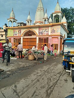
Durga mandir (temple) in Dineshpur
India Uttarakhand location map.svg
Red pog.svg
Dineshpur
Location in Uttarakhand, India
India location map.svg
Red pog.svg
Dineshpur
Dineshpur (India)
Coordinates: 28°59′N79°24′E / 28.98°N 79.40°E / 28.98; 79.40
CountryFlag of India.svg India
State Uttarakhand
District Udham Singh Nagar
Government
  BodyNagar Panchayat Dineshpur
Population
 (2021)
  Total
11,343
Languages
  Official Hindi
  Native Bengali
Time zone UTC+5:30 (IST)
Vehicle registration UK06
Website uk.gov.in

Dineshpur is a town and a nagar panchayat in Udham Singh Nagar district in the state of Uttarakhand, India.

Contents

Geography

Dineshpur is located at 28°59′N79°24′E / 28.98°N 79.40°E / 28.98; 79.40 . [1]

Accessibility

The nearest Airport is 17 km away at Pantnagar. Nearest Railway Station is 8 Km away at Gularbhoj, Other Nearby Railway Station is Rudrapur City (13 Km).

Demographics

As of 2021 India census, [2] Dineshpur had a population of 11,343. Males constitute 52% of the population and females 48%. Dineshpur has an average literacy rate of 77%, higher than the national average of 59.5%: male literacy is 79% and, female literacy is 75%. In Dineshpur, 19% of the population is under 6 years of age.

References

  1. "Yahoo maps location of Dineshpur". Yahoo maps. Retrieved 19 January 2009.
  2. "Census of India 2001: Data from the 2011 Census, including cities, villages and towns (Provisional)". Census Commission of India. Archived from the original on 16 June 2004. Retrieved 1 November 2008.