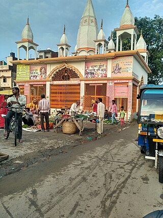
Deoband is a town and a municipality in Saharanpur district in the state of Uttar Pradesh, India, about 150 km from Delhi. Darul Uloom Deoband, an Islamic seminary and one of the largest Islamic Institutions of India is located there.

Udham Singh Nagar is a district of Uttarakhand state in northern India. Rudrapur is the district headquarter. The district consists of nine Tehsils named Bajpur, Gadarpur, Jaspur, Kashipur, Khatima, Kichha, Nanakmatta, Rudrapur, Sitarganj. The district is located in the Terai region, and is part of Kumaon Division. It is bounded on the north by Nainital District, on the northeast by Champawat District, on the east by Nepal, and on the south and west by Bareilly, Rampur, Moradabad, Pilibhit and Bijnor District of Uttar Pradesh state. The district was created on 29 September 1995, by Mayawati government out of Nainital District. It is named for freedom fighter and Indian revolutionary Udham Singh.
Bhatni Bazar is a town and a Nagar Panchayat in the Deoria district in the Indian state of Uttar Pradesh. It is the capital of the Development block Bhatni.
Bhogpur is a town and a Nagar Panchayat in Jalandhar district in the state of Punjab, India. Bhogpur has a Dana Mandi and have subsequent villages under it. It also acts as a route from Jalandhar to Tanda and is known for its famous sweet shops, and tailor shops. Sikhism is the major religion followed by Hinduism.

Dineshpur is a town and a nagar panchayat in Udham Singh Nagar district in the state of Uttarakhand, India.
Doharighat is a town and a nagar panchayat in Mau district in the state of Uttar Pradesh, India.
Hatod is a town and a nagar parishad in Indore district in the Indian state of Madhya Pradesh.
Jashpur Nagar is a town and a Nagar palika in Jashpur District in the Indian state of Chhattisgarh. It is the administrative headquarters of Jashpur district and was formerly the capital of Jashpur State.
Kakod is a town and a nagar panchayat in Bulandshahr district in the Indian state of Uttar Pradesh.
Kanti is a town and a notified area in Muzaffarpur district in the Indian state of Bihar. It is also a block headquarters belongs to "Tirhut Division". It is located 15 km by road from District headquarters Muzaffarpur. Kanti holds a distinct history for it was a spot for indigo production. Kanti was once a site for saltpeter production. In 2022, Kanti Nagar Panchayat was upgraded to Nagar Parishad. Pin Code 843109.

Kevadiya, now known as Ekta Nagar is a census town in Narmada district in the Indian state of Gujarat. The town is best known as the location of the Statue of Unity, the tallest statue in the world. The town is also home to the Ekta Nagar railway station.
Khetia is a town and a nagar panchayat in the Barwani district in the Indian central western state of Madhya Pradesh. The town shares its border with the state of Maharashtra and connectivity for the state of Gujarat.
Mahua Dabra Haripura is a town, a nagar panchayat in Udham Singh Nagar district in the Indian state of Uttarakhand.
Sahpau is a town and a nagar panchayat in Hathras district in the Indian state of Uttar Pradesh.
Satwas is a town and a Nagar Panchayat in Dewas district in the Indian state of Madhya Pradesh. Satwas is around 136.8 km (85.0 mi) from Dewas.
Vijaynagar or Vijaynagar is a town and a municipality in Sri Ganganagar district in the Indian state of Rajasthan.
Jafarabad is a town and nagar panchayat in Jaunpur district in the Indian state of Uttar Pradesh.
Chakia is a small town and the sub-divisional headquarters of Chakia Tehsil in the District of Chandauli of Varanasi Division in the northern Indian state of Uttar Pradesh.
Ratangarh is a town and a nagar parishad in Neemuch district in the Indian state of Madhya Pradesh.
Rampura is a town and Nagar palika, near Neemuch town in the Neemuch district of the Indian state of Madhya Pradesh. Rampura was founded by Rama bhil. Mahagarh was also ruled by Bhil king ,Rama was King but after the defeat against Chandrawats of Mewar, the town of Rampura was under their control until the independence of India.


