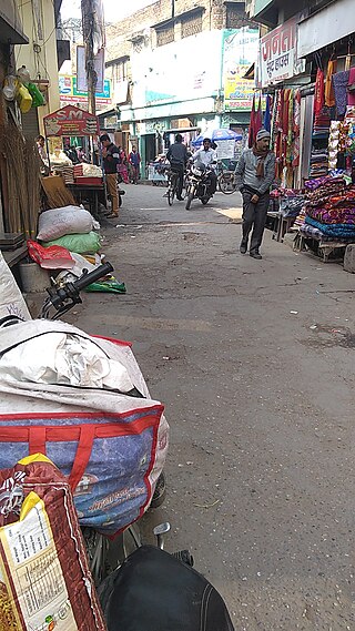
Bigwara is a village and gram panchayat in Rudrapur city, Udham Singh Nagar district in the Indian state of Uttarakhand. Bigwara is located in the fertile Terai region on National Highway 74, 3km milestone from Rudrapur. Since the establishment of SIDCUL, the village has enjoyed rapid development.
The Bigwara village has population of 1729 of which 884 are males while 845 are females as per Population Census 2011.
In Bigwara village population of children with age 0-6 is 292 which makes up 16.89% of total population of village. Average Sex Ratio of Bigbara village is 956 which is lower than Uttarakhand state average of 963. Child Sex Ratio for the Bigwara as per census is 1000, higher than Uttarakhand average of 890.
Bigwara village has lower literacy rate compared to Uttarakhand. In 2011, literacy rate of Bigwara village was 72.65% compared to 78.82% of Uttarakhand. In Bigbara Male literacy stands at 81.71% while female literacy rate was 63.09%.
As per constitution of India and Panchyati Raaj Act, Bigwara village is administrated by Sarpanch (Head of Village) who is elected representative of village.
Lifestyle
The fertile land lends itself to different forms of agriculture, giving rise to agriculture-related activities and industry, making this land a green place which has resulted in prosperity all around.
Accessibility
Bigwara is located on National Highway 74 in Rudrapur city in the state of Uttarakhand. The nearest Airport is at Pantnagar. Bigwara is well connected by road with all the major cities of the state and region. Delhi is at a distance of 234km whereas Nainital is just 75km away. The place is a junction of roads heading in four directions, one towards Kashipur and beyond to Haridwar, the other to Nainital, the third towards Kichha leading to Bareilly and Lucknow and the last one heading towards the national capital, New Delhi.
Residential zone
Since the establishment of SIDCUL, the village has enjoyed rapid development and many companies have establish townships and residential projects in village Bigwara.
Champawat is a town and a Nagar Palika Parishad in Champawat district in the state of Uttarakhand, India. It is the administrative headquarters of Champawat district. The town was the former capital of the Kumaon Kingdom.
Almora is a district in the Kumaon Division of Uttarakhand state, India. The headquarters is at Almora. It is 1,638 meters above sea level. The neighbouring regions are Pithoragarh district to the east, Chamoli district to the west, Bageshwar district to the north and Nainital district to the south.
Kashipur is a city of Udham Singh Nagar district in the Indian state of Uttarakhand, and one of its seven subdivisions. Located in the western part of Udham Singh Nagar district, it is Kumaun's third most populous city and the sixth most populous in Uttarakhand. According to the 2011 Census of India, the population is 121,623 for the city of Kashipur and 283,136 for Kashipur Tehsil. Kashipur also has IIM Kashipur, one of the thirteen Indian Institutes of Managements the government has set up during the Eleventh Five-year Plan.
Bhowali is a town and a municipal board in Nainital District in the state of Uttarakhand, India. It is situated at a distance of 11 km (6.8 mi) from the city of Nainital, the district headquarters; at an average elevation of 1,654 m (5,427 ft) from sea level. It is the seat of Bhowali tehsil, one of the eight subdivisions of Nainital district.
Chandpur is a town and a municipal board in Bijnor district in the Indian state of Uttar Pradesh, India.
Doiwala is a town and a Nagar Palika in Dehradun district in the state of Uttarakhand, India.
Gadarpur is a post independence city and a municipal board in Udham Singh Nagar district in the state of Uttarakhand, India. This city was formed with the arrival of the refugees from Pakistan at the time of partition of 1947. The refugees settled here and started living here. The refugees are Punjabi which makes up a majority in the city.
Jaspur is a developing town and a municipal board in Udham Singh Nagar district in the Indian state of Uttarakhand.
Kaladhungi is a town and a nagar panchayat in Nainital district in the Indian state of Uttarakhand.
Kelakhera is a Municipality Town in Tehsil Bajpur of Udham Singh Nagar district in the Indian state of Uttarakhand.
Kichha is oldest tehseel of Udham Singh Nagar district. It is older than Rudrapur city. It has its own municipal board, located in Udham Singh Nagar district, Uttarakhand, India.
Lalkuan is a Nagar Panchayat in the Nainital district of the Indian state of Uttarakhand.
Noorpur is a City and a Municipal Board in Bijnor District in the Indian State of Uttar Pradesh.
Rithora is a town and a nagar panchayat in Bareilly Tehsil of Bareilly district in the Indian state of Uttar Pradesh.
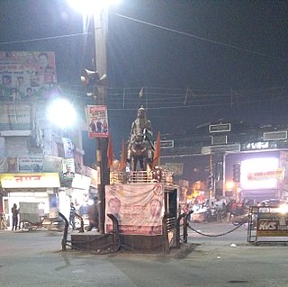
Rudrapur is a city that serves as the headquarters of the Udham Singh Nagar district in the Indian state of Uttarakhand. Located at a distance of about 250 km (160 mi) northeast of New Delhi and 250 km (160 mi) south of Dehradun, Rudrapur is located in the fertile Terai plains in the southern part of Kumaon division over an area of 27.65 km2. With a population of 140,857 according to the 2011 census of India, it is the 5th most populous city of Uttarakhand.
Sitarganj is a city and a municipal board in Udham Singh Nagar district in the Indian state of Uttarakhand. Now it is home to the Integrated Industrial Estate Sitarganj (IIE) being developed by State Industrial Development Corporation of Uttarakhand Limited (SIDCUL).
Chaukori is a hill station in the Pithoragarh district set among the lofty peaks of the western Himalayan Range in the Kumaon Division of Uttarakhand, India. To its north is Tibet and to its south is Terai. The Mahakali River, running along its eastern boundary, forms the Indo-Nepal international border. This place has become a prominent tourist place and from here a wide and picturesque view of Himalayan range can be viewed. The golden yellow colour of sun rays falling on the Himalayan range in the morning time is really worth seeing. There are cottages available here where one can stay and enjoy the serene surroundings. Tourists coming to this place generally also visit the nearby tourist places like Patal Bhuvaneshwar, Kausani, Bageshwar and Almora.
Kausani is a hill station and Village situated in Bageshwar district in the state of Uttarakhand, India. It is famous for its scenic splendour and its spectacular 300 km-wide panoramic view of Himalayan peaks like Trisul, Nanda Devi and Panchchuli. Mahatma Gandhi called this place the 'Switzerland of India', due to similarity in landscapes.
Someshwar is the name of the sub-division headquarters, a conglomeration of revenue villages and it also refers to the entire region as Someshwar Tehsil and Sub Division in the Almora District in the hill-state of Uttarakhand, India.
Jangalia Gaon Ganja is a village in Nainital District,Uttarakhand,India.
This page is based on this Wikipedia article Text is available under the CC BY-SA 4.0 license; additional terms may apply. Images, videos and audio are available under their respective licenses.