
Kumaon is a revenue and administrative division in the Indian State of Uttarakhand. It spans over the eastern half of the state and is bounded on the north by Tibet, on the east by Nepal, on the south by the state of Uttar Pradesh, and on the west by Garhwal. Kumaon comprises six districts of the state: Almora, Bageshwar, Champawat, Nainital, Pithoragarh and Udham Singh Nagar.

Udham Singh Nagar District is a district of Uttarakhand state in northern India. Rudrapur is the district headquarters. This district consists of nine Tehsils named Bajpur, Gadarpur, Rudrapur, Jaspur, Kashipur, Kichha, Khatima, Sitarganj, Nanakmatta. The district is located in the Terai region, and is part of Kumaon Division. It is bounded on the north by Nainital District, on the northeast by Champawat District, on the east by Nepal, and on the south and west by Bareilly, Rampur, Moradabad, Pilibhit and Bijnor District of Uttar Pradesh state. The district was created on 29 September 1995, by Mayawati government out of Nainital District. It is named for freedom fighter and Indian revolutionary Udham Singh.
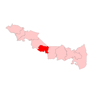
Kashipur is a city of Udham Singh Nagar district in the Indian state of Uttarakhand, and one of its seven subdivisions. Located in the western part of Udham Singh Nagar district, it is Kumaun's third most populous city and the sixth most populous in Uttarakhand. According to the 2011 Census of India, the population is 121,623 for the city of Kashipur and 283,136 for Kashipur Tehsil. Kashipur also has IIM Kashipur, one of the thirteen Indian Institutes of Managements the government has set up during the Eleventh Five-year Plan.
Bazpur, or Bajpur, is a city and a municipality in Udham Singh Nagar district in the state of Uttarakhand, India.

Bhowali is a town and a municipal board in Nainital District in the state of Uttarakhand, India. It is situated at a distance of 11 km (6.8 mi) from the city of Nainital, the district headquarters; at an average elevation of 1,654 m (5,427 ft) from sea level. It is the seat of Bhowali tehsil, one of the eight subdivisions of Nainital district.
Dineshpur is a town and a nagar panchayat in Udham Singh Nagar district in the state of Uttarakhand, India.

Gadarpur is a post independence city and a municipal board in Udham Singh Nagar district in the state of Uttarakhand, India. This city was formed with the arrival of the refugees from Pakistan at the time of partition of 1947. The refugees settled here and started living here. The refugees are Punjabi which makes up a majority in the city.
Jaspur is a developing town and a municipal board in Udham Singh Nagar district in the Indian state of Uttarakhand.
Kelakhera is a Municipality Town in Tehsil Bajpur of Udham Singh Nagar district in the Indian state of Uttarakhand.

Kichha is oldest tehseel of Udham Singh Nagar district. It is older than Rudrapur city. It has its own municipal board, located in Udham Singh Nagar district, Uttarakhand, India.
Mahuakhera Ganj is a City, a Nagar Palika Parishad in Udham Singh Nagar district in the Indian state of Uttarakhand. The Mahuakhera Ganj city is divided into 9 wards for which elections are held every 5 years.
Rithora is a town and a nagar panchayat in Bareilly Tehsil of Bareilly district in the Indian state of Uttar Pradesh.
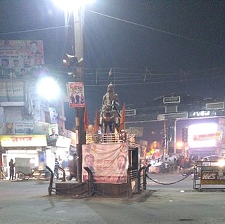
Rudrapur is a city that serves as the headquarters of the Udham Singh Nagar district in the Indian state of Uttarakhand. Located at a distance of about 250 km (160 mi) northeast of New Delhi and 250 km (160 mi) south of Dehradun, Rudrapur is located in the fertile Terai plains in the southern part of Kumaon division over an area of 27.65 km2. With a population of 140,857 according to the 2011 census of India, it is the 5th most populous city of Uttarakhand.

Sitarganj is a city and a municipal board in Udham Singh Nagar district in the Indian state of Uttarakhand. Now it is home to the Integrated Industrial Estate Sitarganj (IIE) being developed by State Industrial Development Corporation of Uttarakhand Limited (SIDCUL).

Bigbara is a village and gram panchayat in Rudrapur city, Udham Singh Nagar district in the Indian state of Uttarakhand. Bigbara is located in the fertile Terai region on National Highway 74, 3km milestone from Rudrapur. Since the establishment of SIDCUL, the village has enjoyed rapid development.
Kathangari is a village in Udham Singh Nagar district in the state of Uttrakhand, India, 10km from Sitarganj, 20 km from Kichha and 34km from Rudrapur, on the Sitarganj - Kichha National Highway 74. In the 2011 census of India, kathangari had a population of 896 people.
National Highway 109, , is a highway in India which runs in the Indian state of Uttarakhand. It is one of the most important routes, connecting the entire Kumaon region to the state as well as the country. It is also the major route towards the hill stations such as Nainital, Kausani, Ranikhet, Mukteswar and Almora from Delhi. Previously known as NH 87, it was renumbered as NH 109 in 2010. The northern terminal is at NH 7 near Karnaprayag and the southern terminal is at National Highway 9 near Rudrapur. More than 10,000 vehicles travel through NH-109 in tourist season.
Sotran is a village in Shaheed Bhagat Singh Nagar district of Punjab State, India. It is located 9.2 kilometres (5.7 mi) away Mukandpur, 1.8 kilometres (1.1 mi) from Banga, 12 kilometres (7.5 mi) from district headquarters Shaheed Bhagat Singh Nagar and 105 kilometres (65 mi) from the state capital Chandigarh. The village is administrated by Sarpanch an elected representative of the village.
Laroya is a village in Shaheed Bhagat Singh Nagar district of Punjab State, India. It is located 7.2 kilometres (4.5 mi) away from postal head office Mukandpur, 12 kilometres (7.5 mi) from Banga, 15 kilometres (9.3 mi) from district headquarter Shaheed Bhagat Singh Nagar and 106 kilometres (66 mi) from state capital Chandigarh. The village is administrated by Sarpanch an elected representative of the village.
Rudrapur Legislative Assembly constituency is one of the seventy electoral Uttarakhand Legislative Assembly constituencies of Uttarakhand state in India. It includes Rudrapur area of Udham Singh Nagar District.

