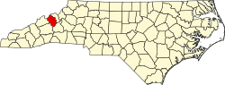
Ramseytown, North Carolina

Last updated
Ramseytown, North Carolina
One of the suspension bridges over the Cane River in Yancey County, NC.jpg
A suspension bridge over the Cane River, Ramseytown
USA North Carolina location map.svg
Red pog.svg
Ramseytown
Location within the state of North Carolina
Coordinates: 36°0′2.40″N82°21′26.48″W / 36.0006667°N 82.3573556°W / 36.0006667; -82.3573556
CountryUnited States
State North Carolina
County Yancey
IncorporatedFebruary 11, 1874
DisincorporatedUnknown
Named for Ramsey Family of Yancey County, NC
Area
  Total0.79 sq mi (2.0 km2)
  Land0.715 sq mi (1.85 km2)
  Water0.075 sq mi (0.19 km2)
Elevation
2,303 [1]  ft (996 m)
Highest elevation
(Julius Knob [2] )
3,822 ft (1,165 m)
Lowest elevation
(Cane River [3] )
2,099 ft (640 m)
Population
  Estimate 
(2020)
~45
Time zone UTC-5 (Eastern (EST))
  Summer (DST) UTC-4 (EDT)
ZIP code
28714
Area code 828
GNIS feature ID1022144

Ramseytown, formerly known as Ramsaytown and Ramsey Town Baptist Church, [4] [5] is an unincorporated community in far northern Yancey County, North Carolina, on the Cane River. Yancey County's Ramseytown Township derives its name from the settlement.

Contents

History

A U.S. Post Office bearing the name of Ramsaytown was established on November 5, 1852, with the first postmaster being Abraham Whitsen. It ceased operations on February 29, 1956. [4] The community was incorporated by the North Carolina General Assembly on February 11, 1874 as Ramsey Town Baptist Church, and the municipal limits were defined as a circle of one mile in radius, centered on the local baptist church. It was disincorporated on an unknown date. Alcoholic beverages consisting of 21% alcohol by volume or greater were illegal in the town, and the municipality's council was composed of five members. [5]

During World War I, five men from Ramseytown were drafted. [6]

The official name of the town, as recognized by the federal government, was changed from Ramsaytown to Ramseytown on January 1, 1931. [7]

On April 21, 1948, local railroad engineer Clarence Davenport (July 24, 1894–April 21, 1948) was killed in a boiler explosion near Ramseytown, described as one of the worst locomotive explosions in United States history at the time. The locomotive's fireman also perished in the blast. [8]

The community was home to the Ramsey Mine. [9]

Transportation and infrastructure

U.S. Route 19W runs through the community. [10] The community was formerly served by the Clinchfield Railroad. [8]

Ramseytown shares a fire department, the Egypt-Ramseytown Volunteer Fire Department, with the nearby unincorporated community of Egypt, North Carolina. [11] The department receives $21,037.50 in funding from the State of North Carolina as of 2023. [12]

U.S. Route 19W in Ramseytown US 19W in Ramseytown, NC.jpg
U.S. Route 19W in Ramseytown

Weather

Ramseytown was the site of an EF1 tornado during the Tornado outbreak sequence of August 4–8, 2023. Tornadoes are exceptionally rare in the area. [13]

Related Research Articles

<span class="mw-page-title-main">Raleigh, North Carolina</span> Capital city of North Carolina, United States

Raleigh is the capital city of the state of North Carolina and the seat of Wake County in the United States. It is the second-most populous city in North Carolina, after Charlotte. Raleigh is the tenth-most populous city in the Southeast, the 41st-most populous city in the U.S., and the largest city of the Research Triangle metro area. Raleigh is known as the "City of Oaks" for its many oak trees, which line the streets in the heart of the city. The city covers a land area of 147.6 sq mi (382 km2). The U.S. Census Bureau counted the city's population as 467,665 in the 2020 census. It is one of the fastest-growing cities in the United States. The city of Raleigh is named after Sir Walter Raleigh, who established the now-lost Roanoke Colony in present-day Dare County.

<span class="mw-page-title-main">Yancey County, North Carolina</span> County in North Carolina, United States

Yancey County is a county located in the U.S. state of North Carolina. As of the 2020 census, the population was 18,470. Its county seat is Burnsville.

<span class="mw-page-title-main">Madison County, North Carolina</span> County in North Carolina, United States

Madison County is a county located in the U.S. state of North Carolina. As of the 2020 census, the population was 21,193. Its county seat is Marshall. Madison County is part of the Asheville, NC Metropolitan Statistical Area.

<span class="mw-page-title-main">Cherokee County, North Carolina</span> County in North Carolina, United States

Cherokee County is the westernmost county in the U.S. state of North Carolina. It borders Tennessee to its west and Georgia to its south. As of the 2020 census, the population was 28,774. The county seat is Murphy.

<span class="mw-page-title-main">Caldwell County, North Carolina</span> County in North Carolina, United States

Caldwell County is a county in the U.S. state of North Carolina. It is located in the foothills of the Blue Ridge Mountains. As of the 2020 census, the population was 80,652. Its county seat is Lenoir. Caldwell County is part of the Hickory-Lenoir-Morganton, NC Metropolitan Statistical Area.

<span class="mw-page-title-main">Buncombe County, North Carolina</span> County in North Carolina, United States

Buncombe County is a county located in the U.S. state of North Carolina. It is classified within Western North Carolina. The 2020 census reported the population was 269,452. Its county seat is Asheville. Buncombe County is part of the Asheville, NC Metropolitan Statistical Area.

<span class="mw-page-title-main">Madisonville, Kentucky</span> City in Kentucky, United States

Madisonville is a home rule-class city in and the county seat of Hopkins County, Kentucky, United States, located along Interstate 69 in the state's Western Coal Fields region. The population was 19,591 at the 2010 census. Madisonville is a commercial center of the region and is home to Madisonville Community College.

<span class="mw-page-title-main">Burlington, North Carolina</span> City in North Carolina, United States

Burlington is a city in Alamance and Guilford counties in the U.S. state of North Carolina. It is the principal city of the Burlington, NC Metropolitan Statistical Area, which encompasses all of Alamance County, in which most of the city is located, and is a part of the Greensboro–Winston-Salem–High Point, NC Combined Statistical Area. The population was 57,303 at the 2020 census, which makes Burlington the 18th most populous city in North Carolina.

<span class="mw-page-title-main">Yanceyville, North Carolina</span> Town in North Carolina, United States

Yanceyville is a town in and the county seat of Caswell County, North Carolina, United States. Located in the Piedmont Triad region of the state, the town had a population of 1,937 at the 2020 census.

<span class="mw-page-title-main">Jacksonville, North Carolina</span> City in North Carolina, United States

Jacksonville is a city in Onslow County, North Carolina, United States. As of the 2020 census, the population was 72,723, which makes Jacksonville the 14th-most populous city in North Carolina. Jacksonville is the county seat and most populous community of Onslow County, which is coterminous with the Jacksonville, NC Metropolitan Statistical Area. Demographically, Jacksonville is the youngest city in the United States, with an average age of 22.8 years old, which can be attributed to the large military presence. The low age may also be in part due to the population drastically going up over the past 80 years, from 783 in the 1930 census to 72,876 in the 2021 Census estimate.

<span class="mw-page-title-main">Apex, North Carolina</span> Town in North Carolina, United States

Apex is a town in Wake County, North Carolina, United States. At its southern border, Apex encompasses the community of Friendship. In 1994, the downtown area was designated a historic district, and the Apex train depot, built in 1867, is designated a Wake County landmark. The depot location marks the highest point on the old Chatham Railroad, hence the town's name. The town motto is "The Peak of Good Living".

<span class="mw-page-title-main">Wake Forest, North Carolina</span> Town in North Carolina, United States

Wake Forest is a town in Franklin, Granville and Wake counties in the U.S. state of North Carolina; located almost entirely in Wake County, it lies just north of the state capital, Raleigh. At the 2020 census, the population was 47,601. That is up from 30,117 in 2010, up from 12,588 in 2000. The U.S. Census Bureau estimates the city's population to be 47,601 as of April 1, 2020. In 2007, the town was listed by Forbes magazine as the 20th fastest growing suburb in America, with a 73.2 percent increase in population between 2000 and 2006. Wake Forest was the original home of Wake Forest University for 122 years before it moved to Winston-Salem in 1956.

<span class="mw-page-title-main">Burnsville, North Carolina</span> Town in North Carolina, United States

Burnsville is a town that serves as the county seat of Yancey County, North Carolina, United States. Located in the Blue Ridge Mountains of western North Carolina, sits in the shadow of Mount Mitchell, the highest peak in the Eastern Continental United States. The population was 1,612 at the 2020 census.

<span class="mw-page-title-main">Davidson, North Carolina</span> Town in North Carolina, United States

Davidson is a suburban town located in northern Iredell and Mecklenburg counties, North Carolina, United States, on the banks of Lake Norman. It is a suburb in the Charlotte metropolitan area. The population was 10,944 at the 2010 census, and in 2019 the estimated population was 13,054. The town was founded in 1837 with the establishment of the Presbyterian Davidson College, named for Brigadier General William Lee Davidson, a local Revolutionary War hero. The land for Davidson College came from Davidson's estate, a large portion of which was donated by his son.

<span class="mw-page-title-main">U.S. Route 19E</span> Suffixed section of U.S. Highway in Tennessee and North Carolina

U.S. Route 19E (US 19E) is a divided highway of US 19 in the U.S. states of North Carolina and Tennessee. The United States Numbered Highway, which is complemented by US 19W to the west, travels 75.9 miles (122.1 km) from US 19 and US 19W at Cane River, North Carolina, north to US 11E, US 19, and US 19W in Bluff City, Tennessee. US 19E connects Asheville, North Carolina, and Bristol, Tennessee, with Burnsville, Spruce Pine, and Elk Park in North Carolina and Roan Mountain and Elizabethton in Tennessee. US 19E also has an unsigned concurrency with State Route 37 (SR 37) for its entire course in Tennessee.

<span class="mw-page-title-main">U.S. Route 19W</span> Suffixed section of U.S. Highway in Tennessee and North Carolina

U.S. Route 19W (US 19W) traverses approximately 63 miles (101 km) from Cane River, North Carolina, to Bluff City, Tennessee.

Longwood is an unincorporated community in Brunswick County, North Carolina, United States. The community is located on North Carolina Highway 904, 8.6 miles (13.8 km) north of Sunset Beach. Longwood has a post office with ZIP code 28452.

<span class="mw-page-title-main">Gilmore, Oklahoma</span> Unincorporated community in Oklahoma, United States

Gilmore is an unincorporated community in Le Flore County, Oklahoma, United States. The town, formerly incorporated, boasted a small post office, city hall, and Mayor Pratt McMillin, a rancher and oil distributor who died in April 2001, aged 84.

<span class="mw-page-title-main">Sioux, North Carolina</span> Unincorporated community in North Carolina, United States

Sioux is an unincorporated community in far northern Yancey County, North Carolina, located alongside Big Creek, a tributary of the Cane River.

<span class="mw-page-title-main">Boonford, North Carolina</span> Ghost town in North Carolina, United States

Boonford is a ghost town in Yancey County, North Carolina, and Mitchell County, North Carolina, located near present-day North Carolina Highway 80.

References

  1. US Department of Commerce, NOAA. "National Weather Service". forecast.weather.gov. Retrieved 2023-10-17.
  2. "OpenStreetMap". OpenStreetMap. Retrieved 2023-10-21.
  3. "OpenStreetMap". OpenStreetMap. Retrieved 2023-10-21.
  4. 1 2 "Yancey County Post Offices 1833 to 1971 - Alphabetical Order". www.carolana.com. Retrieved 2023-10-21.
  5. 1 2 State of North Carolina (1874). Laws and Resolutions of the State of North Carolina, Passed by the General Assembly at Its Session, 1873-'74. Compiled by Turner, Josiah, Jr. (1873-'74 ed.). Raleigh, North Carolina: J. Gales & Son, 1874. p. 382.
  6. "Local Draft Board Records, Yancey County - North Carolina Digital Collections". digital.ncdcr.gov. Retrieved 2023-10-21.
  7. "Geographic Names Information System". edits.nationalmap.gov. Retrieved 2023-10-21.
  8. 1 2 Gardner, Tim (2023-04-21). "Locomotive Explosion Killing Avery County Engineer Ed Davenport Recalled on the Tragedy's 75th Anniversary". High Country Press. Retrieved 2023-10-21.
  9. https://www.mindat.org/loc-27605.html
  10. "NCRoads.com: U.S. 19-W". www.vahighways.com. Retrieved 2023-10-17.
  11. "Egypt-Ramseytown - wncfirepics". www.wncfirepics.com. Retrieved 2023-10-21.
  12. https://www.ncosfm.gov/2023-fire-grant-recipients/open
  13. Newman, Anne (16 August 2023). "Tornado touched down in Yancey County, NWS confirms". WYFF4. Retrieved 17 October 2023.