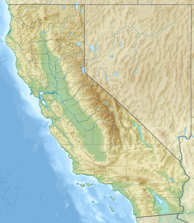
Johannesburg is a census-designated place (CDP) in Kern County, California, in a mining district of the Rand Mountains. Johannesburg is located 1 mile (1.6 km) east-northeast of Randsburg, at an elevation of 3,517 feet (1,072 m). The terminus of the Randsburg Railway was here from 1897 to 1933. The population was 172 at the 2010 census, down from 176 at the 2000 census. Johannesburg is divided from the neighboring community of Randsburg by a ridge. The town is frequently referred to as "Jo-burg" by locals and frequent visitors to the northwest Mojave.

The Mojave Desert is an arid rain-shadow desert and the driest desert in North America. It is in the Southwestern United States, primarily within southeastern California and southern Nevada, and it occupies 47,877 sq mi (124,000 km2). Small areas also extend into Utah and Arizona. Its boundaries are generally noted by the presence of Joshua trees, which are native only to the Mojave Desert and are considered an indicator species, and it is believed to support an additional 1,750 to 2,000 species of plants. The central part of the desert is sparsely populated, while its peripheries support large communities such as Las Vegas in Nevada, Barstow, Lancaster, Palmdale, and Victorville in California, and St. George in Utah.

The Panamint Range is a short rugged fault-block mountain range in the northern Mojave Desert, within Death Valley National Park in Inyo County, eastern California. Dr. Darwin French is credited as applying the term Panamint in 1860 during his search for the fabled Gunsight Lode. The orographic identity has been liberally applied for decades to include other ranges.

Oro Grande is an unincorporated community in the Mojave Desert of San Bernardino County, California, United States. It lies on the city boundary of Victorville and Adelanto. It is at 3,000 feet (910 m) elevation in Victor Valley north of the San Bernardino mountain range. It is located on old Route 66 near Interstate 15 between Victorville and Barstow. The ZIP code is 92368 and the community is inside area codes 442 and 760. Less than 1,000 residents live in the unincorporated area.
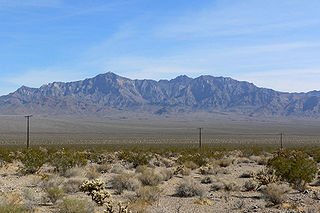
The Providence Mountains are found in the eastern Mojave Desert of San Bernardino County, California, U.S. The range reaches an elevation of 7,162 feet (2,183 m) at Edgar Peak and is home to the Mitchell Caverns Natural Preserve in the Providence Mountains State Recreation Area, and the Mojave National Preserve.

The Chemehuevi Mountains are found at the southeast border of San Bernardino County in southeastern California adjacent the Colorado River. Located south of Needles, California and northwest of the Whipple Mountains, the mountains lie in a north-south direction in general, and are approximately 15 miles in length.
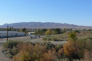
The Sacramento Mountains are a mountain range in the Eastern Mojave Desert and within Mojave Trails National Monument, in San Bernardino County, California.

The Turtle Mountains, are located in northeastern San Bernardino County, in the southeastern part of California. The colorful Turtle Mountains vary from deep reds, browns, tans and grays, to black. The area has numerous springs and seeps. The Turtle Mountains are also a National Natural Landmark, with two mountain sections of entirely different composition.

The Whipple Mountains are located in eastern San Bernardino County, California. They are directly west of the Colorado River, Parker Dam, and Lake Havasu; south of Needles, California; north of Parker, Arizona and Vidal, California; and northeast of Vidal Junction, California.

The El Paso Mountains are located in the northern Mojave Desert, in central Southern California in the Western United States.

The Castle Mountains are located in the Eastern Mojave Desert, in northeastern San Bernardino County, California and Clark County, Nevada. The range lies south and east of the New York Mountains, southwest of Searchlight and west of Cal-Nev-Ari, Nevada.

The Calico Mountains of California are a mountain range located in the Mojave Desert. The range spans San Bernardino and Inyo counties in California.

The Randsburg Railway was a 28.5-mile (45.9 km) branch line railroad in California's Mojave Desert. It originated at the main line of the Atchison, Topeka, and Santa Fe Railroad (AT&SF) at Kramer Junction, California, and terminated at Johannesburg, California, with a stop at Atolia. The Railway served as a supply link to the Rand Mine, which produced more silver than any mine in California. The Rand mine closed in 1929, as it was no longer profitable.
Atolia is a ghost town in the Mojave Desert near Randsburg, in northwestern San Bernardino County, California.

The Deserts of California have unique ecosystems and habitats, a sociocultural and historical "Old West" collection of legends, districts, and communities, and they also form a popular tourism region of dramatic natural features and recreational development. All of the deserts are located in eastern Southern California, in the Western United States.
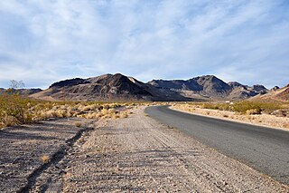
The Bullfrog Hills are a small mountain range of the Mojave Desert in southern Nye County, southwestern Nevada. Bullfrog Hills was so named from a fancied resemblance of its ore to the color of a bullfrog.

The Buckskin Mountains is a mountain range in La Paz County, Arizona, United States. The range lies just east of the north-south Colorado River, and borders south of the east-west, west-flowing Bill Williams River.

The Rawhide Mountains are a mountain range of western Arizona, in the southwest of Mohave County. It is part of a block of mountain ranges on the north of an insular region called the Maria fold and thrust belt, containing mountain ranges, valleys, and plains. The Rawhide Mountains border the much smaller Artillery Mountains southeast, bordering on Alamo Lake State Park and the south-flowing Big Sandy River.
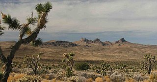
Castle Mountains National Monument is a U.S. National Monument located in the eastern Mojave Desert and northeastern San Bernardino County, in the state of California.
Seventeen Mile Point is a mountain at the north end of the Old Dad Mountains in San Bernardino County, California. Its summit is at an altitude of 2,500 feet / 762 meters.
