The topic of this article may not meet Wikipedia's notability guideline for biographies .(October 2017) |
Raymond Murray Patterson (1898 - 1984) was an Oxford educated writer and explorer of the Canadian northwest.
The topic of this article may not meet Wikipedia's notability guideline for biographies .(October 2017) |
Raymond Murray Patterson (1898 - 1984) was an Oxford educated writer and explorer of the Canadian northwest.
"R.M. Patterson is recognized by many as one of the finest writers on the Canadian wilderness. While his writing skills earned him a wide and appreciative audience, he was more than a skilled wordsmith. He was also a careful and sympathetic observer, an intrepid explorer and a meticulous historian. Orville Prescott, in the New York Times, described his Dangerous River as "a modest book which betrays no indication that Mr. Patterson realizes what a remarkable man he is.” It is through his autobiographical writings, a blended mix of history, adventure and vivid description, that we can appreciate this remarkable individual. He published five books over a span of 14 years: Dangerous River (1954), Buffalo Head (1961), Far Pastures (1963), Trail to the Interior (1966) and Finlay’s River (1968)." [1]
Patterson was born in England in 1898. He was educated at Rossall School [2] and later attended Oxford University, where he trained for a career at the Bank of England. He served in World War I as an artillery officer until he was captured, and he remained a POW until the end of the War.
In 1924, longing for adventure, Patterson went to Canada where he obtained a homestead on the Peace River. In 1927 he explored the Nahanni River in a canoe. Many years later, he wrote his most famous book Dangerous River, about his two trips into the Nahanni River Valley during the late 1920s.
Patterson married Marigold Portman in 1929, the same year he sold his homestead and moved to Buck Spring Ranch near Cochrane, Alberta. From this location, for the next four years, he completed a series of explorations throughout the region. Of particular note was his exploration of the Highwood River, Highwood Pass and the Lower and Upper Kananaskis Lakes region.
In 1933 he purchased the Buffalo Head Ranch in the Highwood Valley from George Pocaterra. From this location, between 1933 and 1945 he explored the Highwood and Elk Valley region. In 1945, aggrieved over the opening of a road into the Highwood Valley and the aftermath of a 1936 fire, he sold the ranch and resettled to Victoria, British Columbia. Over the next twenty-five years he wrote a series of articles for Blackwood's Magazine and The Beaver and five books about his explorations and adventures. He died in 1984.
His legacy includes "Patterson's Peak" which was officially adopted in 2000 by the Geographical Names Board of Canada. [3] The peak is just northwest of Mount Head which he is credited with making the first ascent in 1934. He made the first ascent of Holy Cross Mountain in 1937.
The information in this article can be confirmed and supplemented by referring to an article published by The Arctic Institute of North America, linked here: https://pubs.aina.ucalgary.ca/arctic/Arctic44-1-85.pdf

Mount Robson is the most prominent mountain in North America's Rocky Mountain range; it is also the highest point in the Canadian Rockies. The mountain is located entirely within Mount Robson Provincial Park of British Columbia, and is part of the Rainbow Range. Mount Robson is the second highest peak entirely in British Columbia, behind Mount Waddington in the Coast Range. The south face of Mount Robson is clearly visible from the Yellowhead Highway, and is commonly photographed along this route.

Wood Buffalo National Park is the largest national park of Canada at 44,741 km2 (17,275 sq mi). It is located in northeastern Alberta and the southern Northwest Territories. Larger in area than Switzerland, it is the second-largest national park in the world. The park was established in 1922 to protect the world's largest herd of free-roaming wood bison. They became hybridized after the introduction of plains bison. The population is currently estimated at about 3,000. It is one of two known nesting sites of whooping cranes.

Nahanni National Park Reserve in the Dehcho Region of the Northwest Territories, Canada, approximately 500 km (311 mi) west of Yellowknife, protects a portion of the Mackenzie Mountains Natural Region. The centrepiece of the park is the South Nahanni River. Four noteworthy canyons reaching 1,000 m (3,300 ft) in depth, called First, Second, Third and Fourth Canyon, line its whitewater river. The name Nahanni comes from the indigenous Dene language name for the area; Nahʔa Dehé, which means "river of the land of the Nahʔa people". The park was among the world's first four natural heritage locations to be inscribed as World Heritage Sites by UNESCO in 1978 because of its picturesque wild rivers, canyons, and waterfalls. The park is also said to be haunted or cursed, following the mysterious disappearances and deaths of several gold prospectors over the years.

The Dene people are an indigenous group of First Nations who inhabit the northern boreal and Arctic regions of Canada. The Dene speak Northern Athabaskan languages. Dene is the common Athabaskan word for "people". The term "Dene" has two usages. More commonly, it is used narrowly to refer to the Athabaskan speakers of the Northwest Territories and Nunavut in Canada, especially including the Chipewyan (Denesuline), Tlicho (Dogrib), Yellowknives (T'atsaot'ine), Slavey, and Sahtu. However, it is sometimes also used to refer to all Northern Athabaskan speakers, who are spread in a wide range all across Alaska and northern Canada. The Southern Athabaskan speakers, however, also refer to themselves by similar words: Diné (Navajo) and Indé (Apache).

The Peace River is a 1,923-kilometre-long (1,195 mi) river in Canada that originates in the Rocky Mountains of northern British Columbia and flows to the northeast through northern Alberta. The Peace River joins the Athabasca River in the Peace-Athabasca Delta to form the Slave River, a tributary of the Mackenzie River. The Finlay River, the main headwater of the Peace River, is regarded as the ultimate source of the Mackenzie River. The combined Finlay–Peace–Slave–Mackenzie river system is the 13th longest river system in the world.

The Columbia Icefield is the largest ice field in North America's Rocky Mountains. Located within the Canadian Rocky Mountains astride the Continental Divide along the border of British Columbia and Alberta, Canada, the ice field lies partly in the northwestern tip of Banff National Park and partly in the southern end of Jasper National Park. It is about 325 square kilometres (125 sq mi) in area, 100 to 365 metres in depth and receives up to 7 metres (280 in) of snowfall per year.

The Peace River Country is an aspen parkland region centring on the Peace River in Canada. It extends from northwestern Alberta to the Rocky Mountains in northeastern British Columbia, where a certain portion of the region is also referred to as the Peace River Block.

Henry Kelsey was an English fur trader, explorer, and sailor who played an important role in establishing the Hudson's Bay Company in Canada.

The Kechika River is a tributary of the Liard River, about 300 kilometres (190 mi) long, in northern British Columbia, Canada. The Kechika flows generally northwest through the northernmost section of the Rocky Mountain Trench before turning east to join the Liard, a major branch of the Mackenzie River system. The river's 22,700 km2 (8,800 sq mi) drainage basin is characterized by high glaciated peaks, boreal forest, and open tundra. With no settlements, roads or dams along its course, the Kechika is considered "one of British Columbia's finest examples of wilderness and undisturbed wildlife habitat."
John McLeod was a Scottish-born explorer of Canada, in his capacity as a fur trader with the North West Company and Hudson's Bay Company. He is remembered primarily for his explorations of several major rivers of the southwestern Northwest Territories, southern Yukon Territory, and northern British Columbia.
Pink Mountain may refer to an unincorporated community on the Alaska Highway, a nearby mountain, or the hunting guiding territory west of the mountain.

Longview is a village in southern Alberta, Canada. It is located in the Canadian Rockies foothills, on Cowboy Trail, 32 km west of High River and 64 km south of Calgary. Highwood River flows west of the village.

The history of the Northwest Territories covers the period from thousands of years ago to the present day. Prior to European colonization, the lands that encompass present-day Northwest Territories were inhabited for millennia by several First Nations. European explorers and fur traders began to explore the region since the late-16th century. By the 17th century, the British laid claim to both the North-Western Territory and Rupert's Land; and granted the Hudson's Bay Company a commercial fur trade monopoly over the latter region.

The South Nahanni River is a major tributary of the Liard River, located roughly 500 km (310 mi) west of Yellowknife in the Northwest Territories of Canada. It is the centerpiece of Nahanni National Park Reserve. It flows from the Mackenzie Mountains in the west, through the Selwyn Mountains, growing as it heads east over the majestic Virginia Falls, and finally empties into the Liard River. The Nahanni has a unique geological history. It was formed when the area was a broad flat plain, forming a winding course typical of flatland rivers. As the mountains lifted, the river cut four deep canyons into the rock, maintaining its eccentric course.
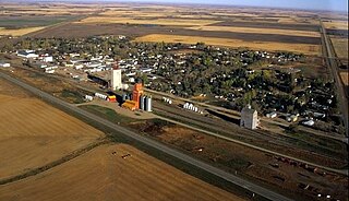
Luseland is a small town in Rural Municipality of Progress No.351, in the west-central region of Saskatchewan. The town's population as of the 2006 Canadian Census was 571, down 5% from the 2001 Census.
Albert Faille was an early pioneer, explorer, trapper and prospector of the Canadian North.
Nahanni is a 1962 short documentary from the National Film Board of Canada directed by Donald Wilder.
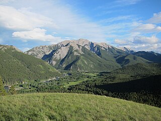
The Livingstone Range is a sub-range of the Canadian Rockies in Alberta, Canada. It forms the eastern boundary of the Rockies in the south of the province. Its northern boundary is the Highwood River, and it extends to the Crowsnest Pass in the south. The Livingstone and Oldman Rivers bound it to the west.

Mount Head is a 2,782-metre (9,127-foot) mountain summit located in Alberta, Canada.
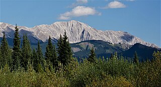
Holy Cross Mountain is a 2,650-metre (8,694-foot) mountain summit located in Alberta, Canada.
| International | |
|---|---|
| National | |
| Other | |