| Highwood Pass | |
|---|---|
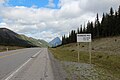
 Misty Range towering above Kananaskis Trail in the Highwood Pass | |
| Elevation | 2,206 m (7,238 ft) [1] [2] |
| Traversed by | Kananaskis Trail |
| Location | Kananaskis, Alberta, Canada |
| Range | Misty Range |
| Coordinates | 50°35′58″N114°59′16″W / 50.59944°N 114.98778°W [3] |
| Topo map | NTS 82J10 Mount Rae |
 Location in Alberta | |
Highwood Pass is a mountain pass in Kananaskis Country, Alberta, Canada. It lies west of Mount Rae and Mount Arethusa of the Misty Range, south of Elbow Pass. It lies within Peter Lougheed Provincial Park on Alberta Highway 40 (Kananaskis Trail). Kananaskis Trail runs through the pass and offers access to campgrounds and recreational areas. The Highwood River originates in the pass.