
The Winston Churchill Range is a mountain range in the central section of the Park Ranges of the Canadian Rockies located in Jasper National Park. The range was named after Sir Winston Churchill, former British prime minister.

The Fairholme Range is a mountain range east of the Bow River valley in the Canadian Rockies. The range is bounded on the west side by the Trans-Canada Highway as it passes through the towns of Exshaw and Canmore, while the northern section of the range extends into Banff National Park to the southern shores of Lake Minnewanka. John Palliser named the range in 1859 after his sister Grace Fairholme, who had married William Fairholme.

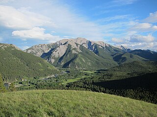
The Slate Range is a mountain range of the Canadian Rockies, located in Banff National Park, Canada. The range is named after slate, the primary composition of the mountains in the area.

The Kananaskis Range is a mountain range west of the Kananaskis River in the Continental Ranges of the Canadian Rockies. Many of the peaks are named after ships and people involved in the Battle of Jutland.

The Sawback Range is a mountain range of the Canadian Rockies that stretches from the Bow Valley in Alberta into southeastern Banff National Park.

The Blue Range is a mountain range of the Canadian Rockies, located on the Continental Divide in Banff National Park, Canada. The range was so named on account of its blueish colour when viewed from afar. Mount Alcantara is the highest point in the range.

The Jacques Range is a mountain range in the Front Ranges of the Canadian Rockies, located south of Highway 16 and Jasper Lake in Jasper National Park, Alberta, Canada.

The Colin Range is a mountain range of the Canadian Rockies located directly northeast of the Jasper townsite in Jasper National Park, Canada.

The Maligne Range is a mountain range of the Canadian Rockies located directly southeast of Jasper townsite in Jasper National Park, Canada. The southern tail-end of the range finishes at Endless Chain Ridge.

The Misty Range is a mountain range of the Canadian Rockies located east of the Bighorn Highway within Kananaskis Country, Canada.

The Bow Range is a mountain range of the Park Ranges in Alberta and British Columbia, Canada. The range is named in association with the Bow River and was officially adopted on March 31, 1917 by the Geographic Board of Canada.

The High Rock Range is a mountain range of the Canadian Rockies in southwestern Alberta and southeastern British Columbia, Canada.

The South Jasper Ranges are mountain ranges of the Rocky Mountains in Alberta and British Columbia, Canada.

Mount Unwin is a 3,268-metre (10,722-foot) mountain summit located on the west side of Maligne Lake in Jasper National Park, in the Queen Elizabeth Range of the Canadian Rockies of Alberta, Canada. Its nearest higher peak is Mount Brazeau, 13.0 km (8.1 mi) to the east-southeast.
The Tower of London Range is a sub-range of the Northern Rocky Mountains in northern British Columbia, Canada, located northwest of the Tuchodi Lakes at the northwest end of the Northern Rocky Mountains Provincial Park to the southwest of Fort Nelson.
The Livingstone Range is a sub-range of the Canadian Rockies in Alberta, Canada. It forms the eastern boundary of the Rockies in the south of the province. Its northern boundary is the Highwood River and it extends to Crowsnest Pass in the south. The Livingstone and Oldman Rivers bound it to the west.

Mount Charlton is a 3,217-metre (10,554-foot) mountain summit located on the west side of Maligne Lake in Jasper National Park, in the Canadian Rockies of Alberta, Canada. Its nearest higher peak is Mount Unwin, 1.2 km (0.75 mi) to the west.

Maligne Mountain is a 3,200-metre (10,500-foot) multi-peak massif located east of Maligne Lake in Jasper National Park, in the Canadian Rockies of Alberta, Canada. Maligne Mountain is surrounded by glaciers, and its nearest higher peak is Monkhead, 7.8 km (4.8 mi) to the south.
Misinchinka Ranges, is the largest subdivision range of the Hart Ranges, of the Northern Rockies in British Columbia, Canada. The boundaries of the Misinchinka Ranges generally lie between the Rocky Mountain Trench to the west, Clearwater Creek and the Sukunka River to the east, the Peace Arm of Williston Reservoir to the north and Monkman Provincial Park to the south.

The Flathead Range is a mountain range of the Canadian Rockies in Alberta and British Columbia, Canada. It is located on the Continental Divide, east of Fernie, in the Kootenay Land District. It stretches 27 km (17 mi) lengthwise north–south from Crowsnest Pass to North Kootenay Pass. The range's toponym was officially adopted on 30 June 1912 by the Geographic Board of Canada, and was named in association with the Flathead River.

