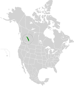
Alberta Mountains forest | |
---|---|
Ecology | |
Realm | Nearctic |
Biome | Temperate coniferous forests |
Borders | |
Bird species | 179 [1] |
Mammal species | 57 [1] |
Geography | |
Area | 39,800 km2 (15,400 sq mi) |
Country | Canada |
Provinces | |
Climate type | Highly variable |
Conservation | |
Conservation status | Relatively Stable/Intact [2] |
Habitat loss | 56.25% [1] |
Protected | 63.85% [1] |
The Alberta Mountain forests are a temperate coniferous forests ecoregion of Western Canada, as defined by the World Wildlife Fund (WWF) categorization system. [2]
This ecoregion covers the grand Rocky Mountains of Alberta including the eastern outliers of the Continental Ranges. Located almost entirely in Alberta and taking in the Alberta-British Columbia border from Banff north to Jasper, Alberta and Kakwa Wildlands Park. This is an area of glaciers and high mountains covered with a forest of tall trees. The highest points are the mountains around the Columbia Icefield the largest ice field in the Rockies.
The mountain valleys have a mild climate with warm, dry summers and snowy winters but the high mountain sides have a harsher climate. Average summer temperatures are 12 °C going down to -7 °C in winter. [2]
Trees include Trembling aspen ( Populus tremuloides ), Lodgepole Pine ( Pinus contorta ), Engelmann spruce ( Picea engelmannii ), White spruce ( Picea glauca ), Subalpine fir ( Abies lasiocarpa ) [2] and Rocky Mountain Douglas-fir ( Pseudotsuga menziesii var. glauca ) as minor component in the central and southern part of the ecoregion.
These mountains are home to good numbers of large mammals. All five species of North American deer inhabit this ecoregion including woodland caribou (Rangifer tarandus caribou), elk (Cervus elaphus), moose (Alces alces andersoni), mule deer (Odocoileus hemionus), and white-tailed deer (northern Rocky Mountains/tawny white-tail) (Odocoileus virginianus ochrourus). Bighorn sheep (Ovis canadensis), and mountain goat (Oreamnos americanus) can also be found here. Predators in the mountains and forests include lynx (Lynx canadensis), coyote (Canis latrans), grizzly bear (Ursus arctos horribilis), black bear (Ursus americanus cinnamomum), cougar (Puma concolor couguar), red fox (Vulpes vulpes), and wolf (Canis lupus). Smaller wildlife such as snowshoe hare (Lepus americanus), and American pygmy shrew (Sorex hoyi) can be found here as well and the Banff Springs snail (Physella johnsoni) which is endemic to Banff National Park. Birds include Townsend's warbler (Setophaga townsendi), Clark's nutcracker (Nucifraga columbiana), Black-billed magpie (Pica hudsonia), veery (Catharus fuscescens), and bald eagle (Haliaeetus leucocephalus). [2]
80% of these forests are intact although some is being removed for urban development and tourism in the valley areas. Large areas of natural habitat remain in Banff National Park, Jasper National Park, Kakwa Wildlands, Willmore Wilderness Park, and Ghost River Wilderness Area.
This ecozone corresponds to the human region called Alberta's Rockies.
British Columbia mainland coastal forests is a temperate coniferous forest ecoregion the Pacific coast of North America, as defined by the World Wildlife Fund (WWF) categorization system.
The Cascade Mountains leeward forests are a temperate coniferous forest ecoregion of North America, as defined by the World Wildlife Fund (WWF) categorization system.
The eastern forest–boreal transition is a temperate broadleaf and mixed forests ecoregion of North America, mostly in eastern Canada. It is a transitional zone or region between the predominantly coniferous Boreal Forest and the mostly deciduous broadleaf forest region further south.
The Eastern Great Lakes lowland forests is a temperate broadleaf and mixed forest ecoregion of North America, as defined by the World Wildlife Fund. It lies mostly in south and eastern Ontario and Quebec in Canada, and Upstate New York and Vermont in the United States.
The Gulf of St. Lawrence lowland forests are a temperate broadleaf and mixed forest ecoregion of Eastern Canada, as defined by the World Wildlife Fund (WWF) categorization system.
The Alberta–British Columbia foothills forests are a temperate coniferous forests ecoregion of Western Canada, as defined by the World Wildlife Fund (WWF) categorization system. This ecoregion borders Canada's taiga and contains a mix of subarctic forest and temperate forest species as a result. This makes the region an ecotone region, or a region that acts as a buffer between two other biomes.
The Eastern Canadian Shield taiga is an ecoregion of Canada as defined by the World Wildlife Fund (WWF) categorization system.
The Yukon Interior dry forests is a taiga ecoregion of Canada.
The Muskwa-Slave Lake forests ecoregion covers Canadian taiga in northwestern Alberta, northeastern British Columbia and a large portion of the southwestern Northwest Territories around the Mackenzie River valley and the Great Slave Lake.
The South Central Rockies forests is a temperate coniferous forest ecoregion of the United States located mainly in Wyoming, Idaho, and Montana. It has a considerably drier climate than the North Central Rockies forest.
The Colorado Rockies forests is a temperate coniferous forest ecoregion of the United States.
The Wasatch and Uinta montane forest is a temperate coniferous forest ecoregion in the Wasatch Range and Uinta Mountains of the western Rocky Mountains system, in the Western United States.
The North Central Rockies forests is a temperate coniferous forest ecoregion of Canada and the United States. This region overlaps in large part with the North American inland temperate rainforest and gets more rain on average than the South Central Rockies forests and is notable for containing the only inland populations of many species from the Pacific coast.
The Mid-Continental Canadian forests are a taiga ecoregion of Western Canada, as defined by the World Wildlife Fund (WWF) categorization system.
The Midwestern Canadian Shield forests ecoregion, in the Taiga and Boreal forests Biome, are of northern Canada.
The Central Canadian Shield forests are a taiga ecoregion of Eastern Canada, as defined by the World Wildlife Fund (WWF) categorization system.
The Southern Great Lakes lowland forests is a temperate broadleaf and mixed forest ecoregion of North America, as defined by the World Wildlife Fund. Located near the Great Lakes, it lies mostly in the central northeastern United States and extends into southeast central Canada. In modern times, little of it remains intact due to land use, including agriculture and urban uses.
The Interior Yukon-Alaska alpine tundra ecoregion covers alpine, sub-alpine, and boreal forest areas along the cordillera of Interior Alaska and south-central Yukon Territory. Geologically, they are the disjunct uplands of the Yukon-Tanana Terrane plus a southern extension of the Brooks Range. The cover is extensive 'dark taiga' of closed spruce forest, open forest of other species, and alpine vegetation at higher altitudes. The region is mostly wilderness and relatively untouched by human development.
The Ogilvie–MacKenzie alpine tundra ecoregion covers the mountainous middle of the Yukon Territory in Canada, with extensions into the Northwest Territories. The vegetation is alpine and subalpine open forest of stunted spruce, fir and pine. The area is rugged but sections appear to have been unglaciated in the late Pleistocene and there are therefore relic species in the region. The area is remote and supports large, sustainable predator-prey systems.