British Columbia is the westernmost province of Canada, bordered by the Pacific Ocean. With an area of 944,735 km2 (364,764 sq mi) it is Canada's third-largest province. The province is almost four times the size of the United Kingdom and larger than every United States state except Alaska. It is bounded on the northwest by the U.S. state of Alaska, directly north by Yukon and the Northwest Territories, on the east by Alberta, and on the south by the U.S. states of Washington, Idaho, and Montana. Formerly part of the British Empire, the southern border of British Columbia was established by the 1846 Oregon Treaty. The province is dominated by mountain ranges, among them the Canadian Rockies but dominantly the Coast Mountains, Cassiar Mountains, and the Columbia Mountains. Most of the population is concentrated on the Pacific coast, notably in the area of Vancouver, located on the southwestern tip of the mainland, which is known as the Lower Mainland. It is the most mountainous province of Canada.
Graystokes Provincial Park is a provincial park located on the border between the regional districts of Central Okanagan and North Okanagan in south-central British Columbia. It was established on 18 April 2001 to protect a large area of the ecologically diverse Okanagan Highland east of the Okanagan Valley.

Hesquiat Lake Provincial Park is a provincial park located on the west coast of Vancouver Island in British Columbia, Canada. It was established on April 5, 2001 to mature coastal forests of Western hemlock, western red cedar and lodgepole pine along the eastern shores of Hesquiat Lake.

Myra-Bellevue Provincial Park is a provincial park in British Columbia, Canada, located in the Okanagan Highland east of Kelowna. It was established to protect the full elevational range of the North Okanagan Basin and North Okanagan Highlands ecosections.
Pine Le Moray Provincial Park is a provincial park in British Columbia, Canada. The park, 70 km southwest of Chetwynd covers 43,289 hectares. It is located within the Hart Ranges ecosection near the Rocky Mountains. It is within the Engelmann Spruce-Subalpine Fir biogeoclimatic zone. Water courses include Link and Mountain Creeks, the Pine River, and Heart Lake. It provides habitat for trout, Arctic grayling, mountain whitefish, high elevation caribou, moose, wolverine, and grizzly bear. It is recognized by the province as an area traditionally used by First Nations people. Its topography has examples of Karst topography and alpine areas.
Pink Mountain Provincial Park is a provincial park in British Columbia, Canada.
Seton Portage Historic Provincial Park is a historic provincial park located in the community of Seton Portage, British Columbia, Canada. It was established on March 29, 1972 to commemorate the location of the first railway in the province of British Columbia.
Tweedsmuir South Provincial Park is a provincial park covering parts of the eastern Kitimat Ranges, northern Pacific Ranges, and the Rainbow Range in British Columbia, Canada. It was established on May 21, 1938 in the western interior of the province, to protect its important natural features. Tweedsmuir Provincial Park is located on the unceded ancestral territory of the Nuxalk Nation. The park hosts a variety of recreation activities for visitors. This park encompasses a range of diverse species in this park including bears, moose, and various fish. There are also a few at risk species in this park.
The biogeoclimatic zones of British Columbia are units of a classification system used by the British Columbia Ministry of Forests for the Canadian province's fourteen different broad, climatic ecosystems. The classification system, termed Biogeoclimatic Ecosystem Classification, exists independently of other ecoregion systems, one created by the World Wildlife Fund and the other in use by Environment Canada, which is based on one created by the Commission for Environmental Cooperation (CEC) and also in use by the US Environmental Protection Agency (EPA). The system of biogeoclimatic ecosystem classification was partly created for the purpose of managing forestry resources, but is also in use by the British Columbia Ministry of Environment and Climate Change Strategy and other provincial agencies. A biogeoclimatic zone is defined as "a geographic area having similar patterns of energy flow, vegetation and soils as a result of a broadly homogenous macroclimate."
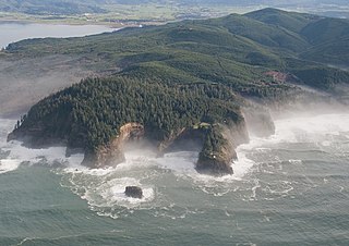
The Central Pacific coastal forests is a temperate coniferous forest ecoregion located in the Canadian province of British Columbia and the U.S. states of Oregon and Washington, as defined by the World Wildlife Fund (WWF) categorization system.

The Cascade Mountains leeward forests are a temperate coniferous forest ecoregion of North America, as defined by the World Wildlife Fund (WWF) categorization system.

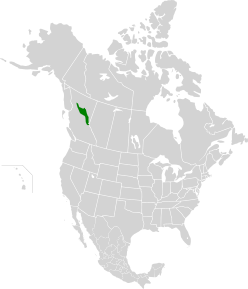
The North Central Rockies forests is a temperate coniferous forest ecoregion of Canada and the United States. This region overlaps in large part with the North American inland temperate rainforest and gets more rain on average than the South Central Rockies forests and is notable for containing the only inland populations of many species from the Pacific coast.

South Chilcotin Mountains Provincial Park is a provincial park in British Columbia, Canada, located on Highway 40 northwest of Lillooet, British Columbia. The park, which is 56,796 ha. in size, was established on April 18th, 2001, and It was created out of a portion of the Spruce Lake Protected Area. The park is located on three Indigenous Nations: The Tsilhqot’in, St’at’imc, and Secwepemc.

The Newfoundland Highland forests are a taiga ecoregion located on the island of Newfoundland in Newfoundland and Labrador, Canada. It has a total area of 4,031,999 acres.
Puget lowland forests is a temperate coniferous forest ecoregion the Pacific coast of North America, as defined by the World Wildlife Fund (WWF) categorization system.

Okanagan dry forests is a temperate coniferous forest ecoregion in the Pacific Northwest of North America, as defined by the World Wildlife Fund (WWF) categorization system. It is closely associated with the Okanagan region of British Columbia and Washington. Only 20% of the ecosystem is still intact, and continues to be under threat for preservation due to land clearing and urban expansion, alongside the increasing threats of fire and extreme weather due to climate change.

Northern transitional alpine forests is a temperate coniferous forest ecoregion in the northwestern interior of British Columbia, as defined by the World Wildlife Fund (WWF) categorization system.

Pacific Coastal Mountain icefields and tundra is a tundra ecoregion in Alaska, British Columbia, and Yukon, as defined by the World Wildlife Fund (WWF) categorization system.

Northern Cordillera forests is a taiga ecoregion that extends across the northern interior of British Columbia, southern Yukon, and a small area of the Northwest Territories as defined by the World Wildlife Fund (WWF) categorization system.

The Ogilvie–MacKenzie alpine tundra ecoregion covers the mountainous middle of the Yukon Territory in Canada, with extensions into the Northwest Territories. The vegetation is alpine and subalpine open forest of stunted spruce, fir and pine. The area is rugged but sections appear to have been unglaciated in the late Pleistocene and there are therefore relic species in the region. The area is remote and supports large, sustainable predator-prey systems.