The Chihuahuan Desert is a desert ecoregion designation covering parts of northern Mexico and the southwestern United States. It occupies much of far West Texas, the middle to lower Rio Grande Valley and the lower Pecos Valley in New Mexico, and a portion of southeastern Arizona, as well as the central and northern portions of the Mexican Plateau. It is bordered on the west by the Sonoran Desert, the Colorado Plateau, and the extensive Sierra Madre Occidental range, along with northwestern lowlands of the Sierra Madre Oriental range. Its largest, continual expanse is located in Mexico, covering a large portion of the state of Chihuahua, along with portions of Coahuila, north-eastern Durango, the extreme northern part of Zacatecas, and small western portions of Nuevo León. With an area of about 501,896 km2 (193,783 sq mi), it is the largest desert in North America. The desert is fairly young, existing for only 8000 years.

The ecology of California can be understood by dividing the state into a number of ecoregions, which contain distinct ecological communities of plants and animals in a contiguous region. The ecoregions of California can be grouped into four major groups: desert ecoregions, Mediterranean ecoregions, forested mountains, and coastal forests.

The Scandinavian montane birch forests and grasslands is defined by the World Wildlife Fund (WWF) as a terrestrial tundra ecoregion in Norway, Sweden, and Finland.

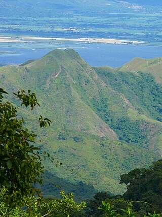
The Cordillera de la Costa montane forests is a montane ecoregion of the tropical and subtropical moist broadleaf forests biome, in the Venezuelan Coastal Range on the Caribbean Sea in northern Venezuela.

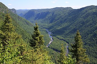
The eastern forest–boreal transition is a temperate broadleaf and mixed forests ecoregion of North America, mostly in eastern Canada. It is a transitional zone or region between the predominantly coniferous Boreal Forest and the mostly deciduous broadleaf forest region further south.

The Yukon Interior dry forests is a taiga ecoregion of Canada.

The Alaska–St. Elias Range tundra is an ecoregion of northwestern North America.

The Great Basin montane forests is an ecoregion of the Temperate coniferous forests biome, as designated by the World Wildlife Fund (WWF).

The Eastern Anatolian montane steppe is a temperate grasslands, savannas, and shrublands ecoregion. It is located in the Armenian Highlands, covering parts of eastern Turkey, Armenia, Azerbaijan, southern Georgia, and northwestern Iran.

The Northern Andean páramo (NT1006) is an ecoregion containing páramo vegetation above the treeline in the Andes of Colombia and Ecuador. In the past, when the climate was cooler, the treeline and the páramo units were lower and the units were connected. During the present warmer Holocene epoch the páramos have migrated uphill, shrinking and becoming isolated. They contain many rare or endangered species, some of them restricted to a narrow area of one mountain or mountain range. The ecoregion is relatively well preserved, but faces threats from over-grazing and farming.

The Cordillera Central páramo (NT1004) is an ecoregion containing páramo vegetation above the treeline in the Andes mountain range of northern Peru and southern Ecuador. Due to its isolation there are high levels of endemism. Despite many human settlements and some destruction of habitat by agriculture and mining, the ecoregion is relatively intact.

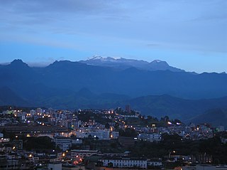
The Cauca Valley montane forests (NT0109) is an ecoregion in western Colombia. It covers the sides of the Cauca Valley, which runs from south to north between the Central and Western Ranges (cordilleras) of the Colombian Andes. The ecoregion is home to very diverse fauna and flora, due in part to its varied elevations and climates, in part to its position near the isthmus of Panama, the route along which North American species invaded South America and then diversified as they moved to the upper parts of the Andes. Little of the original habitat remains at lower levels, but higher up there are sizeable blocks of forest, some of which are protected.

The Central British Columbia Mountain forests is a temperate coniferous forest ecoregion in north-central British Columbia, as defined by the World Wildlife Fund (WWF) categorization system.

Okanagan dry forests is a temperate coniferous forest ecoregion in the Pacific Northwest of North America, as defined by the World Wildlife Fund (WWF) categorization system. It is closely associated with the Okanagan region of British Columbia and Washington. Only 20% of the ecosystem is still intact, and continues to be under threat for preservation due to land clearing and urban expansion, alongside the increasing threats of fire and extreme weather due to climate change.

Northern transitional alpine forests is a temperate coniferous forest ecoregion in the northwestern interior of British Columbia, as defined by the World Wildlife Fund (WWF) categorization system.

Pacific Coastal Mountain icefields and tundra is a tundra ecoregion in Alaska, British Columbia, and Yukon, as defined by the World Wildlife Fund (WWF) categorization system.

The Tasmanian Central Highland forests is a temperate broadleaf and mixed forests ecoregion in Australia. It covers Tasmania's Central Highlands region.

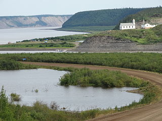
The Northwest Territories taiga ecoregion (WWF:NA0614) is located in the Northwest Territories and Yukon provinces of Canada. It covers forest and tundra along the Mackenzie River Valley and the surrounding highlands in the southern portion of the valley.

The Interior Yukon-Alaska alpine tundra ecoregion covers alpine, sub-alpine, and boreal forest areas along the cordillera of Interior Alaska and south-central Yukon Territory. Geologically, they are the disjunct uplands of the Yukon-Tanana Terrane plus a southern extension of the Brooks Range. The cover is extensive 'dark taiga' of closed spruce forest, open forest of other species, and alpine vegetation at higher altitudes. The region is mostly wilderness and relatively untouched by human development.

The Ogilvie–MacKenzie alpine tundra ecoregion covers the mountainous middle of the Yukon Territory in Canada, with extensions into the Northwest Territories. The vegetation is alpine and subalpine open forest of stunted spruce, fir and pine. The area is rugged but sections appear to have been unglaciated in the late Pleistocene and there are therefore relic species in the region. The area is remote and supports large, sustainable predator-prey systems.


