Mount Kitchener

Last updated
Mount Kitchener
Mtkitchener.jpg
Mt. Kitchener at dawn from the Icefields Parkway
Highest point
Elevation 3,505 m (11,499 ft) [1] [2]
Prominence 280 m (920 ft) [3]
Listing Mountains of Alberta
Coordinates 52°12′58″N117°19′15″W / 52.21611°N 117.32083°W / 52.21611; -117.32083 [4]
Geography
Canada Alberta relief location map - transverse mercator proj.svg
Red triangle with thick white border.svg
Mount Kitchener
Location in Alberta
Mount Kitchener
Interactive map of Mount Kitchener
Country Canada
Province Alberta
Parent range Winston Churchill Range
Topo map NTS 83C3 Columbia Icefield [4]
Climbing
First ascent 1927 by Alfred J. Ostheimer, guided by Hans Fuhrer [1]
Easiest route rock/snow climb

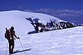
Mount Kitchener is a mountain located within the Columbia Icefield of Jasper National Park, which is part of the Canadian Rockies. The mountain can be seen from the Icefields Parkway (highway 93) near Sunwapta Pass.

Contents

Mt. Kitchener was originally named Mount Douglas by J. Norman Collie after David Douglas. In 1916, the mountain was renamed Mount Kitchener, its present-day name, after Lord Kitchener, who had just been killed in World War I. [1]

Climbing

Routes
Notable ascents

Mount K2

Mount K2, elevation 3,090m, [2] was named in 1938 by Rex Gibson (former Alpine Club of Canada president), apparently to signify this as a secondary peak of Mount Kitchener. [6]

Climate

Based on the Köppen climate classification, Mount Kitchener is located in a subarctic climate zone with cold, snowy winters, and mild summers. [7] Temperatures can drop below −20 °C (−4 °F) with wind chill factors below −30 °C (−22 °F).

References

  1. 1 2 3 "Mount Kitchener". cdnrockiesdatabases.ca. Retrieved 2007-08-31.
  2. 1 2 "Topographic map of Mount Kitchener". opentopomap.org. Retrieved 2021-03-31.
  3. "Mount Kitchener". Bivouac.com. Retrieved 2013-05-17.
  4. 1 2 "Mount Kitchener". Geographical Names Data Base . Natural Resources Canada . Retrieved 2021-03-31.
  5. Lowe, Jeff (1976). "Winter Ice Climbing and its Techniques on Kitchener". The Cold Dance Review. American Alpine Journal. 20 (50). New York, NY, USA: American Alpine Club: 326–333. Retrieved 2021-03-31.
  6. "Mount K2". cdnrockiesdatabases.ca. Retrieved 2020-11-21.
  7. Peel, M. C.; Finlayson, B. L.; McMahon, T. A. (2007). "Updated world map of the Köppen−Geiger climate classification". Hydrol. Earth Syst. Sci. 11: 1633–1644. ISSN   1027-5606.