
The Winston Churchill Range is a mountain range in the central section of the Park Ranges of the Canadian Rockies located in Jasper National Park. The range was named after Sir Winston Churchill, former British prime minister.

The Slate Range is a mountain range of the Canadian Rockies, located in Banff National Park, Canada. The range is named after slate, the primary composition of the mountains in the area.

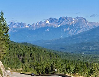
The Sawback Range is a mountain range of the Canadian Rockies that stretches from the Bow Valley in Alberta into southeastern Banff National Park.

The Queen Elizabeth Ranges is a group of mountain ranges in the Canadian Rockies on the southeastern side of Jasper National Park, Canada. The northern end of the ranges begins east of Medicine Lake and extends in a southeasterly direction past the southern shore of Maligne Lake. The group was named in 1953 to celebrate the coronation of Elizabeth II as Canada's sovereign.

The Blue Range is a mountain range of the Canadian Rockies, located on the Continental Divide in Banff National Park, Canada. The range was so named on account of its blueish colour when viewed from afar. Mount Alcantara is the highest point in the range.
The President Range is a mountain range of the Canadian Rockies, located in the northwestern section of Yoho National Park. The range is named for the highest peak in the range, The President.

The Beaverfoot Range is a mountain range of the Canadian Rockies, located in southeastern British Columbia. The range extends from Cedared Creek near Spillimacheen north to the Kicking Horse River.

The Massive Range is a mountain range of the Canadian Rockies, located in the southwestern area of the Bow River valley in Banff National Park, Canada.

The Vermilion Range is a mountain range of the Canadian Rockies, in Banff National Park, Canada. The range is east of the Sawback Range and west of the Bare and Palliser Ranges.

The Miette Range is a mountain range of the Canadian Rockies located south of Highway 16 near the east border of Jasper National Park, Alberta, Canada.

The Jacques Range is a mountain range in the Front Ranges of the Canadian Rockies, located south of Highway 16 and Jasper Lake in Jasper National Park, Alberta, Canada.

The Colin Range is a mountain range of the Canadian Rockies located directly northeast of the Jasper townsite in Jasper National Park, Canada.
The Bosche Range is a mountain range of the Canadian Rockies located northwest of Highway 16 near the eastern border of Jasper National Park, Canada.
The Nikanassin Range is a group of mountain ranges in the Canadian Rockies on the eastern edge of Jasper National Park in Alberta, Canada. It is developed south-east of the Fiddle Range, and one of the front ranges. Nikanassin means "first range" in Cree.
Fiddle Peak was named by James Hector in 1858. It is located in the Fiddle Range of Jasper National Park, Alberta, Canada.
The Tower of London Range is a sub-range of the Northern Rocky Mountains in northern British Columbia, Canada, located northwest of the Tuchodi Lakes at the northwest end of the Northern Rocky Mountains Provincial Park to the southwest of Fort Nelson.
Mount Ulysses, is the highest mountain in the Muskwa Ranges of the Northern Canadian Rockies in British Columbia. It and neighbouring peaks are part of a group of names drawing on the epic poem The Odyssey, in which here Ulysses wanders for 10 years before being able to return home to Ithaca.

The Sundance Range is a mountain range in the Canadian Rockies, south of the town of Banff. It is located on the Continental Divide, which forms the boundary between British Columbia and Alberta in this region.
The Livingstone Range is a sub-range of the Canadian Rockies in Alberta, Canada. It forms the eastern boundary of the Rockies in the south of the province. Its northern boundary is the Highwood River and it extends to Crowsnest Pass in the south. The Livingstone and Oldman Rivers bound it to the west.
The Vermilion Range is a mountain range of the Canadian Rockies, in British Columbia, Canada. The range is west of the Vermilion River and east of the headwaters of the Kootenay River.

