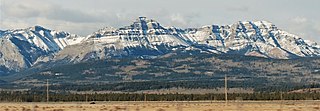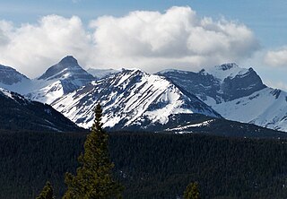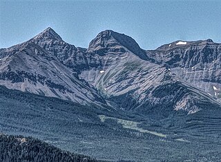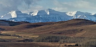
Saint Nicholas Peak is a 2,938-metre (9,639-foot) mountain summit in the Rocky Mountains of Canada. It is located on the Continental Divide, on the Alberta-British Columbia border, in both Banff National Park and Yoho National Park. It lies at the eastern edge of the Wapta Icefield, and is part of the Waputik Mountains which are a sub-range of the Canadian Rockies.

Mount Allen is a mountain in the Canadian Rockies, on the Continental Divide, which forms the provincial boundary between British Columbia and Alberta in this region. J. Monroe Thorington named this mountain for Samuel Evans Stokes Allen in 1924. Allen was an American cartographer who mapped this area of the Rockies in 1894–1895. Allen had named this mountain "Shappee", the Stoney language word for "six", as part of his naming of the ten mountains in the Valley of the Ten Peaks. The peak forms part of the backdrop to Moraine Lake in Banff National Park.

Mount Bowlen is located on the border of Alberta and British Columbia and forms part of the Valley of the Ten Peaks. It was named in 1953 after John J. Bowlen, a native of Prince Edward Island, successful Alberta rancher, honorary chief of the Blackfoot, and a Lieutenant Governor of Alberta. Its former name was "Yamnee", which translates to the number 3 in the local Nakoda (Stoney) language.

Mount Weed is a 3,080-metre (10,100-foot) mountain summit located in the Mistaya River valley of Banff National Park, in the Canadian Rockies of Alberta, Canada. Mount Weed is situated at the confluence of Silverhorn Creek and Mistaya River, 3.5 kilometres southwest of Mount Noyes, 4.5 km east of Mistaya Lake, and 14 km north of Bow Lake. Its nearest higher peak is Mount Patterson, 5.82 km (3.62 mi) to the southwest. Patterson stands directly across the Mistaya River valley from Weed, and both are prominent features seen from the Icefields Parkway.

Gap Mountain is a 2,675-metre (8,776-foot) mountain summit located at the southern end of the Opal Range in the Canadian Rockies of Alberta, Canada. The nearest higher neighbor is Elpoca Mountain, 2 km (1.2 mi) to the east. Gap Mountain is situated 5 km (3.1 mi) south of Mount Wintour, within Peter Lougheed Provincial Park. Gap Mountain is a conspicuous peak seen from Alberta Highway 40 at Highwood Pass. It is a popular climbing destination because it offers exposed scrambling on its eastern flanks with excellent summit views of Kananaskis Country.

Geraldine Peak is a 2,930-metre (9,610-foot) mountain summit located in the Athabasca River valley of Jasper National Park, in the Canadian Rockies of Alberta, Canada. The peak is also known as Whirlpool Mountain, and Mount Geraldine. No name has been officially adopted yet. The names derive from its position at the northern end of the long ridge that divides Geraldine Lakes and Geraldine Creek on the southeast side, from the Whirlpool River on the northwest side. The nearest higher peak is Mount Fryatt, 7.0 km (4.3 mi) to the south-southeast. Geraldine Peak can be seen from the Icefields Parkway in the vicinity of Athabasca Falls.

Mount Noyes is a 3,080-metre (10,100-foot) mountain summit located in the Mistaya River valley of Banff National Park, in the Canadian Rockies of Alberta, Canada. Mount Noyes is situated at the confluence of Silverhorn Creek and Mistaya River, 3.5 km northwest of Mount Weed, and 9.2 km east of Howse Peak. Its nearest higher peak is Mount Patterson, 8.55 km (5.31 mi) to the south. Topographic relief is significant as it rises over 1,380 metres above the Icefields Parkway in two km.

Sofa Mountain is a 2,515-meter (8,251-foot) summit located in Waterton Lakes National Park, in Alberta, Canada. It is part of the Lewis Range which is a subset of the Canadian Rockies, and is the easternmost mountain in the Canadian Rockies, as well as the park. It is situated 5.4 km (3.4 mi) east of Vimy Peak, and the nearest higher neighbor is Crypt Peak, 4.6 km (2.9 mi) to the southwest. Topographic relief is significant as the north aspect rises over 1,220 meters (4,000 feet) above Middle Waterton Lake in approximately six kilometers.

Mount Tecumseh is a 2,547-metre-high (8,356 ft) mountain summit located in the Canadian Rockies of Alberta, Canada.

Seven Sisters Mountain is a 2,591-metre-high (8,501 ft) mountain summit located in the Canadian Rockies of Alberta, Canada.

Sentry Mountain is a 2,435-metre (7,989-foot) summit located in the Canadian Rockies of Alberta, Canada.

Association Peak is a 2,362-metre (7,749 ft) mountain summit located in Alberta, Canada.

Mount McLaren is a 2,301-metre (7,549-foot) mountain summit located in Alberta, Canada.

Mount Parrish is a 2,530-metre (8,301-foot) mountain summit located in Alberta, Canada.

Mount Head is a 2,782-metre (9,127-foot) mountain summit located in Alberta, Canada.

Barbette Mountain is 3,072-metre (10,079-foot) summit located on the shared border of Alberta and British Columbia, Canada.

Cairngorm is a 2,610-metre (8,563 ft) mountain located in Alberta, Canada.

Marmot Mountain is a 2,608-metre (8,556-foot) mountain summit located in Alberta, Canada.

Mount Howard is a 2,777-metre (9,111-foot) mountain summit located 68 km (42 mi) west-southwest of Calgary in Kananaskis Country of Alberta, Canada. Mount Howard is the fourth-highest peak in the Fisher Range which is a subrange of the Canadian Rockies. The nearest higher neighbor is Fisher Peak, 5.03 km (3.13 mi) to the southwest. Precipitation runoff from the mountain drains into Nihahi Creek and Canyon Creek which are tributaries of the Elbow River. Topographic relief is modest as the summit rises 777 metres (2,549 ft) above Canyon Creek in approximately 2 km (1.2 mi).

Pyriform Mountain is a 2,739-metre (8,986-foot) mountain summit located 74 km (46 mi) southwest of Calgary in Kananaskis Country of Alberta, Canada. Pyriform Mountain is the third-highest officially named peak in the Highwood Range which is a subrange of the Canadian Rockies. Precipitation runoff from the mountain's west slope drains into headwaters of Junction Creek which is a tributary of the Sheep River; and the east slope drains to Trap Creek which is a tributary of the Highwood River. Topographic relief is modest as the summit rises approximately 740 m (2,430 ft) above Junction Creek in 2 km (1.2 mi).


