
The Marshall Islands, officially the Republic of the Marshall Islands, is an independent island country near the Equator in the Pacific Ocean, slightly west of the International Date Line. Geographically, the country is part of the larger island group of Micronesia. The country's population of 58,413 people is spread out over 5 islands and 29 coral atolls, comprising 1,156 individual islands and islets. The capital and largest city is Majuro. It has the largest portion of its territory made of water of any sovereign state, at 97.87%.
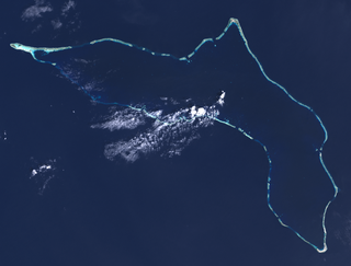
Kwajalein Atoll is part of the Republic of the Marshall Islands (RMI). The southernmost and largest island in the atoll is named Kwajalein Island, which its majority English-speaking residents often called by the shortened name, Kwaj. The total land area of the atoll amounts to just over 6 square miles (16 km2). It lies in the Ralik Chain, 2,100 nautical miles southwest of Honolulu, Hawaii.

The Ratak Chain is a chain of islands within the island nation of the Marshall Islands. Ratak means "sunrise". It lies to the east of the country's other island chain, the Ralik Chain. In 1999 the total population of the Ratak islands was 30,925.
The Ralik Chain is a chain of islands within the island nation of the Marshall Islands. Ralik means "sunset". It is west of the Ratak Chain. In 1999 the total population of the Ralik islands was 19,915. Christopher Loeak, who became President of the Marshall Islands in 2012, was formerly Minister for the Ralik Chain.
Ailinglaplap or Ailinglapalap is a coral atoll of 56 islands in the Pacific Ocean, and forms a legislative district of the Ralik Chain in the Marshall Islands. It is located 152 kilometres (94 mi) northwest of Jaluit Atoll. Its total land area is only 14.7 square kilometres (5.7 sq mi), but it encloses a lagoon of 750 square kilometres (290 sq mi). The economy of the atoll is dominated by coconut plantations. The population of the atoll was 1,729 in 2011. Jabat Island is located off the coast of Ailinglaplap Atoll. The former president of the Marshall Islands, Kessai Note, was born on Jeh Island, Ailinglaplap Atoll.

Ebeye is the most populous island of Kwajalein Atoll in the Marshall Islands, as well as the center for Marshallese culture in the Ralik Chain of the archipelago. Settled on 80 acres of land, it has a population of more than 15,000. Over 50% of the population is estimated to be under the age of 18.
The Marshallese language (Marshallese: new orthography Kajin M̧ajeļ or old orthography Kajin Majōl, also known as Ebon, is a Micronesian language spoken in the Marshall Islands. The language is spoken by about 44,000 people in the Marshall Islands, making it the principal language of the country. There are also roughly 6,000 speakers outside of the Marshall Islands, including those in Nauru and the United States.
Langor is one of the most populous islands in the Arno Atoll. It is part of the Marshall Islands in the Pacific Ocean.

Meck Island is part of the Kwajalein Atoll in the Ralik Chain in the Republic of the Marshall Islands, 2,100 nautical miles (3,900 km) southwest of Honolulu, Hawaii.
Kobjeltak is one of the most populous islands in the Arno Atoll. It is part of the Marshall Islands in the Pacific Ocean.
Tutu is one of the most populous islands in the Arno Atoll. It is located in the Marshall Islands in the Pacific Ocean.

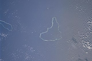
Erikub Atoll is an uninhabited coral atoll of fourteen islands in the Pacific Ocean, located in the Ratak Chain of the Marshall Islands. Its total land area is only 1.53 square kilometres (0.59 sq mi), but it encloses a lagoon with an area of 230 square kilometres (89 sq mi). It is located slightly south of Wotje.
Taroa is an island in the east of Maloelap Atoll in the Marshall Islands. During World War II, it was the site of a major Japanese airfield. The airfield was destroyed towards the end of World War II, and wreckage and remnants of the base can still be seen around the island.
Ajeltake is a town in the Marshall Islands. It is located on Majuro Atoll and occupies the southwestern section of the Atoll ring. The population numbered 1,700 in 2006.

Laura is an island town situated in Marshall Islands. It is located in the west of Majuro Atoll. At approximately 10 feet (3.0 m) above sea level, Laura has the highest elevation of any islands in the Majuro Atoll. Marshall Islands International Airport is located on the island of Laura. A road connects the island of Laura to Djarrit.
Rairok is a town in the Marshall Islands. It is located on the southeastern side Majuro Atoll, between Delap in the east and Ajeltake in the west.
Delap is an island district in the Marshall Islands. It is located in the east of Majuro Atoll. Along with Uliga and Djarrit it forms what is known as the "Delap-Uliga-Djarrit".
Uliga is an island district in the Marshall Islands. It is located in the east of Majuro Atoll. Along with Delap and Djarrit, it forms a town known as "Delap-Uliga-Djarrit".
Djarrit is an island district in the Marshall Islands. It is located in the east of Majuro Atoll. Along with Uliga and Delap, it forms what is known as the "Delap-Uliga-Djarrit".

Alele Museum & Public Library is the National Museum and the National Archive of the Marshall Islands. It also hosts the only public library in the country.