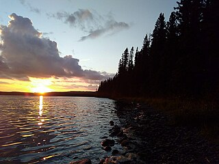
Lake Winnipeg is a very large, relatively shallow 24,514-square-kilometre (9,465 sq mi) lake in North America, in the province of Manitoba, Canada. Its southern end is about 55 kilometres (34 mi) north of the city of Winnipeg. Lake Winnipeg is Canada's sixth-largest freshwater lake and the third-largest freshwater lake contained entirely within Canada, but it is relatively shallow excluding a narrow 36 m (118 ft) deep channel between the northern and southern basins. It is the eleventh-largest freshwater lake on Earth. The lake's east side has pristine boreal forests and rivers that were in 2018 inscribed as Pimachiowin Aki, a UNESCO World Heritage Site. The lake is 416 km (258 mi) from north to south, with remote sandy beaches, large limestone cliffs, and many bat caves in some areas. Manitoba Hydro uses the lake as one of the largest reservoirs in the world. There are many islands, most of them undeveloped.

Lake Winnipegosis is a large (5,370 km2) lake in central North America, in Manitoba, Canada, some 300 km northwest of Winnipeg. It is Canada's eleventh-largest lake.

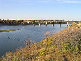
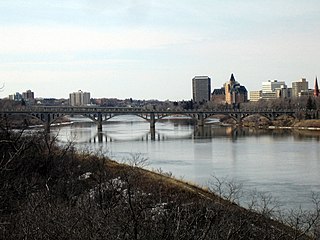
The Saskatchewan River is a major river in Canada. It stretches about 550 kilometres (340 mi) from where it is formed by the joining of the North Saskatchewan River and South Saskatchewan River just east of Prince Albert, Saskatchewan, to Lake Winnipeg. It flows roughly eastward across Saskatchewan and Manitoba to empty into Lake Winnipeg. Through its tributaries the North Saskatchewan and South Saskatchewan, its watershed encompasses much of the prairie regions of Canada, stretching westward to the Rocky Mountains in Alberta and north-western Montana in the United States.

The South Saskatchewan River is a major river in the Canadian provinces of Alberta and Saskatchewan. The river begins at the confluence of the Bow and Oldman Rivers in southern Alberta and ends at the Saskatchewan River Forks in central Saskatchewan. The Saskatchewan River Forks is the confluence of the South and North Saskatchewan Rivers and is the beginning of the Saskatchewan River.
Provincial Trunk Highway 77 is a provincial highway in the Canadian province of Manitoba. It runs from the Saskatchewan boundary near Westgate to PTH 10 near Baden. It was designated in 1987, replacing PR 277.
Erwood is a hamlet in the Canadian province of Saskatchewan. The hamlet has an outfitting business, a community centre, and a Church of God. There is a traffic bridge on Highway 3, just west of the hamlet, where residents enjoy swimming in the Red Deer River. Residents of the area also maintain the Erwood Cemetery that exists approximately 1.5 miles from the hamlet.
Lac des Mille Lacs is a lake in the western part of Thunder Bay District in northwestern Ontario, Canada. It is in the Nelson River drainage basin and is the source of the Seine River. The lake lies between Ontario Highway 17 on the north and Ontario Highway 11 on the south about 100 kilometres (62 mi) west of the city of Thunder Bay.
Botsford Lake is a lake in the Hudson Bay drainage basin in Kenora District in northwestern Ontario, Canada. It is about 15 kilometres (9 mi) long and 2.2 kilometres (1.4 mi) wide, is at an elevation of 357 metres (1,171 ft), and lies between the settlements of Superior Junction and McDougall Mills; Rosnel is on the south shore of the lake. The CN transcontinental rail line travels the along the entire south shore. Highway 642 runs west of the lake, and Highway 516 runs approximately parallel to the north shore of the lake at a distance of about 6 kilometres (4 mi).

Barrows is a community in the Canadian province of Manitoba.
Red Deer Lake is a community in the Canadian province of Manitoba. A designated place in Canadian census data, the community had a population of 25 in the Canada 2006 Census.
The Red Deer Lumber Company was a forestry company that had approximately 10 logging operations along the Red Deer River, and owned and operated a sawmill on the south shore of Red Deer Lake.
The Shaw Brothers Lumber Company was a forestry company that had logging operations and sawmills along the Manitoba Escarpment.
Herman Finger (1856-1929) was a lumberman who owned and operated various lumber companies that operated in Wisconsin, Minnesota, Ontario, Manitoba, and Saskatchewan. He also served as the first mayor of The Pas after its establishment in 1912.
The Pas Lumber Company was a forestry company that owned and operated several sawmills and logging operations in Manitoba, Saskatchewan, and British Columbia.

Porcupine Hills Provincial Park is the newest provincial park in the Canadian Province of Saskatchewan. It was created in 2018 through the amalgamation of five pre-existing provincial recreation sites south-east of the town of Hudson Bay. The park is in the Porcupine Provincial Forest in the Porcupine Hills, which is a geographical feature in eastern Saskatchewan and western Manitoba. The hills are part of a range of hills called the Manitoba Escarpment.
Hudson Bay Regional Park is a regional park in the Canadian province of Saskatchewan. It is located on the south side of the town of Hudson Bay in the RM of Hudson Bay No. 394 along the shores of the Red Deer River. The park is the site of a North West Company fur trading fort called Fort Red Deer River that was built in 1790. About 14 kilometres (8.7 mi) downstream, near Erwood, was a Hudson's Bay Company trading post that was built in 1757.

Red Deer River is a river in the Canadian provinces of Saskatchewan and Manitoba. It has its source at Nut Lake in east central Saskatchewan and from there, it flows east towards Manitoba where it empties into Dawson Bay of Lake Winnipegosis. To the north of Red Deer's basin is the Saskatchewan River, to the south-west is the upper Assiniboine River, and to the south-east is Swan River.

Armit River is a river in the Canadian provinces of Manitoba and Saskatchewan in the Nelson River drainage basin. The river begins in the Porcupine Hills of the Manitoba Escarpment at Armit Lake and flows in a northerly direction closely following the Manitoba / Saskatchewan border and into Red Deer Lake along the course of the Red Deer River.


