Garden City is a city in Ada County, Idaho. The population was 12,316 at the time of the 2020 census. Garden City is nearly surrounded by Boise but retains a separate municipal government.

Edwardsville is a borough in Luzerne County, Pennsylvania, United States. The population was 4,918 at the 2020 census.

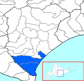
Hiroo is a district located in Tokachi Subprefecture, Hokkaido, Japan.

Tanjung Piai is a cape in Pontian District, Johor, Malaysia. It is the southernmost point of Peninsular Malaysia and thus the most southern point of mainland Eurasia. The skyline of Singapore is visible across the Johor Strait from the point. It features seafood restaurants, perched on wooden jetties that are surrounded by a rugged and rarefied coastline of unspoiled mangrove forests.

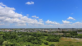
Dalin Township is an urban township in Chiayi County, Taiwan. To the east is Meishan, to the south Minxiong and to the north Yunlin County. Dalin TzuChi General Hospital (大林慈濟醫院) is located here.

Karkaraly District is a district of Karaganda Region in central Kazakhstan. The administrative center of the district is the town of Karkaraly. As of 2019, the district is home to a population of 36,025 people.
Araksavan is a village in the Artashat Municipality of the Ararat Province of Armenia.
Aşağı Qolqəti is a village in the Agdash Rayon of Azerbaijan.
Gülalan is a village in the Khachmaz Rayon of Azerbaijan. The village forms part of the municipality of Qaraqurdlu.
Shibonta is a settlement in the Java district of South Ossetia.
Oxford International College (OIC) is an independent college based in central Oxford, United Kingdom for girls and boys from 14 to 18 years. The school teaches GCSE and A-Level courses to prepare students for entry into British universities. Many of the school's pupils are from China.
Upper Port La Tour is a community in the Canadian province of Nova Scotia, located in the Municipality of the District of Barrington of Shelburne County.
Stoney Island is a community on Cape Sable Island in the Canadian province of Nova Scotia, located in the Municipality of the District of Barrington of Shelburne County.
Beverley is an unincorporated community in Saskatchewan.
Vlasovo is a village in the municipality of Prokuplje, Serbia. According to the 2022 census, the village has a population of 17 people.
Susječno is a village in the municipality of Kalinovik, Republika Srpska, Bosnia and Herzegovina.
Metsaääre is a village in Saarde Parish, Pärnu County in southwestern Estonia.

Tidda is a town and commune in Tiaret Province in north-western Algeria.
Alder is a census-designated place (CDP) in Pierce County, Washington, United States. The population was 227 at the 2010 census. The community is located along the shore of Alder Lake on State Route Highway 7 near the entrance to Mount Rainier National Park.
Knox is a former town in Vinton County, in the U.S. State of Ohio. The GNIS classifies it as a populated place.


