Holy Trinity is a Roman Catholic church located in Honolulu, Hawaiʻi.

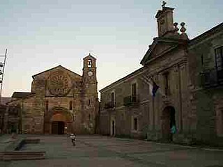
Meira is a municipality in the Galician province of Lugo. It is in the northwest of the province, including the Terra Chá and the Serras Orientais to the west of the Serra de Meira. The most popular festivals are those of the candles, carnival, corpus, Santa Maria, San Roque, and the Festa da Malha.
Piotrowice Małe is a village in the administrative district of Gmina Jemielno, within Góra County, Lower Silesian Voivodeship, in south-western Poland. Prior to 1945 it was in Germany.

Kuchak formerly known as Alikuchak, is a village in the Aragatsotn Province of Armenia. It was founded in 1829-30 and named after Nahapet Kuchak, a 16th-century Armenian poet.

Skoraczewko is a village in the administrative district of Gmina Sośno, within Sępólno County, Kuyavian-Pomeranian Voivodeship, in north-central Poland. It lies approximately 13 kilometres (8 mi) south of Sośno, 20 km (12 mi) south of Sępólno Krajeńskie, and 32 km (20 mi) north-west of Bydgoszcz.
Ludomirowo is a village in the administrative district of Gmina Sidra, within Sokółka County, Podlaskie Voivodeship, in north-eastern Poland.

Strzeszkowice is a village in the administrative district of Gmina Wodzisław, within Jędrzejów County, Świętokrzyskie Voivodeship, in south-central Poland. It lies approximately 7 kilometres (4 mi) east of Wodzisław, 12 km (7 mi) south of Jędrzejów, and 46 km (29 mi) south-west of the regional capital Kielce.

Gaj Koniemłocki is a village in the administrative district of Gmina Staszów, within Staszów County, Świętokrzyskie Voivodeship, in south-central Poland. It lies approximately 5 kilometres (3 mi) south-west of Staszów and 55 km (34 mi) south-east of the regional capital Kielce.

Mościce is a village in the administrative district of Gmina Regimin, within Ciechanów County, Masovian Voivodeship, in east-central Poland. It lies approximately 4 kilometres (2 mi) north-west of Regimin, 12 km (7 mi) north-west of Ciechanów, and 88 km (55 mi) north of Warsaw.

Wilkowyja is a village in the administrative district of Gmina Garwolin, within Garwolin County, Masovian Voivodeship, in east-central Poland. It lies approximately 9 kilometres (6 mi) south-west of Garwolin and 54 km (34 mi) south-east of Warsaw.

Zakręt is a village in the administrative district of Gmina Wiązowna, within Otwock County, Masovian Voivodeship, in east-central Poland. It lies approximately 7 kilometres (4 mi) north-west of Wiązowna, 12 km (7 mi) north of Otwock, and 20 km (12 mi) east of Warsaw.
Markowo is a village in the administrative district of Gmina Dubeninki, within Gołdap County, Warmian-Masurian Voivodeship, in northern Poland, close to the border with the Kaliningrad Oblast of Russia.

Kotkowo is a village in the administrative district of Gmina Kętrzyn, within Kętrzyn County, Warmian-Masurian Voivodeship, in northern Poland.
Wolisko is a village in the administrative district of Gmina Nidzica, within Nidzica County, Warmian-Masurian Voivodeship, in northern Poland.

Kamionka is a village in the administrative district of Gmina Mieszkowice, within Gryfino County, West Pomeranian Voivodeship, in north-western Poland, close to the German border. It lies approximately 5 kilometres (3 mi) north-east of Mieszkowice, 49 km (30 mi) south of Gryfino, and 68 km (42 mi) south of the regional capital Szczecin.

European route E772 is a class B road, part of the International E-road network in Bulgaria. It connects the two sections of the Hemus motorway (A2) constructed so far, and is part of one of the most important transport corridors in the country: from the capital Sofia in the west to Varna and the northern Bulgarian Black Sea Coast in the east.

Mačkovac is a village in the municipality of Kuršumlija, Serbia. According to the 2002 census, the village has a population of 298 people.

Ponikve is a village in the municipality of Čajniče, Bosnia and Herzegovina.
Kaubi is a village in Saaremaa Parish, Saare County in western Estonia.

Duga Luka is a village in the municipality of Vranje, Serbia. According to the 2002 census, the village has a population of 154 people.


