
Rocky Bar is a ghost town in Elmore County, Idaho, United States. At its height in the late 19th century Rocky Bar boasted a population of over 2,500 and served as county seat of Alturas County from 1864 to 1882. It was also the original county seat of Elmore County when it was created in 1889.

Kanpur Nagar district, meaning Urban Kanpur District is one of the districts of the Uttar Pradesh state of India. It is a part of Kanpur division and its district headquarters is Kanpur. Kanpur was formerly spelled Cawnpore.

Es Castell is a small municipality in eastern Menorca in the Balearic Islands, Spain. The town was founded in 1771 by British Col. Patrick Mackellar and was originally called Georgetown in honour of King George III; however, it takes its current name from the large fort nearby, known to the British as St. Philip's Castle. Col. Patrick MacKellar was the chief engineer of Menorca and his house today is known as Son Granot. Es Castell celebrates its Foundation Day on 1 June with 18th-century themed festivities, in which the Municipality itself, St. Philip's Castle Foundation, Son Granot and other institutions participate.

Kráľovce is a village and municipality in Košice-okolie District in the Kosice Region of eastern Slovakia. Near flows The Torysa River.
Yelverton Pass is a mountain pass on northern Ellesmere Island, Nunavut, Canada.

Korday is a district of Jambyl Region in south-eastern Kazakhstan. The administrative center of the district is the auyl of Korday.
The Battle of Las Carreras, was a major battle during the years after the Dominican War of Independence and was fought on the 21–22 April 1849, nearby Baní, Peravia Province. A force of 800 Dominican troops, a portion of the Army of the South, led by General Pedro Santana, defeated an outnumbering force of 10,000 troops of the Haitian Army led by Faustin Soulouque.

Lisów is a village in the administrative district of Gmina Skołyszyn, within Jasło County, Subcarpathian Voivodeship, in south-eastern Poland. It lies approximately 3 kilometres (2 mi) north of Skołyszyn, 11 km (7 mi) west of Jasło, and 57 km (35 mi) south-west of the regional capital Rzeszów.
Bobrowniki is a village in the administrative district of Gmina Głowaczów, within Kozienice County, Masovian Voivodeship, in east-central Poland. It lies approximately 4 kilometres (2 mi) south-west of Głowaczów, 20 km (12 mi) west of Kozienice, and 72 km (45 mi) south of Warsaw.
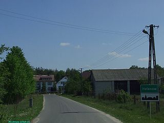
Helenów is a village in the administrative district of Gmina Wiśniew, within Siedlce County, Masovian Voivodeship, in east-central Poland.
Lipinki is a village in the administrative district of Gmina Wołomin, within Wołomin County, Masovian Voivodeship, in east-central Poland.
Wielka Wieś is a village in the administrative district of Gmina Stęszew, within Poznań County, Greater Poland Voivodeship, in west-central Poland. It lies approximately 4 kilometres (2 mi) north-west of Stęszew and 21 km (13 mi) south-west of the regional capital Poznań.
The Port Davey Track, officially the Old Port Davey Track, is a bushwalking track located in the south western region of Tasmania, Australia. The 70-kilometre (43 mi) track traverses remote wilderness within the Southwest National Park, part of the Tasmanian Wilderness World Heritage Site, and is managed as a wilderness walk. The Tasmanian Parks & Wildlife Service recommend that experienced bushwalkers can take four-to-five days to cover the track in one direction.

Gornje Gare is a village in the municipality of Crna Trava, Serbia. According to the 2002 census, the village has a population of 80 people.
Budoželja is a village in the municipality of Ivanjica, Serbia. According to the 2011 census, the village has a population of 214 inhabitants.

Slivlja is a village in the municipality of Gacko, Republika Srpska, Bosnia and Herzegovina.
Šumata Trnica is a village in the municipality of Trgovište, in southeastern Serbia. According to the 2002 census, the village has a population of 50 people.

Severni Kočarnik is a village in the municipality of Tutin, Serbia. According to the 2002 census, the village has a population of 821 people.

Capvern is a railway station in Capvern, Occitanie, France. The station is on the Toulouse–Bayonne railway line. The station is served by TER (local) services operated by the SNCF.
Cerovac is a village in the municipality of Smederevska Palanka, Serbia. According to the 2002 census, the village has a population of 1177 people.
