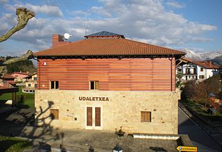
Olaberria is a town and municipality located in the Goierri region of the province of Gipuzkoa, in the autonomous community of the Basque Country, northern Spain.

Newtonville is one of the thirteen villages within the city of Newton in Middlesex County, Massachusetts, United States.
Poczekajka is a village in the administrative district of Gmina Żmudź, within Chełm County, Lublin Voivodeship, in eastern Poland.
Wólka Rozwadowska is a village in the administrative district of Gmina Firlej, within Lubartów County, Lublin Voivodeship, in eastern Poland.

Pomyski Młyn is a village in the administrative district of Gmina Bytów, within Bytów County, Pomeranian Voivodeship, in northern Poland. It lies approximately 9 kilometres (6 mi) north-east of Bytów and 73 km (45 mi) west of the regional capital Gdańsk.

Zilanlı is a village in the Qubadli Rayon of Azerbaijan.
Świniarsko is a village in the administrative district of Gmina Chełmiec, within Nowy Sącz County, Lesser Poland Voivodeship, in southern Poland. It lies approximately 3 kilometres (2 mi) south of Chełmiec, 4 km (2 mi) south-west of Nowy Sącz, and 73 km (45 mi) south-east of the regional capital Kraków.

Modliszewice is a village in the administrative district of Gmina Końskie, within Końskie County, Świętokrzyskie Voivodeship, in south-central Poland. It lies approximately 4 kilometres (2 mi) west of Końskie and 40 km (25 mi) north-west of the regional capital Kielce.
Mostki is a village in the administrative district of Gmina Staszów, within Staszów County, Świętokrzyskie Voivodeship, in south-central Poland. It lies approximately 7 kilometres (4 mi) north-east of Staszów and 51 km (32 mi) south-east of the regional capital Kielce.
Czeberaki is a village in the administrative district of Gmina Stara Kornica, within Łosice County, Masovian Voivodeship, in east-central Poland. It lies approximately 10 kilometres (6 mi) east of Łosice and 127 km (79 mi) east of Warsaw.

Kobierne is a village in the administrative district of Gmina Dębe Wielkie, within Mińsk County, Masovian Voivodeship, in east-central Poland.

Stara Niedziałka is a village in the administrative district of Gmina Mińsk Mazowiecki, within Mińsk County, Masovian Voivodeship, in east-central Poland.

Wólka Mińska is a village in the administrative district of Gmina Mińsk Mazowiecki, within Mińsk County, Masovian Voivodeship, in east-central Poland.
Janówek Duranowski is a village in the administrative district of Gmina Sochaczew, within Sochaczew County, Masovian Voivodeship, in east-central Poland.
Jemieliste is a village in the administrative district of Gmina Goworowo, within Ostrołęka County, Masovian Voivodeship, in east-central Poland.
Owcze Błota is a village in the administrative district of Gmina Osieczna, within Starogard County, Pomeranian Voivodeship, in northern Poland. It lies approximately 4 kilometres (2 mi) north of Osieczna, 29 km (18 mi) south-west of Starogard Gdański, and 69 km (43 mi) south-west of the regional capital Gdańsk.
Kowanowo is a village in the administrative district of Gmina Świdwin, within Świdwin County, West Pomeranian Voivodeship, in north-western Poland. It lies approximately 11 kilometres (7 mi) west of Świdwin and 81 km (50 mi) north-east of the regional capital Szczecin.

Toponica is a village in the municipality of Bela Palanka, Serbia. According to the 2002 census, the village has a population of 68 people.
Devča is a village situated in Merošina municipality in Serbia.

McVille is an unincorporated community in South Buffalo Township, Armstrong County, Pennsylvania, United States. The community is 6.6 miles (10.6 km) northeast of Freeport along PA-128, north of Nicholson Run. McVille Airport lies 0.7 miles (1.1 km) to the northeast on Ford City Road at 40°44′07″N79°35′57″W. McVille Union Cemetery is located nearby, on the north side of McVille Road, at 40°43′39″N79°36′18″W.

