Underwood is a community in the Regional Municipality of York in Markham, Ontario, Canada that is located at the corner of Warden Ave between Birchmount Road and Steeles Avenue, north up to Hwy 7. Underwood is considered part of Downtown and Uptown Markham. It is likely considered to be part of Milliken.

Marynowo is a village in the administrative district of Gmina Sejny, within Sejny County, Podlaskie Voivodeship, in north-eastern Poland, close to the border with Lithuania. It lies approximately 5 kilometres (3 mi) south-west of Sejny and 110 km (68 mi) north of the regional capital Białystok.

Żdanów is a village in the administrative district of Gmina Stoszowice, within Ząbkowice Śląskie County, Lower Silesian Voivodeship, in south-western Poland. Prior to 1945 it was in Germany.

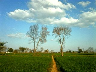
Chakbasawa or Chak Wasawa is a village and union council of Mandi Bahauddin District in the Punjab province of Pakistan. It is located at 32°34'30N 73°33'30E and has an altitude of 219 metres.

Jeże is a village in the administrative district of Gmina Złoczew, within Sieradz County, Łódź Voivodeship, in central Poland. It lies approximately 7 kilometres (4 mi) north-west of Złoczew, 21 km (13 mi) south-west of Sieradz, and 73 km (45 mi) south-west of the regional capital Łódź.
Kita is a small village in the administrative district of Gmina Złoczew, within Sieradz County, Łódź Voivodeship, in central Poland.

Getargel, formerly known as Radiokayanin kits, or SMO is a village in the Kotayk Province of Armenia.

Tempoczów-Rędziny is a village in the administrative district of Gmina Skalbmierz, within Kazimierza County, Świętokrzyskie Voivodeship, in south-central Poland. It lies approximately 5 kilometres (3 mi) south-west of Skalbmierz, 10 km (6 mi) north-west of Kazimierza Wielka, and 66 km (41 mi) south of the regional capital Kielce.

Nadole is a village in the administrative district of Gmina Dukla, within Krosno County, Subcarpathian Voivodeship, in south-eastern Poland, close to the border with Slovakia. It lies approximately 2 kilometres (1 mi) south-west of Dukla, 16 km (10 mi) south-west of Krosno, and 59 km (37 mi) south-west of the regional capital Rzeszów.

Osęczyzna is a village in the administrative district of Gmina Dobre, within Mińsk County, Masovian Voivodeship, in east-central Poland. It lies approximately 7 kilometres (4 mi) west of Dobre, 15 km (9 mi) north of Mińsk Mazowiecki, and 42 km (26 mi) east of Warsaw.

Świdno is a village in the administrative district of Gmina Wierzbno, within Węgrów County, Masovian Voivodeship, in east-central Poland.
Hamdallaye, Niger is a village and rural commune in Niger. It is the location of the US Peace Corps training site.

Ravno Bučje is a village in the municipality of Knjaževac, Serbia. According to the 2002 census, the village has a population of 28 people.

Paunci is a village in the municipality of Foča, Republika Srpska, Bosnia and Herzegovina.

Blagojevići is a village in the municipality of Novo Goražde, Republika Srpska, Bosnia and Herzegovina.

Jezero is a village in the municipality of Konjic, Bosnia and Herzegovina.

Zahirovići is a village in Bosnia and Herzegovina. According to the 1991 census, the village is located in the municipality of Srebrenik.

Jarci is a village in the municipality of Višegrad, Bosnia and Herzegovina.

The RN-3 National Highway is a short national highway of Djibouti. The highway begins at 11°33′30″N43°7′32″E, at a junction with National Highway 1 in Djibouti City, near College De Fukuzawa. It passes along the coast to the north of Djibouti City, past Port de Doraleh and terminates at a small beach resort at 11°35′30″N43°1′18″E.
Kletskaya is a rural locality and the administrative center of Kletsky District of Volgograd Oblast, Russia. Population: 5,323 (2010 Census); 5,350 (2002 Census); 5,126 (1989 Census).


