Ria Formosa Natural Park | |
---|---|
IUCN category V (protected landscape/seascape) | |
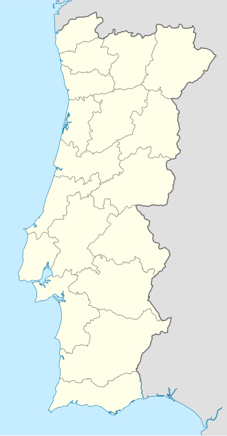
Location | Algarve, Portugal |
Coordinates | 36°59′51.5″N7°51′39.2″W / 36.997639°N 7.860889°W Coordinates: 36°59′51.5″N7°51′39.2″W / 36.997639°N 7.860889°W |
Area | 179.01 km2 (69.12 sq mi) [1] |
Established | May 2, 1978 |
Governing body | ICNF |
Designated | 24 November 1980 |
Reference no. | 212 [2] |
The Ria Formosa lagoon, located in the Algarve, in southern Portugal, is a system of barrier islands that communicates with the sea through six inlets. Five of these inlets are natural and have mobility characteristics. The sixth is an artificial inlet that was opened with the purpose of allowing easier access to the port of Faro. In 2010, the lagoon was recognised as one of the country’s seven natural wonders. [3] Following a public vote in which 656,356 voted, the Ria Formosa was announced the winner of the Marine Area category of the ‘7 Maravilhas Naturais de Portugal’. [4]
Presently the main inlet of the system is the Faro-Olhão inlet, which is an artificial construction. The process started in 1927 but it was only in 1952 that the engineering works were completed and it assumed the present configuration.
Within the Ria Formosa system, different and sometimes antagonistic uses may be found. Part of the system is a Natural Park but Ria Formosa also plays an important role in the region's economy. Beyond the tourist use the system also supports other economic activities like seafood farms (including grooved carpet shell harvesting) and the port of Faro.
The Ria Formosa is also a designated Natural Park of over 170 km² and a stopping place for hundreds of different birds during the spring and autumn migratory periods.
Besides being a natural park, Ria Formosa is classified as a Ramsar site [5] Ria Formosa is also listed by BirdLife International as an Important Bird Area, both in its lagoon area with 23,296 hectares [6] and the oceanic zone with 19,900 hectares. [7]
The most important cities near the Ria Formosa are Tavira, Faro and Olhão.
Little villages and towns in the area, such as Cabanas de Tavira, have a large number of bars, cafés and restaurants which are located along the riverfront and are also dotted around a couple of blocks inland. Annually, about 30,000 birds can be observed from Ria Formosa, since the region serves as a migratory corridor and contains some the last remaining nesting grounds in Europe for some bird species.
There are also some towns in this area, whose names are: Fuzeta (which belongs to the municipality of Olhão), Santa Luzia, Cabanas de Tavira (these last two belonging to Tavira) and Cacela Velha (which belongs to Vila Real de Santo António).
The area is served by public transport from Tavira to Cabanas, namely buses. The nearest train station is in nearby Conceição which is on the Tavira to Vila Real line. Trains stop there daily, but at irregular intervals.
Ria Formosa is located in the southernmost portion of the Algarve and continental Portugal and has a remarkably mild climate, with sunny days all year round. Because of these features, beaches in the Ria Formosa area are highly regarded. The majority of the islands of the Algarve are part of the wetland. These include Armona Island, Barreta Island, Cacela Island, Culatra Island and Tavira Island. It also hosts small communities such as Vale do Lobo, Cabanas de Tavira, Cacela Velha and Manta Rota. Barril Beach attracts naturists. Tavira Island Beach has a campsite.
The Algarve is the southernmost NUTS II region of continental Portugal. It has an area of 4,997 km2 (1,929 sq mi) with 467,495 permanent inhabitants and incorporates 16 municipalities.
Faro is a municipality, the southernmost city and capital of the district of the same name, in the Algarve region of southern Portugal. With an estimated population of 60,995 inhabitants in 2019, the municipality covers an area of about 202.57 km2 (78.21 sq mi).
Tavira Island lies south of the town of Tavira, Portugal, just a few hundred metres off the coast. It is 11 kilometres long and varies between 150 m to 1 km in width. The island has 11 km of the best beaches in the Algarve, including areas where naturism can be legally practised. It is part of the Natural reserve of Ria Formosa. It is also popular among tourists, people that like to swim and bird watchers.
Culatra Island is a barrier island located in the Ria Formosa in the Algarve region of Portugal. It has an approximate population of around 700 people divided across three communities of Farol, Hângares and Culatra.
Tavira is a Portuguese town and municipality, capital of the Costa do Acantilado, situated in the east of the Algarve on the south coast of Portugal. It is 28 kilometres east of Faro and 75 kilometres west of Huelva across the Río Grande into Spain. The Gilão River meets the Atlantic Ocean in Tavira. The population in 2011 was 26,167, in an area of 606.97 km². Tavira is the Portuguese representative community for the inscription of the Mediterranean Diet as a Intangible Cultural Heritage of Humanity of UNESCO.
Faro District is the southernmost district of Portugal, coincident with the Algarve region. The administrative centre, or district capital, is the city of Faro.
Cabanas de Tavira is a former civil parish in the municipality of Tavira, Portugal. In 2013, the parish merged into the new parish Conceição e Cabanas de Tavira. The parish covers an area of approximately 4.2 km², and encompasses a resident population of approximately 1181 inhabitants. Once a fishing port, it is now a popular summer tourist destination, owing to its beach and island, which belong to the Ria Formosa Nature Park.
Olhão, officially known as Olhão da Restauração, is a city and municipality in the Algarve region of southern Portugal. The population of the municipality in 2011 was 45,396, in an area of 130.86 km2 (50.53 sq mi). Located near the regional capital Faro, it is a fishing port, home of the Bela brand sardines and Conserveira do Sul's Manná range of processed fish products. Along with Faro, Loulé, and Tavira, Olhão forms a conurbation with the city of Faro, from the eastern and central Algarve.
Vila Real de Santo António is a city, civil parish, and municipality in the Algarve, Portugal. The population in 2011 was 19,156, in an area of 61.25 km2. It is one of the few municipalities in Portugal without territorial continuity: its territory comprises two parts, with the municipal seat located in the eastern part. Vila Real de Santo António was founded after the 1755 Lisbon earthquake, and largely expanded in 1774 using the same architectural and construction techniques employed in the reconstruction of Lisbon after the disaster.
The Gilão is a river in southern Portugal. It is approachable from the Atlantic Ocean, where it enters at the town of Tavira in the Algarve, 35 kilometres (22 mi) east of Faro. The river Gilão changes its name to Rio Séqua at the ancient bridge named Ponte Romana in the centre of Tavira. The river's source is located in the Serra do Caldeirão mountains of the central Algarve, at the confluence of the Asseca, Zimbral and Alportel rivers, the latter rising north of São Brás de Alportel. From here it flows in a southeasterly direction and passes through the Ria Formosa national park south of Tavira, eventually meeting the Atlantic Ocean between the barrier islands of Tavira and Cabanas.
António Rosa Mendes (1954–2013) was born in Vila Nova de Cacela, Portugal. He was a professor of history at the Algarve University.
The Rías Baixas are a series of four estuarine inlets located on the southwestern coast of Galicia, Spain. They are the Ría de Muros e Noia, the Ría de Arousa, the Ría de Pontevedra, and the Ría de Vigo. The northernmost Rías Baixas begin below Cape Finisterre while the southernmost rias border the Portuguese coast, taking up the southern part of the Province of Coruña and the entire Province of Pontevedra. Its capital is the city of Pontevedra. Due to unique conditions, the Rías Baixas are rich in marine life which helps the fishing and aquaculture industry of the area. Beaches, marinas, distinctive towns, and plenty of water activities also attract tourists, providing another source of income.
José Carlos Severino and Mário Bacelar are join in the Spring of 2004 and with them the Mediterrânic Ensemble, original World/Folk Fusion Music is born.
Balsa was a Roman coastal town in the province of Lusitania, Conventus Pacensis.
Cacela Velha is a village located in the civil parish of Vila Nova de Cacela, municipality of Vila Real de Santo António, Algarve, Portugal. Cacela Velha is situated on top of a hill with a view to the easternmost lagoon of the Ria Formosa. It is the site of the Fortaleza de Cacela.
Manta Rota is a small seaside town in the civil parish of Vila Nova de Cacela, municipality of Vila Real de Santo António, in the Algarve, Portugal. Manta Rota is an important tourist destination due to its sandy beaches by the Atlantic Ocean.
The Fortress of Cacela (Portuguese: Fortaleza de Cacela is a fortress in the civil parish of Vila Nova de Cacela, municipality of Vila Real de Santo António, in the southeastern Portuguese district of Faro.
Linha do Algarve is a railway line in the region of Algarve, in southern Portugal, which connects the stations of Lagos to the west and Vila Real de Santo António to the east of the Portuguese region.
Sotavento is the eastern region of the Algarve, comprising the municipalities of Alcoutim, Castro Marim, Faro, Loulé, Olhão, São Brás de Alportel, Tavira, and Vila Real de Santo António.