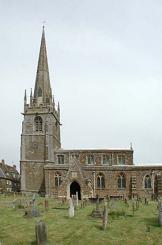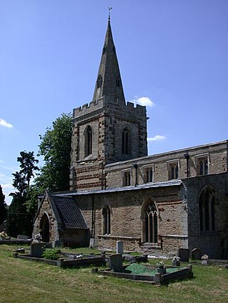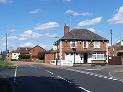
Raunds is a market town in North Northamptonshire, England. It had a population of 9,379 at the 2021 census.

East Northamptonshire was a local government district in Northamptonshire, England, from 1974 to 2021. Its council was based in Thrapston and Rushden. Other towns included Oundle, Raunds, Irthlingborough and Higham Ferrers. The town of Rushden was by far the largest settlement in the district. The population of the district at the 2011 Census was 86,765.

Farthingstone is a village in West Northamptonshire in England. It is close to the major trunk routes of the M1 junction 16, M40 motorway, and A5 road, at the head of a valley and is 7 miles (11 km) south of Daventry and 3.5 miles (5.6 km) south west of Weedon Bec.
Hargrave is a small village and civil parish situated in rural Northamptonshire, England, approximately 21 miles east of Northampton and adjacent to the Northamptonshire-Cambridgeshire-Bedfordshire border. At the time of the 2001 census, the parish's population was 236 people,. increasing to 241 at the 2011 census.

Woodford is a large village and civil parish located in North Northamptonshire, England. At the time of the 2011 census, the parish's population was 1,461 people.

Corby and East Northamptonshire is a constituency in the English county of Northamptonshire. It is represented in the House of Commons of the UK Parliament since July 2024 by Lee Barron, of the Labour Party.
Stanwick is a village and civil parish in North Northamptonshire, England.

Great Addington is a small village and civil parish in Northamptonshire, England. It lies near the west bank of the River Nene, about 5 miles (8 km) east of Kettering. It consists of approximately 100 households; at the time of the 2011 census, the population of the parish was 327 people. It has a school, church, manor house, village hall, a pub called the Hare & Hounds, playing fields and homes. There is a strong bond and rivalry with the neighbouring village Little Addington.
Thrapston was a rural district in England from 1894 to 1935. It was one of the only rural districts to be split between administrative counties, with part in Northamptonshire and part in Huntingdonshire.

Chelveston is a small village in North Northamptonshire. It is about 2 miles (3.2 km) east of Higham Ferrers and 7 miles (11.3 km) east of Wellingborough on the B645 from Higham Ferrers to St Neots. To the south is the hamlet of Caldecott and the settlement of Chelston Rise which together comprise the civil parish of Chelveston cum Caldecott. The population is now included in the civil parish of Chelveston cum Caldecott.

Middleton Cheney is a large village and civil parish in West Northamptonshire, England. The village is about 3 miles (5 km) east of Banbury in Oxfordshire and about 6 miles (10 km) west-northwest of Brackley. The A422 road between Banbury and Brackley used to pass through Middleton Cheney, but now bypasses it to the south.

The A605 road is a main road in the English counties of Northamptonshire and Cambridgeshire.

Denford is a small village and civil parish situated in North Northamptonshire, England. At the time of the 2001 census, the parish population was 250 people, increasing to 282 at the 2011 census.

Little Addington is a village and civil parish in North Northamptonshire, England, about 8 miles (13 km) south-east of Kettering. At the time of the 2011 census, the parish's population was 328 people. Prior to local government restructuring in 2021 the village was in the area of East Northamptonshire District Council.

St Peter's Church is an Anglican Church and the parish church of Raunds. It is a Grade I listed building and stands in an elevated position in Church Street.

The Church of St Laurence is a Grade I listed building in the village of Stanwick in North Northamptonshire. It was originally within the Church of England Diocese of Lincoln but was transferred to the Diocese of Peterborough in 1541 towards the end of the Dissolution of the Monasteries during Henry VIII's reign.

Stanwick Lakes is a country park on the outskirts of the village of Stanwick and was opened in 2006. It is managed by the Rockingham Forest Trust on behalf of East Northamptonshire District Council and comprises 750 acres of former gravel pits. It is part of the larger River Nene Regional Park.

Ditchford Lakes and Meadows is a 31.1-hectare (77-acre) nature reserve Northamptonshire. It is managed by the Wildlife Trust for Bedfordshire, Cambridgeshire and Northamptonshire. It is part of the Upper Nene Valley Gravel Pits Site of Special Scientific Interest, Ramsar wetland site of international importance, and Special Protection Area under the European Communities Birds Directive.

The War Memorial is a Grade II listed structure located in the churchyard of the Church of St Laurence in the village of Stanwick.

Kinewell Lake is a 35.4 hectare Local Nature Reserve west of Ringstead in Northamptonshire, England. It is owned by Ringstead Parish Council and managed by Kinewell Lake Trust. The site is part of the Upper Nene Valley Gravel Pits Site of Special Scientific Interest, Ramsar wetland site of international importance, and Special Protection Area under the European Communities Birds Directive.


