Northumberland is a ceremonial county in North East England, bordering Scotland. It is bordered by the Scottish Borders to the north, the North Sea to the east, Tyne and Wear and County Durham to the south, and Cumbria to the west. The town of Blyth is the largest settlement. Northumberland is the northernmost county in England.
Alaunus or Alaunius is a Gaulish god of healing and prophecy. His name is known from inscriptions found in Lurs, Alpes-de-Haute-Provence in Southern France and in Mannheim in western Germany. In the latter inscription, Alaunus is used as an epithet of Mercury. The feminine form Alauna is at the origin of many place-names and hydronyms across Europe, including the Roman-era names of Valognes in Normandy, Maryport and Watercrook in Cumbria, River Alyn in North Wales, Alcester in Warwickshire, Ardoch in Perthshire, and Learchild and the River Aln in Northumberland.

Alnwick is a market town in Northumberland, England, of which it is the traditional county town. The population at the 2011 Census was 8,116.
The River Wyre, in Lancashire, England, flows into the Irish Sea at Fleetwood. It is 28 miles (45 km) long and has a sheltered estuary which penetrates deep into the Fylde peninsula.
The Allan Water is a river in central Scotland. Rising in the Ochil Hills, it runs through Strathallan to Dunblane and Bridge of Allan before joining the River Forth. It is liable to cause floods in lower Bridge of Allan.

Loch Fleet is a sea loch on the east coast of Scotland, located between Golspie and Dornoch. It forms the estuary of the River Fleet, a small spate river that rises in the hills east of Lairg. The loch was designated a National Nature Reserve (NNR) in 1998, and is managed by a partnership between NatureScot, the Scottish Wildlife Trust (SWT) and Sutherland Estates. The NNR extends to 1058 hectares, including the Loch Fleet tidal basin, sand dunes, shingle ridges and the adjacent pine woods, including Balbair Wood and Ferry Wood. The tidal basin of the loch covers over 630 ha, and forms the largest habitat on the NNR.

The Ythan is a river in the north-east of Scotland rising at Wells of Ythan near the village of Ythanwells and flowing south-eastwards through the towns of Fyvie, Methlick and Ellon before flowing into the North Sea near Newburgh, in Formartine.

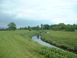
Alnham is a hamlet and civil parish in Northumberland, England. It is about 14 miles (23 km) west of Alnwick, and is about 6 miles (10 km) from the Scottish border, on the south of a small tributary of the River Aln. The village stands on uneven ground, sloping from south to north, at the foot of the southern outliers of the Cheviot Hills. The River Aln flows eastward through the village from its source in the Cheviot Hills down to the coast. The layout of the village appears to have been dictated by the river. The estimated population taken at the 2011 Census was around 245.
Alauna is the feminine form of the Gaulish god Alaunus or (possibly) an unrelated Celtic river goddess in her own right.
Alnmouth is a coastal village in Northumberland, England, situated 4 miles (6 km) east-south-east of Alnwick. The population of the civil parish at the 2001 Census was 562, reducing to 445 at the 2011 Census.

The Ythan Estuary is the tidal component of the Ythan River, emptying into the North Sea 19 kilometres (12 mi) north of Aberdeen, Scotland. The estuary’s tidal action extends a 7 kilometres (4.3 mi) inland and has characteristic widths of between 250 metres (820 ft) and 780 metres (2,560 ft). Besides the tidal channel there are interfaces to the upland dunes including mudflats, sand beaches and shingle flats. Reaches of salt marsh occur, but they are primarily near the Waterside Bridge and the mouth of the Tarty Burn, a small tributary river. Based upon the habitat of the moorland bordering the east of the Ythan River near the mouth, this estuary is the most significant coastal moorland in the northern United Kingdom.

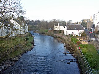
Whittingham is a village and civil parish in Northumberland, England. It is situated on the banks of the River Aln, roughly 4.5 miles (7 km) east of its source at Alnham and 7.3 miles (12 km) west of Alnwick. The thirteenth/fourteenth century pele tower, Whittingham Tower, was converted into almshouses in 1845 and is now in private ownership.
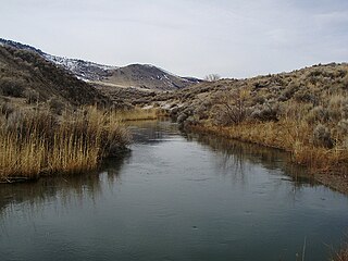
The Ana River is a short spring-fed river in south-central Oregon. It is on the northwestern edge of the Great Basin drainage. It flows 7 miles (11 km) from springs at the foot of Winter Ridge through high desert, range, and wetlands before emptying into Summer Lake. For most of its course, the Ana River flows through the Summer Lake Wildlife Area, which is maintained by the Oregon Department of Fish and Wildlife. The river provides habitat for many mammal and bird species, as well as several fish species, including the rare Summer Lake Tui chub. The largest hybrid striped bass ever caught in Oregon was taken from Ana Reservoir in 2009.

The Summer Lake Wildlife Area is a 29.6-square-mile (77 km2) wildlife refuge located on the northwestern edge of the Great Basin drainage in south-central Oregon. It is administered by the Oregon Department of Fish and Wildlife. The refuge is an important stop for waterfowl traveling along the Pacific Flyway during their spring and fall migrations. The Summer Lake Wildlife Area also provides habitat for shorebirds and other bird species as well as wide variety of mammals and several fish species. The Ana River supplies the water for the refuge wetlands.

Housing more than 200 resident and wintering bird species, Chennai has long been a haven for bird watchers. It is one of the few urban areas in India with diverse range of birds including greater flamingo, black baza, osprey, Indian eagle-owl, Coppersmith barbet, Spot billed pelican and pied avocet can be seen. The following are some known birding hotspots in and around Chennai.

Tring Reservoirs is a group of four reservoirs close to Tring on the border of Hertfordshire and Buckinghamshire, England. Their purpose is to feed the Grand Union Canal.
The Church of St Michael in Alnham, in the English county of Northumberland, is a medieval structure dating from circa 1200. Built on a Roman camp site, it is mentioned in records dating to 1291; it is a Grade I listed building.

The history of Alnmouth, a village and seaport in Northumberland, England, can be traced back to the Mesolithic period. Its modern history starts with the establishment of a settlement in 1152 and a charter for a port and market in 1207/8. Fragmentary evidence of occupation or use in earlier periods has been found. The port's peak period was in the 18th & 19th centuries. From the late 19th century and in the 20th century the village became a coastal resort.

Brooklands Lagoon is technically a very elongated estuary near Brooklands, Christchurch. The Styx river drains into it and it is at the mouth of the Waimakariri river. The Waimakariri used to drain out of Brooklands Lagoon towards the Spencer Park end. This changed when engineers dug through the sand dunes to provide a more direct course to the sea in 1930 in order to reduce the risk of flooding from the Waimakariri River. The Lagoon is protected from the Pegasus Bay by Brooklands Spit. To the south of it is Bottle Lake Forest and Spencer Park. The lagoon is approximately 270 hectares in size, 4.5 kilometers long and 800 meters at its widest. Spring tides will bring approximately 1.6 million cubic meters of water into the lagoon.