The Derwent is a river in Derbyshire, England. It is 50 miles (80 km) long and is a tributary of the River Trent, which it joins south of Derby. Throughout its course, the river mostly flows through the Peak District and its foothills.

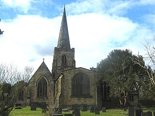
Wirksworth is a market town in the Derbyshire Dales district of Derbyshire, England. Its population of 4,904 in the 2021 census was estimated at 5,220 in 2023. Wirksworth contains the source of the River Ecclesbourne. The town was granted a market charter by Edward I in 1306 and still holds a market on Tuesdays in the Memorial Gardens. The parish church of St Mary's is thought to date from 653. The town developed as a centre for lead mining and stone quarrying. Many lead mines were owned by the Gell family of nearby Hopton Hall.

Duffield is a village in the Amber Valley district of Derbyshire, 5 miles (8.0 km) north of Derby. It is centred on the western bank of the River Derwent at the mouth of the River Ecclesbourne. It is within the Derwent Valley Mills World Heritage Area and the southern foothills of the Pennines.

Cromford is a village and civil parish in Derbyshire, England, in the valley of the River Derwent between Wirksworth and Matlock. It is 17 miles (27 km) north of Derby, 2 miles (3.2 km) south of Matlock and 1 mile (1.6 km) south of Matlock Bath. It is first mentioned in the 11th-century Domesday Book as Crumforde, a berewick of Wirksworth, and this remained the case throughout the Middle Ages. The population at the 2011 Census was 1,433. It is principally known for its historical connection with Richard Arkwright and the nearby Cromford Mill, which he built outside the village in 1771. Cromford is in the Derwent Valley Mills World Heritage Site.

This article details some of the history of lead mining in Derbyshire, England.

The Cromford and High Peak Railway (C&HPR) was a standard-gauge line between the Cromford Canal wharf at High Peak Junction and the Peak Forest Canal at Whaley Bridge. The railway, which was completed in 1831, was built to carry minerals and goods through the hilly rural terrain of the Peak District within Derbyshire, England. The route was marked by a number of roped worked inclines. Due to falling traffic, the entire railway was closed by 1967.

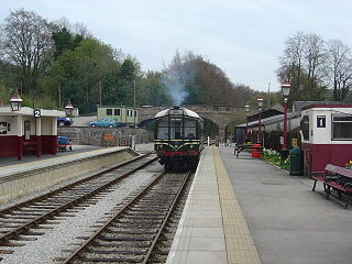
The Ecclesbourne Valley Railway is a 9-mile (14.5 km) long heritage railway in Derbyshire. The headquarters of the railway centre on Wirksworth station, and services operate in both directions between Wirksworth and Duffield and from Wirksworth to Ravenstor.

The Cromford Canal ran 14.5 miles from Cromford to the Erewash Canal in Derbyshire, England with a branch to Pinxton. Built by William Jessop with the assistance of Benjamin Outram, its alignment included four tunnels and 14 locks.

The Derwent Valley line is a railway line from Derby to Matlock in Derbyshire.

Duffield railway station serves the village of Duffield in Derbyshire, England. The station is located on the Midland Main Line from Derby to Leeds, 133 miles 8 chains (214.2 km) north of London St Pancras. It is also a junction with the former branch line to Wirksworth, which is now operated as the Ecclesbourne Valley heritage railway.

A sough is an underground channel for draining water.

Middleton or Middleton-by-Wirksworth is an upland village and civil parish lying approximately one mile NNW of Wirksworth, Derbyshire, England. Middleton was, in 1086, a berewick of the town and manor of Wirksworth. Middleton was formerly known for its lead mines and high quality limestone quarries, including the underground quarry site at Middleton Mine. The Middleton Mine networks underground for approximately 25 miles (40 km) with tunnels on three different levels running under Middleton Moor to the Hopton Wood quarry works at the other side of the hill below Ryder Point Works’. Part of the tunnel collapsed in the 1970s leaving a noticeable depression in the ground above on the eastern side of Middleton Moor. The population of the parish as taken at the 2011 Census was 775.

Shottle and Postern is a civil parish within the Amber Valley district, which is in the county of Derbyshire, England. Sparsely built up with much rural expanse, its population was 270 residents in the 2021 census. The parish is 120 miles (190 km) north west of London, 9 miles (14 km) north west of the county town of Derby, and 2+3⁄4 miles (4.4 km) equidistant of the nearest market towns of Belper and Wirksworth. It shares a boundary with the parishes of Alderwasley, Ashleyhay, Belper, Hazelwood, Idridgehay and Alton, Turnditch and Windley.

Shottle railway station is the second intermediate station on the former Midland Railway branch line to the small town of Wirksworth in Derbyshire. The line is off the Midland Main Line at Duffield railway station, the first being Hazelwood.

Wirksworth Railway Station is a heritage railway station that serves the town of Wirksworth in Derbyshire. It was the former terminus of the Midland Railway Wirksworth branch line, leaving the Midland Main Line at Duffield. The line was reopened as the Ecclesbourne Valley Railway.

Cromford Mill is the world's first water-powered cotton spinning mill, developed by Richard Arkwright in 1771 in Cromford, Derbyshire, England. The mill structure is classified as a Grade I listed building. It is now the centrepiece of the Derwent Valley Mills UNESCO World Heritage Site, and is a multi-use visitor centre with shops, galleries, restaurants and cafes.

Idridgehay railway station is an intermediate station on the former Midland Railway branch line to the town of Wirksworth in Derbyshire. Off the Midland Main Line at Duffield, the line has been reopened as the Ecclesbourne Valley Railway, and Idridgehay station was reopened on 8 March 2008.

Ravenstor railway station is a Heritage railway station at the northernmost limit of the Ecclesbourne Valley Railway, Wirksworth, Derbyshire.

Hazelwood Railway Station is a disused railway station on the Wirksworth branch of the Midland Railway. It served the village of Hazelwood.

Idridgehay is a village in the civil parish of Idridgehay and Alton, in the Amber Valley district of Derbyshire, England.


