

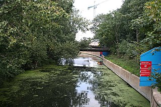
The River Lee Diversion is located in the Lea Valley, close to Enfield Lock and to the north east corner of the King George V Reservoir.
The River Lee Diversion is located in the Lea Valley, close to Enfield Lock and to the north east corner of the King George V Reservoir.
As its name implies, the River Lea was diverted to accommodate the construction of the Chingford Reservoirs and the Banbury Reservoir.
Before skirting the eastern boundary of the King George V Reservoir, the river is joined by the River Lee Flood Relief Channel. The man-made, steep, concrete-banked water flows under Lea Valley Road (A110 road), before forming a boundary with the William Girling Reservoir. It flows under the North Circular Road at the Lea Valley Viaduct before skirting the western perimeter of the Banbury Reservoir, then flows close and parallel to the River Lee Navigation, passing to the west of the Lockwood Reservoir. It continues past Stonebridge Lock and Tottenham Lock, then merges with the River Lee Navigation below Ferry Lane (A503 road).
The river feeds water to some of the reservoirs in the Lee Valley Reservoir Chain. [1]
The clean, well-oxygenated, concrete-lined, fast-flowing water provides the ideal environment for the barbel. Also, of note is the fish-eating bird the goosander which feeds in the river. [2]
Access is limited as the river mainly flows through Thames Water property.
The River Lea is in the East of England and Greater London. It originates in Bedfordshire, in the Chiltern Hills, and flows southeast through Hertfordshire, along the Essex border and into Greater London, to meet the River Thames at Bow Creek. It is one of the largest rivers in London and the easternmost major tributary of the Thames.

The New River is an artificial waterway in England, opened in 1613 to supply London with fresh drinking water taken from Chadwell and Amwell Springs near Ware in Hertfordshire, and later the River Lea and other sources. Originally conceived by Edmund Colthurst and completed by Hugh Myddelton, it was operated by the New River Company for nearly 300 years until London's water supply was taken over by the Metropolitan Water Board in 1904.
The Hertford Union Canal or Duckett's Cut, just over 1 mile (1.6 km) long, connects the Regent's Canal to the Lee Navigation in the London Borough of Tower Hamlets in East London. It was opened in 1830 but quickly proved to be a commercial failure. It was acquired by the Regents Canal Company in 1857, and became part of the Grand Union Canal in 1927.

The Lee Navigation is a canalised river incorporating the River Lea. It flows from Hertford Castle Weir to the River Thames at Bow Creek; its first lock is Hertford Lock and its last Bow Locks.
Lee Valley Regional Park is a 10,000-acre (40 km2) 26 miles (42 km) long linear park, much of it green spaces, running through the northeast of Greater London, Essex and Hertfordshire. The park follows the course of the River Lea (Lee) along the Lea Valley from Ware in Hertfordshire through Essex and the north east of Greater London, through the Queen Elizabeth Olympic Park to East India Docks Basin on the River Thames. The park is managed by Lee Valley Regional Park Authority and is made up of a diverse mix of countryside areas, urban green spaces, heritage sites, country parks, nature reserves and lakes and riverside trails, as well as leading sports centres covering an area of over 10,000 acres (40 km2). It is crossed by a number of roads and railways.
Walthamstow Marshes, is a 36.7-hectare (91-acre) biological Site of Special Scientific Interest in Walthamstow in the London Borough of Waltham Forest. It was once an area of lammas land – common land used for growing crops and grazing cattle.

The River Ching is a tributary of the River Lea, flowing from Epping Forest, in southeast England.

Ponders End is the southeasternmost part of Enfield, north London, centred on the Hertford Road. Situated to the west of the River Lee Navigation, it became industrialised through the 19th century, similar to the Lea Valley in neighbouring Edmonton and Brimsdown, with manufacturing giving way to warehousing in the late-20th century. The area features much social housing, with streets also lined with suburban terraced housing from the 19th and early 20th centuries.

National Cycle Route 1 is a route of the National Cycle Network, running from Dover to Tain. The 1,264 mi-long (2,034-kilometre) cycle-path is located in the United Kingdom.

The Lea Valley Walk is a 50-mile (80 km) long-distance path located between Leagrave, the source of the River Lea near Luton, and the Thames, at Limehouse Basin, Limehouse, east London. From its source much of the walk is rural. At Hertford the path follows the towpath of the River Lee Navigation, and it becomes increasingly urbanised as it approaches London. The walk was opened in 1993 and is waymarked throughout using a swan logo.

The Small River Lea is a minor tributary of the River Lea, which flows through the Lee Valley Park between Cheshunt and Enfield Lock. It forms part of the Turnford and Cheshunt Pits Site of Special Scientific Interest (SSSI) as it flows through the River Lee Country Park.
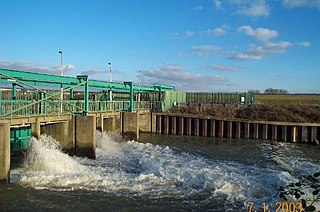
The Lee Flood Relief Channel (FRC) is located in the Lea Valley and flows between Ware, Hertfordshire, and Stratford, east London. Work started on the channel in 1947 following major flooding and it was fully operational by 1976. The channel incorporates existing watercourses, lakes, and new channels. Water from the channel feeds the Lee Valley Reservoir Chain.

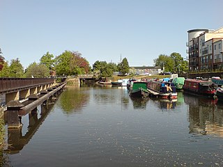
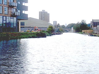
The Lee Valley Reservoir Chain is located in the Lee Valley, and comprises 13 reservoirs that supply drinking water to London.

The Coppermill Stream is a short waterway near Walthamstow in the Lea Valley. Originally a minor tributary of the River Lea, the approximately 2-mile (3.2 km) long stream is now used as an aqueduct to transport water from the reservoirs in the Lea Valley to Coppermills Water Treatment Works. The stream is part of a Site of Metropolitan Importance.

The Middlesex Filter Beds Weir, or Lea Bridge Road Weir, marks the start of the Hackney Cut, an artificial channel of the River Lee Navigation built in 1770, in the London Borough of Hackney. The weir lies between the former Middlesex Filter Beds – now a nature reserve – and the Thames Water treatment works at Lea Bridge Road.
The Hackney Cut is an artificial channel of the Lee Navigation built in England in 1769 by the River Lea Trustees to straighten and improve the Navigation. It begins at the Middlesex Filter Beds Weir, below Lea Bridge, and is situated in the (modern) London Borough of Hackney. When built it contained two pound locks and a half-lock, but was rebuilt to handle larger barges in the 1850s, and now only Old Ford Lock, which is actually a duplicated pair, remains.
The Old River Lea is the former natural channel of the River Lea below Lea Bridge, in the London Borough of Hackney. The Old River forms a large meander from the Middlesex Filter Beds Weir to rejoin the main channel of the River Lee Navigation below Old Ford Lock, just west of the 2012 Olympic stadium.
The River Lynch, also known as the Lynch Brook, is a minor tributary of the River Lea in Hoddesdon, Hertfordshire, England.

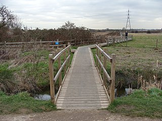
Rammey Marsh is located in the Lee Valley Park at Enfield Lock, Enfield, England, and covers approximately 42 hectares. The site is owned and managed by the Lee Valley Regional Park Authority.

The Coppermills Water Treatment Works is a large water treatment works in the Lea Valley in east London. Completed in 1969 by the Metropolitan Water Board, it is now owned and operated by Thames Water. In 2009, Coppermills was connected to the Thames Water Ring Main via the Northern Extension Tunnel, enabling the facility to be a major supplier of water to the whole London area. It is capable of supplying a maximum of 680 million litres of water per day.