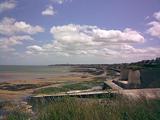
The Swale is a tidal channel of the Thames estuary that separates the Isle of Sheppey from the rest of Kent. On its banks is a 6,509.4-hectare (16,085-acre) biological Site of Special Scientific Interest which stretches from Sittingbourne to Whitstable in Kent. It is also a Ramsar internationally important wetland site and a Special Protection Area under the European Union Directive on the Conservation of Wild Birds. Parts of it are a Nature Conservation Review site, Grade I, National Nature Reserves, a Kent Wildlife Trust nature reserve and a Local Nature Reserve.

Blue Bell Hill is a chalk hill between Maidstone and Rochester in the English county of Kent. It overlooks the River Medway and is part of the North Downs. Settlements on the hill include Walderslade; and Blue Bell Hill and Kit's Coty villages. During the eighteenth and nineteenth centuries much of the hill was quarried for chalk.

Eastbrookend Country Park is an 84-hectare park and Local Nature Reserve in Dagenham in the London Borough of Barking and Dagenham, in England. Together with the neighbouring Chase Nature Reserve it is also designated a Site of Metropolitan Importance for Nature Conservation.

Burham Down is a 110-hectare (270-acre) nature reserve between Maidstone and Chatham in Kent. It is managed by the Kent Wildlife Trust. It is part of the Wouldham to Detling Escarpment Site of Special Scientific Interest and Nature Conservation Review site, Grade I, the Kent Downs Area of Outstanding Natural Beauty, and the North Downs Woodlands Special Area of Conservation.

Burham Marsh nature reserve is an 11 hectare tidal Reed bed on the River Medway 5 miles northwest of Maidstone. It is just east of Snodland but being on the east bank of the river it is accessed via Burham. It is part the Holborough to Wouldham Marshes Site of Special Scientific Interest.
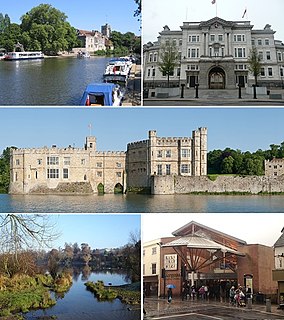
Downswood is a civil parish in the Borough of Maidstone in Kent, England. The population of the civil parish as of the 2011 census is 2,291. It is bounded to the north by the River Len, to the south by Otham and Bearsted and is 2 miles (3 km) from Maidstone, the county town of Kent. Downswood has been a parish in its own right since 1987. Prior to this it was part of the civil parish of Otham.

Roding Valley Meadows is an 18.9 hectare biological Site of Special Scientific Interest in Buckhurst Hill in Essex. It is part of a 65.2 hectare Local Nature Reserve with the same name, which is owned by Epping Forest District Council and Grange Farm Trust, and managed by the Essex Wildlife Trust.
The Chase is a nature reserve in Dagenham in London. Most of it is in the London Borough of Barking and Dagenham, with a small part in Havering. It is owned by the boroughs, and managed by London Borough of Barking & Dagenham - Parks & Countryside Ranger Service. The boroughs have designated the sections in their respective boroughs as Local Nature Reserves. The Chase, together with the neighbouring Eastbrookend Country Park, is also designated a Site of Metropolitan Importance for Nature Conservation.

Beam Valley Country Park is a 74-hectare park in Dagenham in the London Borough of Barking and Dagenham. Most of it is designated as a Local Nature Reserve (LNR) called Beam Valley, but a narrow strip next to the River Beam south from Western Avenue is a separate LNR called Beam Valley. The park is also designated as two Sites of Borough Importance for Nature Conservation, Grade 1, one north and the other south of South Dagenham Road.
Sutcliffe Park is a 16.7 hectare public park in Eltham in the Royal Borough of Greenwich in London. A large part of the park is a local nature reserve and a Site of Borough Importance for Nature Conservation, Grade II. Fauna include dragonflies, damselflies, kingfishers, snipe and reed warblers. The River Quaggy runs through the park, and it has an athletics track and outdoor gym. It received a Green Flag award for 2012-13.
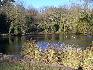
Stanborough Reedmarsh is a 3.3 hectare Local Nature Reserve in Welwyn Garden City in Hertfordshire. It is owned by Welwyn Hatfield Borough Council and managed by the Herts and Middlesex Wildlife Trust.

Dryhill is an 11.7-hectare (29-acre) geological Site of Special Scientific Interest on the western outskirts of Sevenoaks in Kent. It is a Geological Conservation Review site, and an area of 9.5 hectares is a Local Nature Reserve
Thanet Coast is an 816.9-hectare (2,019-acre) biological and geological Site of Special Scientific Interest which stretches along the coast between Whitstable and Ramsgate in Kent. It is a Geological Conservation Review site, and overlaps two Special Area of Conservations. It is also part of a Ramsar Site and a Special Protection Area. Part of it is a Local Nature Reserve,
Wouldham to Detling Escarpment is a 311.2-hectare (769-acre) biological and geological Site of Special Scientific Interest which stretches from Wouldham to Detling, north of Maidstone in Kent. Part of it is a Geological Conservation Review site, and it is part of the North Downs Woodlands Special Area of Conservation and the Kent Downs Area of Outstanding Natural Beauty. It is a Nature Conservation Review site, Grade I and it includes three Kent Wildlife Trust nature reserves and a Local Nature Reserve,

Boxley Warren is a 83-hectare (210-acre) Local Nature Reserve north of Maidstone in Kent. It is privately owned and managed by Maidstone Borough Council. It is part of North Downs Woodlands Special Area of Conservation and Wouldham to Detling Escarpment Site of Special Scientific Interest

Ditton Quarry is a 5.6-hectare (14-acre) Local Nature Reserve in Ditton, on the north-western outskirts of Maidstone in Kent. It is owned and managed by Ditton Parish Council.
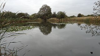
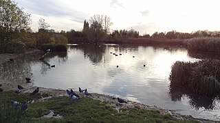
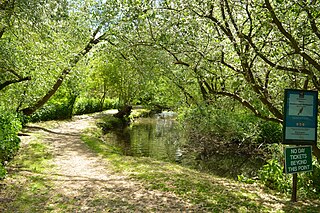
Vinters Valley Park is a 30.2-hectare (75-acre) Local Nature Reserve in Maidstone in Kent. It is owned by Kent County Council and Maidstone Borough Council and managed by the Vinters Valley Trust.

The Larches is a 25-hectare (62-acre) nature reserve north-east of Detling, which is north of Maidstone in Kent. It is managed by Kent Wildlife Trust. It is part of the Wouldham to Detling Escarpment Site of Special Scientific Interest and Nature Conservation Review site, Grade I It is also part of the North Downs Woodlands Special Area of Conservation, and Kent Downs Area of Outstanding Natural Beauty,
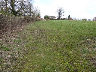
Wateringbury SSSI is a 0.2-hectare (0.49-acre) geological Site of Special Scientific Interest in Wateringburym west of Maidstone in Kent. It is a Geological Conservation Review site.