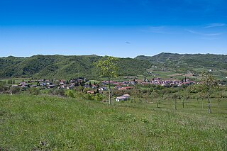
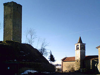
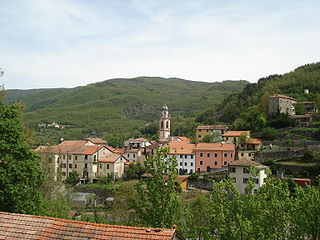
Rivergaro | |
---|---|
Comune | |
Comune di Rivergaro | |
Coordinates: 44°54′N9°36′E / 44.900°N 9.600°E Coordinates: 44°54′N9°36′E / 44.900°N 9.600°E | |
Country | Italy |
Region | Emilia-Romagna |
Province | Province of Piacenza (PC) |
Area | |
• Total | 43.8 km2 (16.9 sq mi) |
Population (Dec. 2011) | |
• Total | 6,843 |
• Density | 160/km2 (400/sq mi) |
Time zone | CET (UTC+1) |
• Summer (DST) | CEST (UTC+2) |
Postal code | 29029 |
Dialing code | 0523 |
Rivergaro (Piacentino: Arvargär) is a comune (municipality) in the Province of Piacenza in the Italian region Emilia-Romagna, located about 150 kilometres (93 mi) northwest of Bologna and about 20 kilometres (12 mi) southwest of Piacenza. As of 31 December 2011, it had a population of 6,843 and an area of 43.8 square kilometres (16.9 sq mi). [1]
The comune is a basic administrative division in Italy, roughly equivalent to a township or municipality.
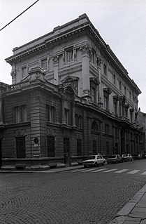
The province of Piacenza is a province in the Emilia-Romagna region of Italy. Its provincial capital is the city Piacenza. As of 2016, it has a total population of 286,572 inhabitants over an area of 2,585.86 square kilometres (998.41 sq mi), giving it a population density of 111.38 inhabitants per square kilometre. The city Piacenza has a population of 102,269, as of 2015. The provincial president is Patrizia Barbieri and it contains 48 comuni. The province dates back to its founding by the Romans in 218 BCE.
Italy, officially the Italian Republic, is a country in Europe. Located in the middle of the Mediterranean Sea, Italy shares open land borders with France, Switzerland, Austria, Slovenia and the enclaved microstates San Marino and Vatican City. Italy covers an area of 301,340 km2 (116,350 sq mi) and has a largely temperate seasonal and Mediterranean climate. With around 61 million inhabitants, it is the fourth-most populous EU member state and the most populous country in Southern Europe.
Localities include Ancarano di Sopra, Fabbiano, Larzano, Rallio, Niviano, Ottavello, Pieve Dugliara, Rivergaro, Roveleto Landi, Suzzano, and Case Buschi.
Fabbiano is an Italian surname. Notable people with the surname include:
The Medieval Castello di Montechiaro (castle of Montechiaro) is located in the locality of Rallio.
Rivergaro borders the following municipalities: Gazzola, Gossolengo, Podenzano, Travo, and Vigolzone.
Gazzola is a comune (municipality) in the Province of Piacenza in the Italian region Emilia-Romagna, located about 150 kilometres (93 mi) northwest of Bologna and about 15 kilometres (9 mi) southwest of Piacenza. As of 31 December 2004, it had a population of 1,856 and an area of 44.1 square kilometres (17.0 sq mi).
Gossolengo is a comune (municipality) in the province of Piacenza in the Italian region Emilia-Romagna, located about 150 kilometres (93 mi) northwest of Bologna and about 9 kilometres (6 mi) southwest of Piacenza, in the valley of the Trebbia river.
Podenzano is a comune in the Province of Piacenza, Emilia-Romagna, northern Italy.
Chiusano d'Asti is a comune (municipality) in the Province of Asti in the Italian region Piedmont, located about 35 kilometres (22 mi) southeast of Turin and about 11 kilometres (7 mi) northwest of Asti. As of 31 December 2004, it had a population of 236 and an area of 2.5 square kilometres (0.97 sq mi).
Cortazzone is a comune (municipality) in the Province of Asti in the Italian region Piedmont, located about 30 kilometres (19 mi) southeast of Turin and about 14 kilometres (9 mi) northwest of Asti.
Cossombrato is a comune (municipality) in the Province of Asti in the Italian region Piedmont, located about 35 kilometres (22 mi) east of Turin and about 12 kilometres (7 mi) northwest of Asti. As of 31 December 2004, it had a population of 493 and an area of 5.3 square kilometres (2.0 sq mi).
Montechiaro d'Asti is a town and comune (municipality) in the Province of Asti in the Italian region Piedmont, located about 35 kilometres (22 mi) east of Turin and about 13 kilometres (8 mi) northwest of Asti.
Soglio is a comune (municipality) in the Province of Asti in the Italian region Piedmont, located about 30 kilometres (19 mi) east of Turin and about 14 kilometres (9 mi) northwest of Asti. As of 31 December 2004, it had a population of 164 and an area of 3.5 square kilometres (1.4 sq mi).
Cartosio is a comune (municipality) in the Province of Alessandria in the Italian region Piedmont, located about 80 kilometres (50 mi) southeast of Turin and about 40 kilometres (25 mi) southwest of Alessandria.
Castelletto d'Erro is a comune (municipality) in the Province of Alessandria in the Italian region Piedmont, located about 70 kilometres (43 mi) southeast of Turin and about 35 kilometres (22 mi) southwest of Alessandria.
Denice is a comune (municipality) in the Province of Alessandria in the Italian region Piedmont, located about 70 kilometres (43 mi) southeast of Turin and about 40 kilometres (25 mi) southwest of Alessandria. As of 31 December 2004, it had a population of 206 and an area of 7.4 square kilometres (2.9 sq mi).
Montechiaro d'Acqui is a comune (municipality) in the Province of Alessandria in the Italian region Piedmont, located about 70 kilometres (43 mi) southeast of Turin and about 40 kilometres (25 mi) southwest of Alessandria.
Piacenza d'Adige is a comune (municipality) in the Province of Padua in the Italian region Veneto, located about 70 kilometres (43 mi) southwest of Venice and about 40 kilometres (25 mi) southwest of Padua. As of 31 December 2004, it had a population of 1,371 and an area of 18.6 square kilometres (7.2 sq mi).
Cerignale is a comune (municipality) in the Province of Piacenza in the Italian region Emilia-Romagna, located about 160 kilometres (99 mi) west of Bologna and about 50 kilometres (31 mi) southwest of Piacenza. As of 31 December 2004, it had a population of 197 and an area of 31.5 square kilometres (12.2 sq mi).
Ottone is a comune (municipality) in the Province of Piacenza in the Italian region Emilia-Romagna, located about 160 kilometres (99 mi) west of Bologna and about 60 kilometres (37 mi) southwest of Piacenza, in the upper Val Trebbia on the Ligurian Apennine. Ottone is the westernmost comune of Emilia-Romagna. The Mount Alfeo is located in its territory.
Travo is a comune (municipality) in the Province of Piacenza in the Italian region Emilia-Romagna, located about 150 kilometres (93 mi) northwest of Bologna and about 25 kilometres (16 mi) southwest of Piacenza. It is on the left bank of the Trebbia river.
Vigolzone is a comune (municipality) in the Province of Piacenza in the Italian region Emilia-Romagna, located about 140 kilometres (87 mi) northwest of Bologna and about 15 kilometres (9 mi) south of Piacenza.
Zerba is a comune (municipality) in the Province of Piacenza in the Italian region Emilia-Romagna, located about 170 kilometres (110 mi) west of Bologna and about 50 kilometres (31 mi) southwest of Piacenza. As of 31 December 2004, it had a population of 123 and an area of 25.0 square kilometres (9.7 sq mi).
Camastra is a comune (municipality) in the Province of Agrigento in the Italian region Sicily, located about 100 kilometres (62 mi) southeast of Palermo and about 20 kilometres (12 mi) southeast of Agrigento. As of 31 December 2004, it had a population of 2,133 and an area of 16.3 square kilometres (6.3 sq mi).
Pigazzano is a frazione of the comune of Travo in the Italian region Emilia-Romagna, located about 24 km southwest of Piacenza.
Montechiaro could refer to:
This article on a location in Emilia–Romagna is a stub. You can help Wikipedia by expanding it. |