Pontenure

Last updated
Pontenure
Comune
Comune di Pontenure
I-PC-Pontenure.JPG
Italy provincial location map 2015.svg
Red pog.svg
Pontenure
Location of Pontenure in Italy
Coordinates: 45°0′N9°47′E / 45.000°N 9.783°E / 45.000; 9.783 Coordinates: 45°0′N9°47′E / 45.000°N 9.783°E / 45.000; 9.783
Country Italy
Region Emilia-Romagna
Province Piacenza (PC)
Frazioni Muradello, Paderna, Valconasso
Government
  Mayor Manola Gruppi
Area
  Total 33.8 km2 (13.1 sq mi)
Elevation 65 m (213 ft)
Population (30 September 2014) [1]
  Total 6,502
  Density 190/km2 (500/sq mi)
Demonym(s) Pontenuresi
Time zone CET (UTC+1)
  Summer (DST) CEST (UTC+2)
Postal code29010
Dialing code 0523
Website Official website

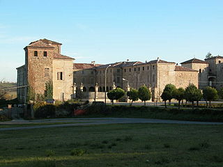
Pontenure (Piacentino : Pontnür [poŋtˈnyːr] ) is a comune (municipality) in the Province of Piacenza in the Italian region Emilia-Romagna, located about 140 kilometres (87 mi) northwest of Bologna and about 9 kilometres (6 mi) southeast of Piacenza.

<i>Comune</i> third-level administrative divisions of the Italian Republic

The comune is a basic administrative division in Italy, roughly equivalent to a township or municipality.
Province of Piacenza Province of Italy

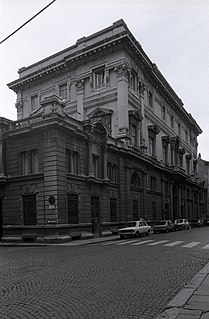
The province of Piacenza is a province in the Emilia-Romagna region of Italy. Its provincial capital is the city Piacenza. As of 2016, it has a total population of 286,572 inhabitants over an area of 2,585.86 square kilometres (998.41 sq mi), giving it a population density of 111.38 inhabitants per square kilometre. The city Piacenza has a population of 102,269, as of 2015. The provincial president is Patrizia Barbieri and it contains 48 comuni. The province dates back to its founding by the Romans in 218 BCE.

Italy republic in Southern Europe

Italy, officially the Italian Republic, is a European country consisting of a peninsula delimited by the Italian Alps and surrounded by several islands. Located in the middle of the Mediterranean sea and traversed along its length by the Apennines, Italy has a largely temperate seasonal climate. The country covers an area of 301,340 km2 (116,350 sq mi) and shares open land borders with France, Slovenia, Austria, Switzerland and the enclaved microstates of Vatican City and San Marino. Italy has a territorial exclave in Switzerland (Campione) and a maritime exclave in the Tunisian sea (Lampedusa). With around 60 million inhabitants, Italy is the fourth-most populous member state of the European Union.

Pontenure borders the following municipalities: Cadeo, Caorso, Carpaneto Piacentino, Cortemaggiore, Piacenza, Podenzano, San Giorgio Piacentino.

Cadeo Comune in Emilia-Romagna, Italy

Cadeo is a town and comune (municipality) in the Province of Piacenza in the Italian region Emilia-Romagna, located about 130 kilometres (81 mi) northwest of Bologna and about 14 kilometres (9 mi) southeast of Piacenza. It has about 5,600 inhabitants. The name is derived from Italian, meaning "House of God." This refers to a time when Cadeo was a stop-over for Christian pilgrims. The photo of the church accompanying this article is actually on the Via Emilia in Roveleto.

Caorso Comune in Emilia-Romagna, Italy

Caorso is a comune (municipality) in the Province of Piacenza in the Italian region Emilia-Romagna, located about 130 kilometres (81 mi) northwest of Bologna and about 13 kilometres (8 mi) east of Piacenza.

Carpaneto Piacentino Comune in Emilia-Romagna, Italy

Carpaneto Piacentino is a comune (municipality) in the Province of Piacenza in the Italian region of Emilia-Romagna, located about 130 kilometres (81 mi) northwest of Bologna and about 15 kilometres (9 mi) southeast of Piacenza.

Related Research Articles

Podenzano Comune in Emilia-Romagna, Italy

Podenzano is a comune in the Province of Piacenza, Emilia-Romagna, northern Italy.

Agazzano Comune in Emilia-Romagna, Italy

Agazzano is a comune (municipality) in the Province of Piacenza in the Italian region Emilia-Romagna, located about 150 kilometres (93 mi) northwest of Bologna and about 20 kilometres (12 mi) southwest of Piacenza. As of 31 December 2004, it had a population of 2,021 and an area of 35.9 square kilometres (13.9 sq mi).

Alseno Comune in Emilia-Romagna, Italy

Alseno is a comune (municipality) in the Province of Piacenza in the Italian region Emilia-Romagna, located about 120 kilometres (75 mi) northwest of Bologna and about 25 kilometres (16 mi) southeast of Piacenza.

Borgonovo Val Tidone Comune in Emilia-Romagna, Italy

Borgonovo Val Tidone is a comune (municipality) in the Province of Piacenza in the Italian region Emilia-Romagna, located about 160 kilometres (99 mi) northwest of Bologna and about 20 kilometres (12 mi) west of Piacenza.

Castelvetro Piacentino Comune in Emilia-Romagna, Italy

Castelvetro Piacentino, also known as Castelvetro, is a town and comune (municipality) in the Province of Piacenza in the Italian region Emilia-Romagna, located about 130 kilometres (81 mi) northwest of Bologna and about 25 kilometres (16 mi) east of Piacenza.

Coli, Emilia-Romagna Comune in Emilia-Romagna, Italy

Coli is a comune (municipality) in the Province of Piacenza in the Italian region Emilia-Romagna, located about 160 kilometres (99 mi) west of Bologna and about 40 kilometres (25 mi) southwest of Piacenza. As of 31 December 2004, it had a population of 1,030 and an area of 72.2 square kilometres (27.9 sq mi).

Farini, Emilia-Romagna Comune in Emilia-Romagna, Italy

Farini is a comune (municipality) in the Province of Piacenza in the Italian region Emilia-Romagna, located about 140 kilometres (87 mi) west of Bologna and about 40 kilometres (25 mi) southwest of Piacenza. As of 31 December 2004, it had a population of 1,744 and an area of 112.0 square kilometres (43.2 sq mi).

Ferriere Comune in Emilia-Romagna, Italy

Ferriere is a comune (municipality) in the Province of Piacenza in the Italian region Emilia-Romagna, located about 150 kilometres (93 mi) west of Bologna and about 45 kilometres (28 mi) southwest of Piacenza, in the Val Nure of the Ligurian Appennines.

Gazzola Comune in Emilia-Romagna, Italy

Gazzola is a comune (municipality) in the Province of Piacenza in the Italian region Emilia-Romagna, located about 150 kilometres (93 mi) northwest of Bologna and about 15 kilometres (9 mi) southwest of Piacenza. As of 31 December 2004, it had a population of 1,856 and an area of 44.1 square kilometres (17.0 sq mi).

Gropparello Comune in Emilia-Romagna, Italy

Gropparello is a comune (municipality) in the Province of Piacenza in the Italian region Emilia-Romagna, located about 130 kilometres (81 mi) northwest of Bologna and about 25 kilometres (16 mi) south of Piacenza.

Lugagnano Val dArda Comune in Emilia-Romagna, Italy

Lugagnano Val d'Arda is a comune (municipality) in the Province of Piacenza in the Italian region Emilia-Romagna, located about 130 kilometres (81 mi) northwest of Bologna and about 30 kilometres (19 mi) southeast of Piacenza, on the Arda stream.

Ponte dellOlio Comune in Emilia-Romagna, Italy

Ponte dell'Olio is a comune (municipality) in the Province of Piacenza in the Italian region Emilia-Romagna, located about 22 kilometres (14 mi) south of Piacenza, about 85 kilometres (53 mi) south of Milan and about 160 kilometres (99 mi) northwest of Bologna. As of 31 December 2004, it had a population of 4,917 and an area of 44.0 square kilometres (17.0 sq mi).

San Giorgio Piacentino Comune in Emilia-Romagna, Italy

San Giorgio Piacentino is a comune (municipality) in the Province of Piacenza in the Italian region Emilia-Romagna, located about 140 kilometres (87 mi) northwest of Bologna and about 11 kilometres (7 mi) south of Piacenza.

San Pietro in Cerro Comune in Emilia-Romagna, Italy

San Pietro in Cerro is a comune (municipality) in the Province of Piacenza in the Italian region Emilia-Romagna, located about 120 kilometres (75 mi) northwest of Bologna and about 20 kilometres (12 mi) east of Piacenza. As of 31 December 2004, it had a population of 962 and an area of 27.5 square kilometres (10.6 sq mi).

Vigolzone Comune in Emilia-Romagna, Italy

Vigolzone is a comune (municipality) in the Province of Piacenza in the Italian region Emilia-Romagna, located about 140 kilometres (87 mi) northwest of Bologna and about 15 kilometres (9 mi) south of Piacenza.

Zerba Comune in Emilia-Romagna, Italy

Zerba is a comune (municipality) in the Province of Piacenza in the Italian region Emilia-Romagna, located about 170 kilometres (110 mi) west of Bologna and about 50 kilometres (31 mi) southwest of Piacenza. As of 31 December 2004, it had a population of 123 and an area of 25.0 square kilometres (9.7 sq mi).

Ziano Piacentino Comune in Emilia-Romagna, Italy

Ziano Piacentino is a comune (municipality) in the Province of Piacenza in the Italian region Emilia-Romagna, located about 160 kilometres (99 mi) northwest of Bologna and about 25 kilometres (16 mi) west of Piacenza. Ziano Piacentino borders the following municipalities: Alta Val Tidone, Borgonovo Val Tidone, Castel San Giovanni, Rovescala, Santa Maria della Versa.

References

  1. All demographics and other statistics: Italian statistical institute Istat.