Rock City, Kansas

Last updated
Rock City
Rockcityks.JPG
Rock City, 2006
Map of Ottawa Co, Ks, USA.png
Map showing location of Rock City
Location Minneapolis, Kansas, Ottawa, Kansas, Kansas, United States
Coordinates 39°5′27.20″N97°44′7.99″W / 39.0908889°N 97.7355528°W / 39.0908889; -97.7355528 Coordinates: 39°5′27.20″N97°44′7.99″W / 39.0908889°N 97.7355528°W / 39.0908889; -97.7355528
Elevation1,276 ft (389 m) [1]
Website Web Site
Designated1976

Rock City is a park located on hillsides overlooking the Solomon River in Ottawa County, Kansas. It is 3.6 miles south of Minneapolis, Kansas and just over 0.5 mile west of Kansas highway K-106 and the Minneapolis City County Airport on Ivy Road. In a patch of prairie about 500 meters (1,600 feet) long and 40 meters (130 feet) wide, Rock City contains three clusters of large spherical boulders. These three clusters contain a total of 200 spherical boulders. It has been designated as a National Natural Landmark.

Contents

The park, owned by a non-profit corporation, has a visitor center and picnic tables. A small admission fee, which is used to maintain this park, is charged.

The remarkable size and spherical shape of these rock formation was first noted by Bell. [2] Later, these boulders were either noted or described by Gould, [3] Landes, [4] Shaffer, [5] Ward, [6] and Swineford. [7] Shaffer [5] was the first person to map the distribution of these boulders at Rock City and investigate their petrography in detail. [8]

Physical characteristics

The large spherical boulders in Rock City are giant calcite-cemented concretions, typically called "cannonball concretions" because of their shape. They range in diameter from 3 to 6 meters (9.8 to 19.7 ft) with the average diameter being 3.6 meters (12 feet). These concretions lie 2 to 8 meters (6.6 to 26.2 ft) apart. [8] Similar giant calcite-cemented concretions have also been found in a quartzite quarry within Lincoln County and in exposures of the similar age sandstones in Utah and Wyoming. [8] [9]

These boulders consist of well-sorted, medium-grained sandstone, which is tightly cemented by calcite. The sandstone consists of more than 95 percent quartz sand. About 20 percent of the original sandstone, mostly feldspar grains, has been replaced by the calcite. Pyrite, which is now oxidized to goethite, occurs within the calcite cement of these concretions as microscopic crystals and very small, knobby concretions. The pyrite concretions typically are about 30 cm (1-foot) in diameter. Also, included within these calcite concretions are smaller calcite concretions, which have been engulfed by the growth of the larger concretions. [8]

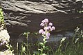
The host rock, which contained these spherical boulders, consists of well-sorted, medium-grained, highly porous, and friable sandstone. Being only weakly indurated by small amounts of iron oxide, sometimes seen as Liesegang rings (banding) at Rock City, it is considerably softer and very much more easily eroded than the calcite concretions. The sand comprising it accumulated within a river channel, which is part of the Dakota Sandstone, which accumulated within a low-lying coastal plain. Differential cementation and later erosion of cross-bedding inherited from the riverine sand, in which these concretions occur, created the "ornamentation", which these concretions exhibit. [8]

Origin

In the past, the origin of the spherical boulders found at Rock City had been erroneously interpreted as glacial boulders, corals, concretionary masses of limestone, and normal erosional remnants of sandstone. Shaffer [5] was the first person to recognize them as calcite-cemented concretions. From a detailed examination of the mineralogy of these concretions and the carbon and oxygen isotopes of the calcite cement comprising them, McBride and others [8] concluded that they formed as the result of diffusion of calcium through and precipitation of calcite within the sandstone containing them after being deeply buried. The carbon and calcium comprising these concretions came either from marine limestone, shells, anhydrite, or some combination of these in addition to bicarbonate derived from oxidized methane from strata outside of, but hydrologically connected to, the Dakota Sandstone. After the formation of the concretions, differential erosion of the considerably softer sandstone surrounding them exposed as free-standing boulders. [8]

See also

Other rock formations in Kansas:

Related Research Articles

<span class="mw-page-title-main">Sandstone</span> Type of sedimentary rock

Sandstone is a clastic sedimentary rock composed mainly of sand-sized silicate grains. Sandstones comprise about 20–25% of all sedimentary rocks.

<span class="mw-page-title-main">Concretion</span> Compact mass formed by precipitation of mineral cement between particles

A concretion is a hard, compact mass formed by the precipitation of mineral cement within the spaces between particles, and is found in sedimentary rock or soil. Concretions are often ovoid or spherical in shape, although irregular shapes also occur. The word 'concretion' is derived from the Latin concretio "(act of) compacting, condensing, congealing, uniting", itself from con meaning 'together' and crescere meaning "to grow". Concretions form within layers of sedimentary strata that have already been deposited. They usually form early in the burial history of the sediment, before the rest of the sediment is hardened into rock. This concretionary cement often makes the concretion harder and more resistant to weathering than the host stratum.

<span class="mw-page-title-main">St. Peter Sandstone</span>

The St. Peter Sandstone is an Ordovician geological formation. It belongs to the Chazyan stage of the Champlainian series in North American regional stratigraphy, equivalent to the late Darriwilian global stage. This sandstone originated as a sheet of sand in clear, shallow water near the shore of a Paleozoic sea and consists of fine-to-medium-size, well-rounded quartz grains with frosted surfaces. The extent of the formation spans north–south from Minnesota to Arkansas and east–west from Illinois into Nebraska and South Dakota. The formation was named by Owen (1847) after the Minnesota River, then known as the St. Peter River. The type locality is at the confluence of the Mississippi and Minnesota Rivers near Fort Snelling, Minnesota. In eastern Missouri the stone consists of quartz sand that is 99.44% silica.

<span class="mw-page-title-main">Moeraki Boulders</span> Large spherical boulders on Otago coast, New Zealand

The Moeraki Boulders are unusually large spherical boulders lying along a stretch of Koekohe Beach on the wave-cut Otago coast of New Zealand between Moeraki and Hampden. They occur scattered either as isolated or clusters of boulders within a stretch of beach where they have been protected in a scientific reserve. These boulders are grey-colored septarian concretions, which have been exhumed from the mudstone and bedrock enclosing them and concentrated on the beach by coastal erosion. Especially in recent years, the boulders have been a popular tourist attraction.

<span class="mw-page-title-main">Denver Basin</span> Geologic structural basin in the U.S.

The Denver Basin, variously referred to as the Julesburg Basin, Denver-Julesburg Basin, or the D-J Basin, is a geologic structural basin centered in eastern Colorado in the United States, but extending into southeast Wyoming, western Nebraska, and western Kansas. It underlies the Denver-Aurora Metropolitan Area on the eastern side of the Rocky Mountains.

<span class="mw-page-title-main">Smoky Hills</span> Region in the United States

The Smoky Hills are an upland region of hills in the central Great Plains of North America. They are located in the Midwestern United States, encompassing north-central Kansas and a small portion of south-central Nebraska.

<span class="mw-page-title-main">Mushroom Rock State Park</span> State park in Kansas, United States

Mushroom Rock State Park is noted for its mushroom rock formations. It is located in the Smoky Hills region of north-central Kansas in Ellsworth County, Kansas, United States.

<span class="mw-page-title-main">Navajo Sandstone</span> Geological formation in the southwestern United States

The Navajo Sandstone is a geological formation in the Glen Canyon Group that is spread across the U.S. states of southern Nevada, northern Arizona, northwest Colorado, and Utah as part of the Colorado Plateau province of the United States.

<span class="mw-page-title-main">Dakota Formation</span> Rock units in Midwestern North America.

The Dakota is a sedimentary geologic unit name of formation and group rank in Midwestern North America. The Dakota units are generally composed of sandstones, mudstones, clays, and shales deposited in the Mid-Cretaceous opening of the Western Interior Seaway. The usage of the name Dakota for this particular Albian-Cenomanian strata is exceptionally widespread; from British Columbia and Alberta to Montana and Wisconsin to Colorado and Kansas to Utah and Arizona. It is famous for producing massive colorful rock formations in the Rocky Mountains and the Great Plains of the United States, and for preserving both dinosaur footprints and early deciduous tree leaves.

<span class="mw-page-title-main">Red Rock Coulee</span> Nature preserve in Canada

Red Rock Coulee is a Provincial Natural Area in southeastern Alberta, Canada, 54 kilometres (30 mi) south-southwest of the city of Medicine Hat and 26 kilometres (20 mi) south of the hamlet of Seven Persons on Alberta Highway 887. The main feature of this natural landscape is the large spherical reddish boulders (concretions), some of which measure 2.5 metres (10 ft) in diameter. They are scattered across the badlands and coulees, and can be seen along the hiking trails, as well as from the viewpoint on Highway 887.

<span class="mw-page-title-main">Geology of Kansas</span>

The geology of Kansas encompasses the geologic history and the presently exposed rock and soil. Rock that crops out in the US state of Kansas was formed during the Phanerozoic eon, which consists of three geologic eras: the Paleozoic, Mesozoic and Cenozoic. Paleozoic rocks at the surface in Kansas are primarily from the Mississippian, Pennsylvanian, and Permian periods.

The Kiowa Formation or Kiowa Shale is a Cretaceous geologic formation in Kansas, diminishing to member status in Colorado and Oklahoma. In Colorado, the Kiowa Shale was classified as a member of the now abandoned Purgatoire Formation. In the vicinity of Longford, Kansas, the local Longford member comprises thinly bedded siltstone, clay, polished gravel, lignite, and sandstone suggests a river and estuary environment.

<span class="mw-page-title-main">Cardenas Basalt</span> Rock formation in the Grand Canyon, Arizona

The Cardenas Basalt, also known as either the Cardenas Lava or Cardenas Lavas, is a rock formation that outcrops over an area of about 310 km2 (120 mi2) in the eastern Grand Canyon, Coconino County, Arizona. The lower part of the Cardenas Basalt forms granular talus slopes. Its upper part forms nearly continuous low cliffs that are parallel to the general course of the Colorado River. The most complete, readily accessible, and easily studied exposure of the Cardenas Basalt lies in Basalt Canyon. This is also its type locality.

<span class="mw-page-title-main">Ogallala Formation</span> Geologic formation in the western United States

The Ogallala Formation is a Miocene to early Pliocene geologic formation in the central High Plains of the western United States and the location of the Ogallala Aquifer. In Nebraska and South Dakota it is also classified as the Ogallala Group. Notably, it records the North American Land Mammal Ages (NALMAs) Hemphillian, Clarendonian, and Barstovian. It also includes an excellent record of grass seeds and other plant seeds, which can be used for biostratigraphic dating within the formation. The Ogallala Formation outcrops of Lake Meredith National Recreation Area preserve fish fossils. Similar specimens from the same unit are found at Alibates Flint Quarries National Monument in Texas.

<span class="mw-page-title-main">Shinumo Quartzite</span> Mesoproterozoic rock formation in the Grand Canyon, Arizona

The Shinumo Quartzite also known as the Shinumo Sandstone, is a Mesoproterozoic rock formation, which outcrops in the eastern Grand Canyon, Coconino County, Arizona,. It is the 3rd member of the 5-unit Unkar Group. The Shinumo Quartzite consists of a series of massive, cliff-forming sandstones and sedimentary quartzites. Its cliffs contrast sharply with the stair-stepped topography of typically brightly-colored strata of the underlying slope-forming Hakatai Shale. Overlying the Shinumo, dark green to black, fissile, slope-forming shales of the Dox Formation create a well-defined notch. It and other formations of the Unkar Group occur as isolated fault-bound remnants along the main stem of the Colorado River and its tributaries in Grand Canyon.

Typically, the Shinumo Quartzite and associated strata of the Unkar Group dip northeast (10°–30°) toward normal faults that dip 60+° toward the southwest. This can be seen at the Palisades fault in the eastern part of the main Unkar Group outcrop area.

<span class="mw-page-title-main">Graneros Shale</span> Geological formation

The Graneros Shale is a geologic formation in the United States identified in the Great Plains as well as New Mexico that dates to the Cenomanian Age of the Cretaceous Period. It is defined as the finely sandy argillaceous or clayey near-shore/marginal-marine shale that lies above the older, non-marine Dakota sand and mud, but below the younger, chalky open-marine shale of the Greenhorn. This definition was made in Colorado by G. K. Gilbert and has been adopted in other states that use Gilbert's division of the Benton's shales into Carlile, Greenhorn, and Graneros. These states include Kansas, Texas, Oklahoma, Nebraska, and New Mexico as well as corners of Minnesota and Iowa. North Dakota, South Dakota, Wyoming, and Montana have somewhat different usages — in particular, north and west of the Black Hills, the same rock and fossil layer is named Belle Fourche Shale.

The Valentine Formation is a geologic unit formation or member within the Ogallala unit in northcentral Nebraska near the South Dakota border. It preserves fossils dating to the Neogene period and is particularly noted for Canid fossils. A particular feature of the Valentine is lenticular beds of green-gray opaline sandstone that can be identified in other states, including South Dakota, Nebraska, Kansas, and Colorado. Even though three mammalian fauna stages can be mapped throughout the range of the Ogallala, no beddings of the Ogallala are mappable and all attempts of formally applying the Valentine to any mappable lithology beyond the type location have been abandoned. Even so, opaline sandstone has been used to refer to the green-gray opalized conglomerate sandstone that is a particular feature of the lower Ogallala.

<span class="mw-page-title-main">Tesuque Formation</span> Geologic formation in New Mexico, United States

The Tesuque Formation is a geologic formation in north-central New Mexico, United States. The formation provides an unusually complete record of the evolution of mammals during the Miocene epoch.

The Kettle Point Formation, also known as the Kettle Point (black) Shale, is a geologic formation that consists of thinly laminated, siliciclastic, organic-rich black shale with thin to thick interbeds of organic-poor mudstone. It is largely restricted to the subsurface of southwestern Ontario.

<span class="mw-page-title-main">Fencepost limestone</span>

Fencepost limestone, Post Rock limestone, or Stone Post is a stone bed in the Great Plains notable for its historic use as fencing and construction material in north-central Kansas resulting in unique cultural expression. The source of this stone is the topmost layer of the Greenhorn Limestone formation. It is a regional marker bed as well as a valued construction material of the late 19th and early 20th centuries in Kansas. This stone was very suitable for early construction in treeless settlements and it adds a notable rust orange tint to the region's many historic stone buildings. But the most famous use is seen in the countless miles of stone posts lining country roads and highways. This status gives rise to such regional appellations as Stone Post Country, Post Rock Scenic Byway, and The Post Rock Capital of Kansas. This rustic quality finds Fencepost limestone still used in Kansas landscaping today.

References

  1. "Rock City". Geographic Names Information System . United States Geological Survey, United States Department of the Interior.
  2. Bell, W.T., 1901, The remarkable concretions of Ottawa County, Kansas, American Journal of Science, 4th Series, v. 11, p. 315-316.
  3. Gould, C.N., 1901, The Dakota Cretaceous of Kansas and Nebraska, Kansas Academy of Science, v. 17, p. 122-178.
  4. Landes, K.K., 1935, Scenic Kansas, Geological Survey of Kansas Bulletin, n. 36, 55 p.
  5. 1 2 3 Shaffer, H.L., 1937, Concretions in the Dakota Sandstone, Compass, v. 17, p. 87-90.
  6. Ward, H.K., 1938, Concretions of Rock City. Mineralogist, v. 6, p. 23-24.
  7. Swineford, Ada (1947). Cemented sandstones of the Dakota and Kiowa formations in Kansas. Geological Survey of Kansas Bulletin. OCLC   5051056.
  8. 1 2 3 4 5 6 7 McBride, Earle F; Milliken, Kitty L (2006). "Giant calcite-cemented concretions, Dakota Formation, central Kansas, USA". Sedimentology. 53 (5): 1161–79. doi:10.1111/j.1365-3091.2006.00813.x.
  9. McBride, E. F; Picard, M. D; Milliken, K. L (2003). "Calcite-Cemented Concretions in Cretaceous Sandstone, Wyoming and Utah, U.S.A". Journal of Sedimentary Research. 73 (3): 462–83. doi:10.1306/111602730462.