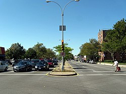
Rockaway Parkway

Last updated
At Flatlands Avenue Holy Family RCC Rockaway Pkwy Flatlands Av jeh.jpg
At Flatlands Avenue
Rockaway Parkway at Skidmore Avenue Rockaway Pkwy at Skidmore jeh.JPG
Rockaway Parkway at Skidmore Avenue

Rockaway Parkway is a major commercial street in the Canarsie and Brownsville neighborhoods of Brooklyn, New York.

Contents

Canarsie High School, as well as a firehouse and several homes and businesses are on Rockaway Parkway. The Rockaway Parkway station is the southern terminus of the BMT Canarsie Line ( L train). The B42 bus runs primarily along Rockaway Parkway, and riders can transfer for free from the Rockaway Parkway subway station. Contrary to its name, Rockaway Parkway does not enter the Rockaways in Queens. The Sutter Avenue-Rutland Road station is located one block away from the intersection of Rockaway Parkway and Rutland Road, over East 98th Street. The IRT New Lots Line also runs parallel to the street from East NY Avenue to Clarkson Avenue.

History

Rockaway Parkway originated as an 18th-century road to the Canarsie Ferry.

Description

Rockaway Parkway is divided into two segments by the Bay Ridge Branch of the LIRR.

Its northern segment begins at East New York Avenue in Brownsville. It then intersects Linden Boulevard and ends past Ditmas Avenue. The southern segment begins north of Avenue D in Canarsie, then intersects Flatlands Avenue, crosses under the Belt Parkway, and ends at Canarsie Pier. Northbound and southbound traffic is separated by a median between Linden Boulevard and Rockaway Avenue; south of Seaview Avenue, Rockaway Parkway again becomes separated by a median to its southern terminus at Canarsie Pier.

See also

40°37′52.1″N73°53′12.3″W / 40.631139°N 73.886750°W / 40.631139; -73.886750

Related Research Articles

<span class="mw-page-title-main">Belt Parkway</span> Highway in New York

The Belt Parkway is the name given to a series of controlled-access parkways that form a belt-like circle around the New York City boroughs of Brooklyn and Queens. The Belt Parkway comprises three of the four parkways in what is known as the Belt System: the Shore Parkway, the Southern Parkway, and the Laurelton Parkway. The three parkways in the Belt Parkway are a combined 25.29 miles (40.70 km) in length. The Cross Island Parkway makes up the fourth parkway in the system, but is signed separately.

The BMT Canarsie Line is a rapid transit line of the B Division of the New York City Subway system, named after its terminus in the Canarsie neighborhood of Brooklyn. It is served by the L train at all times, which is shown in medium gray on the New York City Subway map and on station signs.

<span class="mw-page-title-main">Interstate 395 (Maryland)</span> Short Interstate Highway in Baltimore, Maryland

Interstate 395 (I-395) is an auxiliary Interstate Highway in the US state of Maryland. Known as Cal Ripken Way, the highway runs 1.98 miles (3.19 km) from I-95 north to Howard Street and Camden Street in Downtown Baltimore, where it provides access to the Inner Harbor and the Baltimore Convention Center. The Interstate also serves the Camden Yards Sports Complex, which contains M&T Bank Stadium and Oriole Park at Camden Yards, homes of the Baltimore Ravens and Baltimore Orioles, respectively. I-395 also serves as the southern terminus of Martin Luther King Jr. Boulevard, an urban arterial that provides a western bypass of Downtown Baltimore and connects I-95 with U.S. Route 40 (US 40), US 1, and I-83. The Interstate is maintained by the Maryland Transportation Authority (MDTA) and, like all Interstates, is a part of the National Highway System.

<span class="mw-page-title-main">New York State Route 27</span> State highway on Long Island, New York, United States

New York State Route 27 (NY 27) is a 120.58-mile (194.05 km) long state highway that runs east–west from Interstate 278 (I-278) in the New York City borough of Brooklyn to Montauk Point State Park on Long Island, New York. Its two most prominent components are Sunrise Highway and Montauk Highway, the latter of which includes the Montauk Point State Parkway. NY 27 acts as the primary east–west highway on southern Long Island east of the interchange with the Heckscher State Parkway in Islip Terrace. The entire route in Suffolk, Nassau, and Queens counties were designated by the New York State Senate as the POW/MIA Memorial Highway. The highway gives access to every town on the South Shore. NY 27 is the easternmost state route in the state of New York, as well as the longest highway on Long Island.

<span class="mw-page-title-main">Florida State Road 40</span> Highway in Florida

State Road 40 is a 91.8-mile-long (147.7 km) east–west highway across northern and east-central Florida, running from U.S. Highway 41 (US 41) in Rainbow Lakes Estates eastwards through Ocala over the Ocklawaha River and through the heart of the Ocala National Forest to SR A1A in Ormond Beach. Names of the road include Silver Springs Boulevard in Ocala, Fort Brooks Road from Silver Springs through Astor, Butler Road in Astor, and Granada Boulevard in Ormond Beach. Former sections in Ormond Beach are named "Old Tomoka Road" and "Old Tomoka Avenue."

<span class="mw-page-title-main">Canarsie–Rockaway Parkway station</span> New York City Subway station in Brooklyn

The Canarsie–Rockaway Parkway station is the southern terminal station of the BMT Canarsie Line of the New York City Subway, and is one of the few grade-level stations in the system. Located at the intersection of Rockaway Parkway and Glenwood Road in the Canarsie neighborhood of Brooklyn, it is served by the L train at all times.

Woodhaven Boulevard and Cross Bay Boulevard are two parts of a major boulevard in the New York City borough of Queens. Woodhaven Boulevard runs roughly north–south in the central portion of Queens. South of Liberty Avenue, it is known as Cross Bay Boulevard, which is the main north–south road in Howard Beach. Cross Bay Boulevard is locally known as simply "Cross Bay", and Woodhaven Boulevard, "Woodhaven". The completion of the boulevard in 1923, together with the construction of the associated bridges over Jamaica Bay, created the first direct roadway connection to the burgeoning Atlantic Ocean beachfront communities of the Rockaway Peninsula from Brooklyn and most of Queens.

<span class="mw-page-title-main">B35 (New York City bus)</span> Bus route in Brooklyn, New York

The Church Avenue Line is a public transit line in Brooklyn, New York City, running mainly along 39th Street and Church Avenue between Sunset Park and Brownsville. Originally a streetcar line, it is now the B35 bus route, operated by MTA New York City Bus' Jackie Gleason Depot in Sunset Park.

<span class="mw-page-title-main">B42 (New York City bus)</span> Bus route in Brooklyn, New York

The Rockaway Parkway Line is a public transit line in Brooklyn, New York City, running mostly along Rockaway Parkway between Canarsie Pier and the Canarsie–Rockaway Parkway terminal of the BMT Canarsie Line of the New York City Subway. Originally a streetcar line, it is now the B42 bus route, operated by the New York City Transit Authority.

<span class="mw-page-title-main">B47 (New York City bus)</span> Bus route in Brooklyn, New York

The B47 is a surface transit line on Ralph Avenue in Brooklyn, New York City. Once a streetcar line, it is now part of the B47 bus route, operated by the New York City Transit Authority, Prior to 1995, it was the B78 route; the northern part of the route from St. Johns Place to Woodhull Hospital was part of the B40 line. The B47 was created as a result of a merger of the B40 and B78 on September 8, 2002.

<span class="mw-page-title-main">U.S. Route 17 in Florida</span> Section of U.S. Highway in Florida, United States

U.S. Highway 17 (US 17) in Florida is a north–south United States Numbered Highway that runs 317 miles (510 km) from the Punta Gorda, Florida Metropolitan Statistical Area northeast to the Jacksonville metropolitan area.

<span class="mw-page-title-main">U.S. Route 98 in Florida</span> Highway in Florida

U.S. Route 98 is a major east-west thoroughfare through the U.S. state of Florida. Spanning 670.959 miles (1,079.804 km), it connects Pensacola and the Alabama/Florida state line to the west with Palm Beach and the Atlantic coast in the east. It is the longest US road in Florida, as well as the longest US road in any state east of the Mississippi River.

Flatlands Avenue is a major street in the New York City borough of Brooklyn. It runs approximately 5 miles (8.0 km) east-west, from Avenue N and East 35th Street in Flatlands in the west to Forbell Street, east of Fountain Avenue in East New York, near the Brooklyn-Queens border. The right-of-way continues in Lindenwood and Howard Beach, Queens as 156th Avenue, separated by the remnants of Spring Creek. The portion of Flatlands Avenue east of Louisiana Avenue in East New York was previously mapped as Fairfield Avenue.

<span class="mw-page-title-main">Pennsylvania Avenue (Brooklyn)</span> Avenue in Brooklyn, New York

Pennsylvania Avenue is a major north–south street in Brooklyn, New York. It generally runs north to south, from the Jackie Robinson Parkway in Broadway Junction to the Belt Parkway in Starrett City.

Peninsula Boulevard is a major, 9.1-mile-long (14.6 km) arterial road through southwestern Nassau County, on Long Island, New York. It runs southwest-to-northeast between Cedarhurst connecting the Five Towns area to the Village of Hempstead – in addition to indirectly serving The Rockaways in Queens.