Rocksdale, West Virginia | |
|---|---|
 Rocksdale  Rocksdale | |
| Coordinates: 38°50′41″N81°13′05″W / 38.84472°N 81.21806°W | |
| Country | United States |
| State | West Virginia |
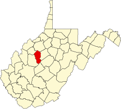
| County | Calhoun |
| Elevation | 676 ft (206 m) |
| Time zone | UTC-5 (Eastern (EST)) |
| • Summer (DST) | UTC-4 (EDT) |
| Area codes | 304 & 681 |
| GNIS feature ID | 1555509 [1] |
Rocksdale is an unincorporated community in Calhoun County, West Virginia, United States. Rocksdale is located along County Route 9 at the confluence of the Henry Fork and the West Fork Little Kanawha River, site of now closed post office established in late 1800s with a country store, 7.5 miles (12.1 km) east-northeast of Spencer. [2]
The community takes its name from a rock formation near the site. [3]