Rockville Township, Stearns County, Minnesota

Last updated
Rockville Township, Minnesota
USA Minnesota location map.svg
Red pog.svg
Rockville Township, Minnesota
Location within the state of Minnesota
Coordinates: 45°27′N94°19′W / 45.450°N 94.317°W / 45.450; -94.317 Coordinates: 45°27′N94°19′W / 45.450°N 94.317°W / 45.450; -94.317
Country United States
State Minnesota
County Stearns
Area
  Total34.5 sq mi (89.3 km2)
  Land32.5 sq mi (84.3 km2)
  Water1.9 sq mi (5.0 km2)
Elevation
1,099 ft (335 m)
Population
 (2000)
  Total1,254
  Density38.5/sq mi (14.9/km2)
Time zone UTC-6 (Central (CST))
  Summer (DST) UTC-5 (CDT)
ZIP code
56369
Area code 320
FIPS code 27-55096 [1]
GNIS feature ID0665440 [2]

Rockville Township was a township in Stearns County, Minnesota, United States. The population was 1,254 at the 2000 census. On 1 June 2002, Rockville Township and the city of Pleasant Lake were merged into the city of Rockville. [3]

Contents

Geography

According to the United States Census Bureau, the township had a total area of 34.5 square miles (89.3 km2). 32.5 square miles (84.3 km2) of it was land and 1.9 square miles (5.0 km2) of it (5.60%) was water.

Rockville Township is located in Township 123 North of the Arkansas Base Line and Range 29 West of the 5th Principal Meridian.

Demographics

As of the census [1] of 2000, there were 1,254 people, 399 households, and 339 families residing in the township. The population density was 38.5 inhabitants per square mile (14.9/km2). There were 441 housing units at an average density of 13.6/sq mi (5.2/km2). The racial makeup of the township was 99.52% White, 0.08% Native American, 0.08% Asian, 0.08% from other races, and 0.24% from two or more races. Hispanic or Latino of any race were 0.16% of the population.

There were 399 households, out of which 45.1% had children under the age of 18 living with them, 81.7% were married couples living together, 1.8% had a female householder with no husband present, and 15.0% were non-families. 12.0% of all households were made up of individuals, and 3.0% had someone living alone who was 65 years of age or older. The average household size was 3.14 and the average family size was 3.45.

In the township the population was spread out, with 32.5% under the age of 18, 5.7% from 18 to 24, 30.5% from 25 to 44, 22.4% from 45 to 64, and 8.9% who were 65 years of age or older. The median age was 36 years. For every 100 females, there were 108.3 males. For every 100 females age 18 and over, there were 102.6 males.

The median income for a household in the township was $61,250, and the median income for a family was $65,625. Males had a median income of $36,250 versus $25,063 for females. The per capita income for the township was $20,703. About 1.5% of families and 2.0% of the population were below the poverty line, including 0.9% of those under age 18 and 2.8% of those age 65 or over.

Related Research Articles

<span class="mw-page-title-main">Rockville, Indiana</span> Town in Indiana, United States

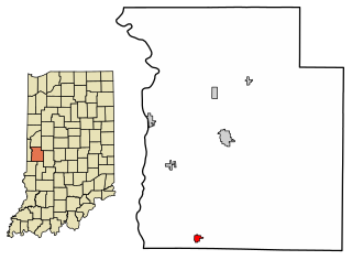
Rockville is a town in Adams Township, Parke County, in the U.S. state of Indiana. The population was 2,607 at the 2010 census. The town is the county seat of Parke County. It is known as "The Covered Bridge Capital of the World".

<span class="mw-page-title-main">Rosedale, Indiana</span> Town in Indiana, United States

Rosedale is a town in Florida Township, Parke County, in the U.S. state of Indiana. The population was 725 at the 2010 census.

Newark Township is a civil township of Gratiot County in the U.S. state of Michigan. The population was 1,149 at the 2000 census.

Carpenter Township is a township in Itasca County, Minnesota, United States. The population was 179 at the 2010 census.

Feeley Township is a township in Itasca County, Minnesota, United States. The population was 306 at the 2010 census.

Grand Rapids Township was a township in Itasca County, Minnesota, United States. The population was 11,747 at the 2000 census. By the time of the 2010 census, the area of the former township had been divided between the cities of Grand Rapids, La Prairie, and Coleraine.

Kandiyohi Township is a township in Kandiyohi County, Minnesota, United States. The population was 600 at the 2000 census.

Stanley Township is a township in Lyon County, Minnesota, United States. The population was 254 at the 2000 census.

Ripley Township is a township in Morrison County, Minnesota, United States. The population was 692 at the 2000 census.

<span class="mw-page-title-main">Salem Township, Olmsted County, Minnesota</span> Township in Minnesota, United States

Salem Township is a township in Olmsted County, Minnesota. The population was 1,061 at the 2000 census. The township hall is located at the junction of County Road 25 and County Road 3 at the unincorporated community of Salem Corners.

Trondhjem Township is a township in Otter Tail County, Minnesota, United States. The population was 171 at the 2000 census.

Tumuli Township is a township in Otter Tail County, Minnesota, United States. The population was 434 at the 2000 census.

Western Township is a township in Otter Tail County, Minnesota, United States. The population was 142 at the 2000 census.

Dell Grove Township is a township in Pine County, Minnesota, United States. The population was 699 at the 2000 census.

Alborn Township is a township in Saint Louis County, Minnesota, United States. At the 2010 census, the population was 460.

<span class="mw-page-title-main">Rockville, Minnesota</span> City in Minnesota, United States

Rockville is a city in Stearns County, Minnesota, United States. The population was 2,448 as of the 2010 census. It is part of the St. Cloud Metropolitan Statistical Area.

Greenfield Township is a township in Wabasha County, Minnesota, United States. The population was 1,254 at the 2000 census.

<span class="mw-page-title-main">La Plume Township, Lackawanna County, Pennsylvania</span> Place in Pennsylvania, United States

La Plume Township is a township in Lackawanna County, Pennsylvania, United States. The population was 486 at the 2020 census. It is home to Keystone College. La Plume is located 11 miles northwest of Scranton, one of Pennsylvania's most populated cities.

<span class="mw-page-title-main">Scott Township, Lawrence County, Pennsylvania</span> Township in Pennsylvania, United States

Scott Township is a township in Lawrence County, Pennsylvania, United States. The population was 2,174 at the 2020 census, a decline from the figure of 2,347 as of the 2010 census.

<span class="mw-page-title-main">Lehigh Township, Northampton County, Pennsylvania</span> Place in Pennsylvania, United States

Lehigh Township is a township in Northampton County, Pennsylvania. The population of Lehigh Township was 10,526 as of the 2010 census. It is part of the Lehigh Valley metropolitan area, which had a population of 861,899 and was the 68th most populous metropolitan area in the U.S. as of the 2020 census.

References

  1. 1 2 "U.S. Census website". United States Census Bureau . Retrieved 2008-01-31.
  2. "US Board on Geographic Names". United States Geological Survey. 2007-10-25. Retrieved 2008-01-31.
  3. Population Estimates Geographic Change Notes: Minnesota Archived 2008-05-02 at the Wayback Machine , 2006-05-19. Accessed 2008-05-28.