
Stantonbury is a district and civil parish of Milton Keynes, Buckinghamshire, England, situated roughly 2 miles (3.2 km) north of Central Milton Keynes. The toponym Stanton is derived from an Old English term for "stone-built farmstead" and the bury element from the French family Barri who held it in 1235. The original Stantonbury is a deserted medieval village now known as Stanton Low; the Stantonbury name has been reused for the modern district at the heart of the civil parish.

Ancaster is a village and civil parish in the South Kesteven district of Lincolnshire, England, on the site of a Roman town. The population of the civil parish was 1,317 at the 2001 census, increasing to 1,647 at the 2011 census. The civil parish includes the settlements of Sudbrook and West Willoughby.

Wroxeter is a village and former civil parish, now in the parish of Wroxeter and Uppington, in the Shropshire district, in the ceremonial county of Shropshire, England. It is beside the River Severn, 5 miles (8.0 km) south-east of Shrewsbury. In 1961 the parish had a population of 657.
Lincolnshire, England derived from the merging of the territory of the ancient Kingdom of Lindsey with that controlled by the Danelaw borough of Stamford. For some time the entire county was called 'Lindsey', and it is recorded as such in the Domesday Book. Later, Lindsey was applied to only the northern core, around Lincoln; it was defined as one of the three 'Parts of Lincolnshire', along with Holland in the south-east and Kesteven in the south west.
Broughton is a town and civil parish situated on the Roman Ermine Street, in the North Lincolnshire district of Lincolnshire, England. The population of the civil parish at the 2011 census was 5,726. In 2021, the population was 5,434. It is situated approximately 2 miles (3 km) north-west from the town of Brigg. The hamlets of Wressle, Castlethorpe, and part of Scawby Brook lie within the parish boundaries.

Nocton is a village and civil parish in the North Kesteven district of Lincolnshire, England. It is situated on the B1202 road, 7 miles (11 km) south-east from Lincoln city centre. The population of the civil parish at the 2011 census was 819. To the east of the village is Nocton Fen with its small settlement of Wasps Nest. To the west of the village, situated at the junction of Wellhead Lane and the B1188 road, is Nocton Top Cottages consisting of eight further dwellings. At the south of the village are the remains of Nocton Hall, and 1 mile (2 km) to the east the earthwork remains of Nocton Park Priory.

Great Casterton is a village and civil parish in the county of Rutland in England. It is located at the crossing of the Roman Ermine Street and the River Gwash.
Flixborough is a village and civil parish in North Lincolnshire, England. The population at the 2011 census was 1,664. It is near the River Trent, 3 miles (5 km) north-west from Scunthorpe. The village is noted for the 1974 Flixborough disaster.

Norton Disney is a small village and civil parish on the western boundary of the North Kesteven district of Lincolnshire, England. It is situated on the border with the adjacent county of Nottinghamshire and shares a boundary with Collingham in that county. This county and parish boundary of Collingham and Norton Disney also splits the Potter Hill area which has important Iron Age and Roman archaeology. The population of the civil parish at the 2011 census was 226. It lies midway between Lincoln and Newark, 2 miles (3.2 km) to the south-east of the A46.
Thenford is a village and civil parish about 5 miles (8 km) northwest of the market town of Brackley in West Northamptonshire, England, and 4 miles (6.4 km) east of Banbury in nearby Oxfordshire. The 2001 Census recorded the parish population as 74. At the 2011 Census the population of the village remained less than 100 and is included in the civil parish of Middleton Cheney.
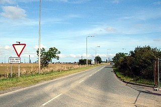
The A1077 road runs through North Lincolnshire, England, between Scunthorpe and South Killingholme.

Roxby is a village in North Lincolnshire, England. It is situated approximately 4 miles (6 km) north from Scunthorpe and 1 mile (1.6 km) south-east from Winterton on the A1077. Roxby stands on a prominent part of the Lincoln Cliff and overlooks the Humber Estuary.
Duncton is a village and civil parish in the District of Chichester in West Sussex, England. The village is in the South Downs 3 miles (5 km) south of Petworth on the A285 road.

Brixton Deverill is a small village and civil parish about 4 miles (6.4 km) south of Warminster in Wiltshire, England.
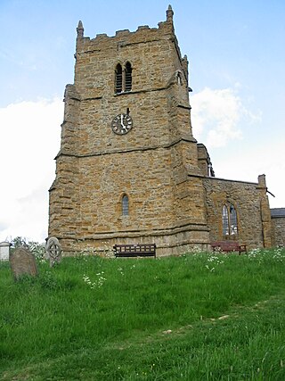
Walesby is a village and civil parish in the West Lindsey district of Lincolnshire, England. The population of the civil parish at the 2011 census was 249. It lies in the Lincolnshire Wolds, 3 miles (5 km) north-east from Market Rasen and 7 miles (11 km) south from Caistor. Tealby parish lies to the south-east. The parish covers about 3,600 acres (15 km2) and includes the hamlets of Risby and Otby.

St Oswald's Priory was founded by Æthelflæd, daughter of Alfred the Great, and her husband Æthelred, ealdorman of Mercia, in the late 880s or the 890s. It appears to have been an exact copy of the Old Minster, Winchester It is a Grade I listed building.
Hainton is a village and civil parish in the East Lindsey district of Lincolnshire, England. It is situated on the A157 road, 10 miles (16 km) west from Louth and 5 miles (8 km) south-east from Market Rasen.

St Mary Magdalene was a Benedictine priory in Lincoln, England. Along with Sandtoft Priory and Hanes Cell, it was a Lincolnshire cell of St Mary's Abbey in York, England. A surviving building, once owned by the priory, is Monks' Abbey, Lincoln.

Market Stainton is a village and civil parish in the East Lindsey district of Lincolnshire, England. It is situated approximately 7 miles (11 km) north from the market town of Horncastle.

Welton le Wold is a village and civil parish in the East Lindsey district of Lincolnshire, England. It is situated approximately 4 miles (6 km) west of the town of Louth.
