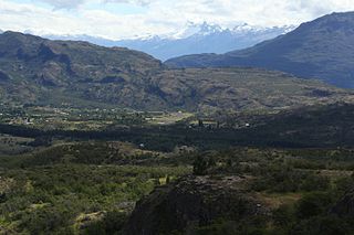
Mocopulli Airport is an airport serving Dalcahue, a port city on Chiloé Island in the Los Lagos Region of Chile. The airport is 6 kilometres (3.7 mi) northwest of Dalcahue.
Pupelde Airport is an airport serving Ancud, a Pacific port city in the Los Lagos Region of Chile. Ancud is on the northern shore of Chiloé Island.
Chaitén Airfield was an airport serving Chaitén, a town in the Los Lagos Region of Chile. The airport was damaged and closed after the 2008 eruption of Chaitén Volcano.
Chañaral Airport Spanish: Aeropuerto de Chañaral, is an airport serving Chañaral, a Pacific coastal city in the Atacama Region of Chile.
Chile Chico Airport Spanish: Aeródromo Chile Chico, is an airport serving Chile Chico, a lakeside town in the Aysén Region of Chile. Chile Chico is on the south shore of General Carrera Lake, 3 kilometres (1.9 mi) west of the Argentina border. The airport is 5 kilometres (3.1 mi) southeast of the town.

Cochrane Airport Spanish: Aeródromo Cochrane, is an airport serving Cochrane, a town in the Aysén Region of Chile. The airport is just northwest of the town, at the foot of Cerro Tamanguito (sv).
Futaleufú Airfield is an airport serving Futaleufú, a town in the Los Lagos Region of Chile.
Robinson Crusoe Airport Spanish: Aeródromo Robinson Crusoe, is an airport serving Robinson Crusoe Island, a Pacific island 620 kilometres (390 mi) off the coast of Chile. It is part of Chile's Valparaíso Region, and is 685 kilometres (426 mi) from Valparaíso.
San Rafael Airport Spanish: Aeródromo de San Rafael de Los Andes, is an airport serving Los Andes, a city in the Valparaíso Region of Chile. The airport is 5 kilometres (3.1 mi) west-northwest of the city.

María Dolores Airport is an airport serving Los Ángeles, capital of Bío Bío Province in the Bío Bío Region of Chile.
Carolina Airport, is an airport located 2 kilometres (1.2 mi) north of Michilla (es), a town in the Antofagasta Region of Chile. The airport is on the Pacific coast and serves the ore processing facility of the Michilla copper mine.
El Tuqui Airport, is an airport serving Ovalle, a city in the Coquimbo Region of Chile.
Huayanay Airport, is an airstrip 36 kilometres (22 mi) northwest of Ovalle, a city in the Coquimbo Region of Chile.
Capitán Fuentes Martínez Airport, is an airport 5 kilometres (3.1 mi) northeast of Porvenir, a port city off the Strait of Magellan in the Magallanes Region of Chile.
Cabo Juan Román Airport is an airport serving Puerto Aysén, a city at the head of the Aysén Fjord in the Aysén Region of Chile.
El Mirador Airport, is an airport just southeast of Puerto Varas, a city in the Los Lagos Region of Chile. Puerto Varas is on the southwest shore of Llanquihue Lake.
Panguilemo Airport is an airport 5 kilometres (3.1 mi) northeast of Talca, capital of the Maule Region of Chile.
Las Breas Airport is an airport 20 kilometres (12 mi) south-southeast of Taltal, a Pacific coastal town in the Antofagasta Region of Chile.
Barriles Airport Spanish: Aeropuerto Barriles is an airport 15 kilometres (9.3 mi) east-southeast of Tocopilla, a Pacific coastal town in the Antofagasta Region of Chile.
Vallenar Airport (Spanish: Aeródromo de Vallenar, is an airport serving Vallenar, a city in the Atacama Region of Chile.


