Laos, officially the Lao People's Democratic Republic, is a landlocked country in Southeast Asia. At the heart of the Indochinese Peninsula, Laos is bordered by Myanmar and China to the northwest, Vietnam to the east, Cambodia to the southeast, and Thailand to the west and southwest. Its capital and largest city is Vientiane.
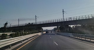
This article concerns the systems of transportation in Laos. Laos is a country in Asia, which possesses a number of modern transportation systems, including several highways and a number of airports. As a landlocked country, Laos possesses no ports or harbours on the sea, and the difficulty of navigation on the Mekong means that this is also not a significant transport route.

The Lao people are a Tai ethnic group native to Southeast Asia, who speak the Lao language of the Kra–Dai languages. They are the majority ethnic group of Laos, making up 53.2% of the total population. The majority of Lao people adhere to Theravada Buddhism. They are closely related to other Tai people, especially with the Isan people, who are also speakers of Lao language, native to neighboring Thailand.

Laos developed its culture and customs as the inland crossroads of trade and migration in Southeast Asia over millennia. As of 2012 Laos has a population of roughly 6.4 million spread over 236,800 km2, yielding one of the lowest population densities in Asia. Yet the country of Laos has an official count of over forty-seven ethnicities divided into 149 sub-groups and 80 different languages. The Lao Loum have throughout the country's history comprised the ethnic and linguistic majority. In Southeast Asia, traditional Lao culture is considered one of the Indic cultures.

The Khmu are an ethnic group of Southeast Asia. The majority (88%) live in northern Laos where they constitute the largest minority ethnic group, comprising eleven percent of the total population. Alternative historical English spellings include Kmhmu, Kemu, and Khammu, among others.
The insurgency in Laos was a low-intensity conflict between the Laotian government on one side and former members of the "Secret Army", Laotian royalists, and rebels from the Hmong and lowland Lao ethnic minorities on the other. These groups have faced reprisals from the Lao People's Army and Vietnam People's Army for their support of the United States-led, anti-communist military campaigns in Laos during the Laotian Civil War, which the insurgency is an extension of itself. The North Vietnamese invaded Laos in 1958 and supported the communist Pathet Lao. The Vietnamese communists continued to support the Pathet Lao after the end of the Laotian Civil War and the establishment of the Lao People's Democratic Republic.

The largest of the ethnic groups in Cambodia are the Khmer, who comprise approximately 90% of the total population and primarily inhabit the lowland Mekong subregion and the central plains. The Khmer historically have lived near the lower Mekong River in a contiguous arc that runs from the southern Khorat Plateau where modern-day Thailand, Laos and Cambodia meet in the northeast, stretching southwest through the lands surrounding Tonle Sap lake to the Cardamom Mountains, then continues back southeast to the mouth of the Mekong River in southeastern Vietnam.

Theravada Buddhism is the largest religion in Laos.
The Constitution of Laos provides for freedom of religion; however, the Government restricted this right in practice. Some government officials committed abuses of citizens' religious freedom.
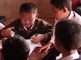
In 2005, the literacy rate in Laos was estimated to be 73%.
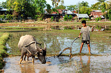
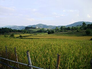
Laotian society is a society characterized by semi-independent rural villages engaged in subsistence agricultural production. Ethnic, geographic, and ecological differences create variations in the pattern of village life from one part of the country to another, but the common threads of village self reliance, limited regional trade and communication, and identification with one's village and ethnic group persist regardless of the setting. Rural trade networks, however, have been a part of life since the 1950s. Except near the larger towns and in the rich agricultural plains of Vientiane and Savannakhét, villages are spaced at least several kilometers apart and the intervening land variously developed as rice paddy and swidden fields or maintained as buffer forest for gathering wild plants and animals, fuelwood, and occasional timber harvest.
Healthcare in Laos is provided by both the private and public sector. It is limited in comparison with other countries. Western medical care is available in some locations, but remote areas and ethnic groups are underserved. Public spending on healthcare is low compared with neighbouring countries. Still, progress has been made since Laos joined the World Health Organization in 1950: life expectancy at birth rose to 66 years by 2015; malaria deaths and tuberculosis prevalence have plunged; and the maternal mortality ratio (MMR) has declined by 75 percent.

Lào Cai ( ) is a province of the mountainous Northwest region of Vietnam bordering the province of Yunnan in China. The province covers an area of 6,383.9 square kilometres and as of 2008 it had a population of 602,300 people.

Muang Sing is a small town and district (muang) in Luang Namtha Province, northwestern Laos, about 60 kilometres northwest of the town of Luang Namtha and 360 kilometres northwest of Vientiane. It lies very close to the border with Yunnan, China, surrounded by mountains and rivers. Historically, Muang Sing has been a major producer of opium and still has problems with drugs and smuggling, due to its proximity to China and Myanmar.
Xiangkhouang is a province of Laos on the Xiangkhoang Plateau, in the nation's northeast. The province has the distinction of being the most heavily bombed place on Earth.
Sekong is a province of Laos in the southeast of the country.

Oudomxay is a province of Laos, located in the northwest of the country. Its capital is Muang Xai.

Khokmanh or Ban Khokmanh is a village in Mueang Luang Prabang, Khoueng Luang Prabang in Laos.

Ban Yang is a village in Luang Prabang district, Luang Prabang province, Laos. It was established around 1935 by Lao Loum ethnic group who used to live in Ban Pha Quang village in Phu Phang Mountain. Ban Pha Quang village is 20 kilometers northeast from Mueang Nan district, Luang Prabang province. When they arrived, they saw this region had immense forested mountain, fertile land, abundant water source in the Huoi Sieu stream, and was convenient for living and farming. They also discovered a big tree with its roots crossing the Huoi Sieu stream like a bridge. The tree root that later was named as Yang, means 'crossing the stream'. Since then, people have called this village Ban Yang.

Ban Phou Pheung Noi is a Laotian village located at the peak of Phou Pheung mountain in the Xieng Khouang province of Laos. Phou Pheung mountain is approximately 916 m (3,005 ft). During the Vietnam War, combat between the American allies, the Hmong, and the Pathet Lao, The Laos Marxist government, and the Communist North Vietnamese People's Army took place on the mountain. Phou Pheung mountain runs from east to west and is rocky, and is covered in tropical forests. It is south of Muang Soui - Nongtang-Nato, and west of Phou Douk, Muang Phuan, Phonsavan and Plain of Jars. To the east, about 10 miles from Ban Phou Pheung Noi, is the Num Ngum 4 hydroelectric dam.